
Ruta 40 Section 5
Ruta 40 in the Patagonian steppe
This section of Argentina’s Ruta 40 between Perito Moreno and Esquel runs across the steppe, far from the Andes and the Andean forests. It is completely paved.
A Summary of this Road Section
Last Updated:
It covers a distance of 538 km (334 mi.) across the Patagonian steppe.
Fully paved section.
The highway crosses the plateau from Perito Moreno to Río Mayo, crosses the Mayo and Senguer rivers and then follows the course of the Senguer River, Genoa creek and Tecka River. Which was the the route of the ancient Tehuelche Indian's "Rastrilladas (or trails -in the US these are known as "traces").
The highway connects with the Andean forests and its lakes: Fontana, La Plata and Vintter; and at its northern terminus, it accesses the World Heritage Site of UNESCO the Parque Nacional Los Alerces National Park.
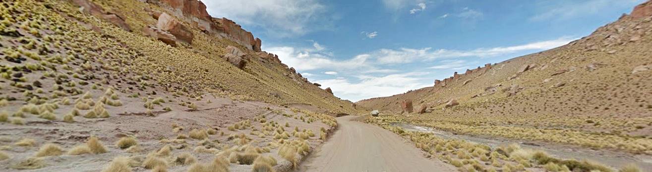
This section of Ruta 40 gives you a taste of the rugged and lonely Patagonia, its relentless winds, the "mesetas" (plateaus) covered with gravel, the well watered valleys, and the solitude only broken by the appearance of a guanaco or the occasional "ñandú" (South American ostrich).
Heights along the road
- 390 m (1,280 ft). At its starting point: Perito Moreno, Santa Cruz.
- 580 m (1,903 ft). At the end of the section in Esquel, Chubut.
Maximum elevation of the section
955 m (3,133 ft) between Gobernador Costa and Tecka, in Chubut.
Towns and villages along the route
These are the towns located on ruta 40 from north to south: Esquel, Tecka, Gobernador Costa, General San Martín, Río Mayo, Perito Moreno.
Map of this Segment of Route 40

Section 5 is located in southern Argentina, see red box at the bottom of this map
Maps of the Section of Ruta 40 from Perito Moreno to Esquel, from North to South.
Detailed Itinerary from Perito Moreno to Esquel
We describe this section of Ruta 40 from South to North, starting at the "Km 0" in the town of Perito Moreno and arriving at Esquel.
Leaving Perito Moreno
Accommodation > >
Perito Moreno
Perito Moreno
Full details on the town of > > Perito Moreno [our Spanish language webpage]
Head north along San Martín Ave. (Ruta 40) and at the roundabout it meets Provincial highways 43 and 45. Turn right (East). If you went west (left) you would reach Lake Buenos Aires and, next to the Chilean border, the town of Los Antiguos.
Accommodation > >
Los Antiguos
Los Antiguos
Full details on the town of > > Los Antiguos [our Spanish language webpage]
Mt. Zeballos Scenic Hwy: The highest Road in Patagonia
From Los Antiguos you can drive along the dirt and grarvel surfaced scenic road of Monte Zeballos, Ruta Provincial 41, reaches an elevation of 1.500 m (4,920 ft.) at "El Portezuelo" making it the highest road in Patagonia.
It goes through three ecological zones: the steppe, the forest and the high Andean tundra.
Learn all about the scenic Monte Zeballos road [our Spanish language webpage]

TripAdvisor
Back to Ruta 40:
Ruta 40 now climbs up a cliff, which is the glacial morraine that marks the eastern edge of the ice sheets that dug out the Lake Buenos Aires basin during the Ice Ages. The road climbs onto the plateau.
The photo below shows Ruta 40 at the morraine:

Along the "Meseta" (Plateau)
The highway runs along the pebble strewn "meseta" and at km 13 Ruta 40 forks off to the left, leaving provincial highway 43 which heads east to Pico Truncado and Ruta Nacional 3 on the Atlantic Ocean's seabord.
Turn north along Ruta 40. This is a typically lonely, solitary Patagonian stretch of road. You won't see any buildings or cattle, except for an occasional guanaco.
At km 48 to the right, road into the El Pluma ranch, at km 64 acceso to Estancia Victoria Ranch and, at km 72 to the left, road into Estancia Juanita ranch. At km 80 access road to estancia Blanco and 12 km further north, the provincial border between Santa Cruz and Chubut (km 92).
Province of Chubut
The 46° South parallel marks the border. At km 98 road crossing. Provincial highway 55 runs east (gravel) towards the town of Sarmiento and to the west, Ruta Nacional 260 heads towards the Huemules Border crossing into Chile. At km 100 another fork with Ruta Nacional 260 heading west towards Chile.
Keep straight along Ruta 40. As from this point you will notice a heavy flow of Chilean trucks which choose to go through Argentina to reach south-central Chile: on the Chilean side, Ruta 7 is cut by fjords and many ferry crossings are required. They will re-enter Chile through the Samoré Pass on the "Ruta de los Siete Lagos" near Villa La Angostura, Neuquen.
At km 130 the road drops into the protected valley where the Guenguel and Mayo rivers meet. Here is the town of Río Mayo. Elevation 430 m.
Río Mayo
It is the regional center. It has fuel, hotels, stores and tourist services. Top up your fuel tank.

History and Place name
English explorer George Musters mentioned Guenguel River as a campsite for the Tehuelche natives back in 1870: Gelgel-Aik, (Aik = Campsite).
In 1886 Lieutenant Gregorio Mayo explored the river which the Tehuelches had named Aayones (marshy ground) all the way to the Senguer River. The river was named after Mayo.
Land was granted to settlers in 1898 and the town was founded in 1935. The economy is based on raising sheep and the town is the venue for the Fiesta Nacional de la Esquila (National Sheep Shearing Festival).
Accommodation > >
Río Mayo
Rio Mayo
Full details on the town of > > Rio Mayo [our Spanish language webpage]
Old Alignment of the Ruta 40
Until 2006, Ruta 40 ran north from Río Mayo to Gobernador Costa passing through Alto Río Senguer along a gravel road, to the west of its present alignment.
See this Map of the old alignment.
Lakes Fontana and La Plata
These lakes are to the west of Alto Rio Senguerr in the Andean forests. Lake La Plata covers 76 km2 (29 sq.mi.) and flows into Lake Fontana (81,5 km2 - 32 sq.mi.). Both flow through the Senguer River.
They hold the world's largest stock of wild brook trout (Salvelinus fontinalis).
Ruta 40 from Río Mayo to the Senguer River
Leave Río Mayo crossing the Mayo River, and climb out of the valley onto the plateau. The road forks (km 135) to the left is the former Ruta 40 running north towards Alto Rio Mayo (89 km away on paved road) . Keep straight on Ruta 40 crossing the gully of Faquico. At km 164 road to the left (Prov. Hwy 46) towards the village of Facundo which is 18 km to the north.
The Ruta 40 runs in a straight line and raches the Senguer River valley at km 181, it descends into the valley with an "S", crosses the river and climbs out of the valley on its eastern side.

The green vally contrasts with the arid plateau. At km 184 Ruta 40 meets Ruta Nacional 26 which leads east to Comodoro Rivadavia (223 km) and Sarmiento (73 km) and Ruta 3 on the Atlantic coast.
Side trip to Sarmiento
If you want to, you can take a side trip to Sarmiento to visit a Petrified Forest:
José Ormaechea Petrified Forest

It is located 38 km south of Sarmiento, Chubut, along a gravel road. This petrified forest is 65 million years old.
See this Map: Ruta 40 to the petrified forest.
The uprising of the Andes and the volcanic ash it caued, transformed the trees that grew in the area into stone in a slow process that replaced the original organic matter with silica.
This area had a temperate and humid climate: the now dry steppe was covered with lakes and forests. The reserve has many petrified trunks.
Open hours: 8 AM to 8 PM (Oct. to Mar.) and 9 AMto 6:40 PM (Apr. to Sept.)
Sarmiento
Full details on the town of > > Sarmiento [our Spanish language webpage]
Ruta 40 along the Senguer and Genoa Valleys
Back at the main alignment, at the roundabout where Ruta 40 meets Ruta Nacional 26, turn north along Ruta 40 (left). At km 199 road to Facundo (6 km to the west).
From the highway which rides along the plateau, you can see the valley of the Senguer River to the west. At km 236 Los Tamariscos ranch.
Road towards Alto Río Senguer
At km 249 paved fork towards the west, heading to Alto Río Senguer (65 km along Prov. Hwy 56 and ex-Ruta 40).
Continue north along Ruta 40 which at km 260 crosses the Genoa Creek. The Cherque hills are to your left.
At km 266 road into estancia La Laurita ranch and at km 297 Nueva Lubecka and road junction with Prov. Hwy. 23
This part of Ruta 40 follwos the old "indian trace" along Genoa Creek.
Historical Genoa Valley

Map by George Musters (1870), with Genoa, Tecka and Apeleg, Chubut
George C. Musters, a British naval officer explored Patagonia from Punta Arenas to Carmen de Patagones. He did it riding with a Tehuelche tribe between 1869 and 1870. And he was the first to mention Genoa Creek:
He called the place Henno Kaik (or Henno campsite) and this gave the valley its name. Time would deform "Henno" into "Genoa".
His map shows Henno, Applekaik (which now is the village of Apeleg) y Chirik, current Cherque Stream, and in the north Teckel which nowadays is the town of Tecka.
Musters named the river "Senguel" with an "L" which now is "Senguer" with an "R".
At km 320 to the left, junction with the "old" ruta 40 coming from Alto Río Senguer. AT km 354 right junction with Prov. Hwy. 63 from José de San Martín (distance: 6 km), which is the seat of the Departamento Tehuelches. Keep north and at km 358 you wil reach the town of Gobernador Costa.
Gobernador Costa
The regional service center, with lodging, food, stores, two service stations (fill your tank). This is a cattle breeding area. Cherque Creek runs along the town's eastern edge.
You can visit the museum:Museo Regional Cacique Saihueque. This is the venue of the Fiesta Provincial del Caballo of Provincial Horse Festival.
Accommodation > >
Gobernador Costa
Gobernador Costa
Full details on the town of > > Gobernador Costa [our Spanish language webpage]
Lake Vintter
This lake was named after General Lorenzo Vintter (o Winter) (1842 - 1915), and is shared with Chile (where it is known as Lake Palena). It is located at a height of 860 m and covers 135 km2 (52 sq.mi.).
You can reach it from Gobernador Costa by leaving Ruta 40, tt km 377 to head west along Prov. Hwy. RP 19 (being paved) which after 81 km reaches the village of Río Pico and continues west into the forrests and Lake Vintter.
See this Map to Lake Vintter.
Accommodation > >
Río Pico
Rio Pico
Full details on the town of > > Rio Pico [our Spanish language webpage]
From Gob. Costa to Tecka
At km 389 Putrachoique (from the Mapuche words "Ostrich belly") the highway has climbed from the sources of Genoa Creek. Here its elevation is 870 m above sea level. To the east is the Tepuel Range.
At km 412 is the highest point of this section (955 m - 3,133 ft).
Ruta 40 now drops towards Tecka. At km 445 junction with Provincial highway 62 linking to the east with Ruta Nacional 25 which runs across Chubut to the east, to Trelew, Madryn and Rawson on the coast. Head north and at km 447 you reach Tecka. Elevation 715 m.
Tecka
Is a small town offering basic services to the tourist. Gasoline. Fill tank!. You can visit Chief Inacayal's Mausoleum which was built beside Ruta 40.
Modesto Inacayal (1833-1888)
Native chief, mix of Tehuelche and Mapuche. He befriended explorers Cox, Musters and Moreno, but during the "Caña de la Conquista del Desierto" (Argentine war against the natives), he fought against the government, was captured and imprisoned in Buenos Aires. His friend Moreno managed to get him out of jail and accommodated him in the La Plata Museum which he directed.
Inacayal died there His remains were finally returned to his homeland at Tecka in 1994.
Tecka
Full details on the town of > > Tecka [our Spanish language webpage]
Final leg: From Tecka to Esquel
Head north out of Tecka. At km 451 junction left of Prov. Hwy. 17 to Corcovado (76 km, gravel).
Accommodation > >
Corcovado
Corcovado
Full details on the town of > > Corcovado [our Spanish language webpage]

At km 452, road crosses the Tecka River, whose waters will reach the Atlantic via the Chubut River. The river's valley is green and lush (photo above).
The road runs close to the rifer and at km 482 to the left junction with Prov. Hwy. 34 towards Trevelin (70 km) this is the Historic trail "Huella de los Rifleros". Map of the Trail.
Accommodation > >
Trevelin
Trevelin
Full details on the town of > > Trevelin [our Spanish language webpage]
At km 494 junction leading to Ruta Nacional 25. At km 511 junction with Ruta 25 and 3 km north, estancia San Ramón ranch.
To the west you can see Nahuel Pan Mountain (2.153 m - 7,064 ft). It marks the continental divide. To the west is the Pacific Ocean watershed, to the eat, the Atlantic Ocean watershed.
At km 529 access to Nahuel Pan railway station of the historic narrow gauge railroad: "La Trochita".
La Trochita (Old Patagonian Express

National Historic Monument
This narrow gauge steam-engine powered railroad (75 cm or 2.46 ft wide) is known as "La Trochita" (narrow-gauge) was built to carry wool and wood as well as passengers. Nowadays it is a tourist train, but in t he past it linked the main Buenos Aires to Bariloche line with Esquel.
It is a Must see for railroad lovers
At km 528 junction with Ruta Nacional 259 from the west, which leads to the city of Esquel, ten kilometers away, at km 538. This marks the end of this Ruta 40 section.
Accommodation > >
Esquel
Esquel
Full details on the town of > > Esquel [our Spanish language webpage]

Next Section North
At the junction if you turn right and head north, Ruta 40 goes on to Epuyen, El Hoyo, Lago Puelo, El Bolsón and Bariloche, which is the next section (Section #6) of Ruta 40.
In Esquel you mus visit the Parque Nacional Los Alerces Alerces National Park:
UNESCO Site: Parque Nacional Los Alerces
Established in 1937, it covers 71.443 ha (276 sq.mi.) where it also preserves over 7,000 ha. (17,000 ares) of the local endemic tree, the Lahuan or Alerce (Fitzroya cupressoides). Some of the trees are up to 2,600 years old.
They are close relatives of North America's redwood and sequoia trees.
More information on Los Alerces National Park

Secretaria de Turismo de Esquel
Tips for this road section
1. The Weather
The weather is cool and the steppe is dry. The Andean mountain area in Northern Chubut is wet and rainy all year. Summers are temperate, cold at night.
2. When to visit and drive this section
It can be driven the whole year, but it is better during the mild weather of spring, summer and autumn (Nov to May) but note that Summer and the July Winter Holidays are high season and therefore more expensive.
3. Safety tips
Very Important: towns are far apart, and gas stations scarce. Side winds from the west are constant and gusts frequent: Pay attention when you drive.
Expect snow and ice on the road in winter.
Secondary highways and shoulders have gravel surface.
Road Conditions
Check the Ruta 40 Road conditions on our website
Take with you...
- Food, water, a paper map.
- Warm clothes, a blanket even in summer. Patagonian weather is unpredictable and the wind factor drops the temperature considerably.
You can fill your car's tank in Perito Moreno, Los Antiguos, Río Mayo, Sarmiento, Gob. Costa, Tecka and Esquel.
›› Location of Ruta 40 Service Stations
Find your hotel
Hotels in Chubut and in Santa Cruz.
Hotels in Esquel...
Booking.comFind your Hotel:


