
Ruta 40: Section 8
Ruta 40 and Volcanoes
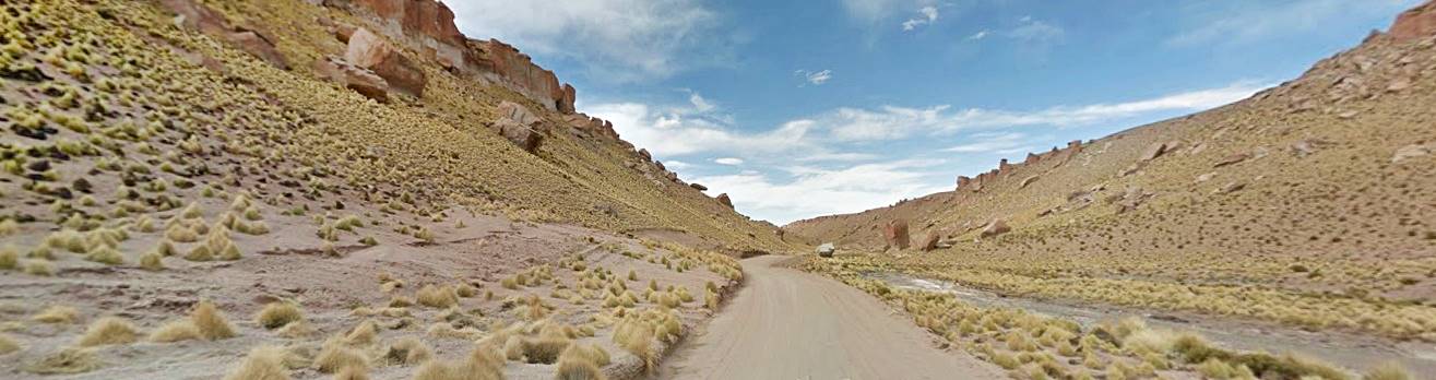
This is a Paved section of Ruta 40. It is the northernmost leg in Patagonia.
Here it runs in the hills and mountain ranges of the arid northern Neuquén province. From Ruta 40 you can reach the Natural Reserve of Copahue, with its mighty volcano, thermal baths, ski resort and araucaria (monkey puzzle) forests, Tromen volcano Natural Reserve with another ski center, the northern Patagonian forests and glacial lakes at the Epulafquen Natural Reserve and the geisers and fumarolas at the Domuyo volcano Natural Reserve, the highest peak in Patagonia.
A Summary of this Road Section
This Paved section covers a distance of 336 km (209 mi.).
Fully paved section.
The highway runs across a very abrupt and arid region crossed by a few rivers which provide the only fertile areas for farming and grazing. The main cities (Las Lajas and Chos Malal) are located on these rivers (the Agrio and Neuquén).
Ruta 40 runs between the mountains of the Patagónides range and contours around the wide base of Tromen volcano to reach the valley of the Colorado and Barrancas rivers.
Heights along the road
It is a higher altitude leg than those located further south, averaging 1.000 meters (3,280 ft.), snow and ice can cause difficulties during winter.

Section 8 is located in Southern Argentina, see red box in this map
- 1.074 m (3,521 ft). At the beginning of the section in Zapala, Neuquén
- 1.124 m (3,685 ft). At the end of the section in Barrancas, Neuquén.
Maximum elevation of the section
1.590m above sea level (5,213 ft) as it countours around the slopes of Tromen Volcano north of Chos Malal.
Things to take into consideration
Ruta 40 is a paved two-lane highway, it runs through mountainous terrain so it has a winding alignment. Drive with care.
Towns and villages along the route
These are the towns located on ruta 40 from north to south: Barrancas, Buta Ranquil, Chos Malal, Las Lajas and Zapala.
Map for this Section of Route 40

www.rionegro.com.ar
See this Google map of the section.
Some image maps of this leg:
Neuquén, maps
Zapala, Starting Point
Zapala
Full information on the town of > > Zapala [our Spanish language webpage]
Accommodation > >
Zapala
We describe this leg from South to North, starting in the city of Zapala and ending at Barrancas, both located in Neuquén province.
From the downtown area of Zapala (km 0) head west along Ruta Nacional 22, at the roundabout it meets Ruta 40 (km 1.5); turn right and head north.
Ahead is the junction with partially paved Ruta Provincial 13 which heads west towards a small ski resort Primeros Pinos ("First Pines" for its monkey puzzle trees) and the turistic town of Villa Pehuenia [our Spanish language webpage] which is 108 km away and is located on Lake Aluminé in the Andes, beside Batea Mahuida volcano.

www.neuquentur.gob.ar
At km 17 junction with Ruta Provincial 3 that runs east towards the village of Mariano Moreno. The higway crosses Covuncó River. At km 44 to the left is the access road to the Cuchillo Curá Natural Reserve.
Cuchillo Curá Natural Reserve
Caves and Caverns
Access. From Ruta 40, (Mapa showing where it is located) following a dirt road through estancia La Porteña.
Description. It has four caverns with an extension of ovre 2.5 miles. It is the largest cave system in Argentina.
It has stalactites, stalagmites and columns, an underground river.
Continue north, at km 55 you reach the small town of Las Lajas.
Las Lajas
Here Ruta 40 leaves Ruta Nacional 22 -which continues towards the Pino Hachado pass to enter Chile (44 km away). Ruta 40 turns right into Las Lajas.
Las Lajas (spanish for "The Shale") is 717 meters above sea level (2,351 ft.), and is locaed on the south bank of the Agrio River. It is a regional center for the local farms. Fill up your gas tank. There is a Municipal Museum too.
Las Lajas
Full information on the town of > > Las Lajas
Side Trips from Las Lajas

www4.neuquen.gov.ar
From Las Lajas you can drive along the paved Ruta Provincial 21 highway to visit Caviahue & Copahue which are 108 km away, in the Andes, at the foot of Copahue volcano. There are araucaria (a monkey puzzle that is native to this region) forests, thermal baths, spas, hotels and cabins plus a ski resort.
Caviahue y Copahue
Full information about the village of > > Caviahue yand Copahue [our Spanish language webpage]
Along Ruta 40 towards Chos Malal
Río Agrio River
The name in Spanish means "bitter" and this is due to the acidity of its water which has its sources in Lake Caviahue at the foot of the Copahue volcano. Sulfur from the volcanic vents saturates its water with sulfur forming sulfuric acid.
As you leave Las Lajas Ruta 40 heads towards the northeast through an arid steppe. Far away, to the right runs the Agrio River. At km 92 to your right is Ruta Provincial 14 which heads towards Villa Bajada del Agrio on the river itself.
The highway takes a north - south direction and at km 105 crosses the Salado River. Ahead at km 110 it meets (left) Ruta Provincial 31. To the east is the "Cordón del Salado" range and behind it, the Neuquén River.
At km 143 is the access (left) to Chorriaca, at km 151 Cerro Rayoso (1.700 m - 5,573 ft) a mountain with layers of sediment and colorful slopes. Further ahead at km 165 junction with Ruta Provincial 9 which heads towards Huitrín.
Ruta 40 crosses the Pichi Neuquén at km 170 (In native Mapuche language, Pichi = "small" so it is the "Small Neuquen River"). To the west is the Sierra de Chorriaca range.
Then comes a relatively flat area (a "Pampa"):Pampa de Naunauco and at km 182, Naunauco, with the junction of Ruta Provincial 5 that heads west to the village of El Huecu [our Spanish language webpage], 61 km away.
Ruta 40 reaches the valley of the Neuquén River (km 207]) mmeting anogher highway leading to El Huecu (Ruta Provincial 6).
Neuquén River
The province got its name from this river, which is 510 km long (317 mi) and has an average flow of 309 m3 ⁄ s (10,900 cu.ft. per sec.), flow which can reach 5.300 m3/s during the snow-melt period in late spring and summer (187,000 cu. ft. per sec).
Its water irrigates the vineyards to the south, at San Patricio del Chañar and generate hydroelectricity at Planicie Banderita.
The name: Neuquén its meaning
Father Bernardo Havestadt was the first person to mention the name "Neuquén"; he explored this region on a missionary trip and wrote in his diary on February 5, 1752: "...we spent the night beyond the fierce Ñudquen. The ñudquen is a es un rough river and can only be crossed in a raft, and, as the providence of our merciful Lord provided us with a guide, we forded it".
The Mapuche language meaning of "Ñudquen": it could have derived from "nüdkun" or "ngüdkun" = "obstruct", "dam currents". It could also come from the words:"nehuen" = "strength" and "quen": "to have" and therefore: to be strong, strong river.
Finally, at km 210 the bridge across the Neuquén River, the highway enters an ara with some vineyards and small farms in the river's valley in the outskirts of Chos Malal:
Chos Malal
Midpoint of Ruta 40
Chos Malal is the midpoint of Ruta 40
Chos Malal is located exactly half way between the starting point of Ruta 40 at Cabo Vírgenes, Santa Cruz province on the Strait of Magellan, and its end point in the Puna Highland, at La Quiaca, Jujuy province.
The monument is located at km 2623 and was designed by Alejandro Santana, a sculptor. It has a curved mast 25 meters high (82 ft.) and its base has images of the Malvinas Islands and some stanzas of Argentina's national anthem.

"Punto Medio", Midpoint monument, neuquentur.gob.ar
The main access into the town of Chos Malal is located at km 213 at the junction with Ruta Provincial 43 (which links the town with Andacollo [our Spanish language webpage] (59 km away).
La Ruta 40 evita el centro y pasa por la falda de un cerro que limita con la ciudad por el noreste.
The City of Chos Malal
Chos Malal
Full information on the town of > > Chos Malal
Accommodation > >
Chos Malal

Patricio Scarabotti
It was founded on August 4, 1887 by Col. Manuel J. Olascoaga, it was a good place to establish a fort as the river Curi Leuvú meets the Neuquén here. It controlled the access to the Andes in a region that had just been occupied after the war against the Mapuche people.
It was the provincial capital until 1904 and it is the most important town in northern Neuquén.
The name
The town's name comes from the Mapuche words "Chos" = "yellow" and "Malal" = "pen", an enclosure for horses made of yellow stones.
It has all the services a tourist may need: stores, shops, lodging, restaurants. It is also the access gate to the protected areas of the northern part of the province, at Epulafquen and Domuyo: lakes, forests, volcanos and geisers, and also to the villages of Huinganco and Andacollo.

TripAdvisor
Ruta 40 skirting Tromen volcano
Ruta 40 must run aroud the slopes of the volcano, a gigantic volcano that has a diameter of 40 km. The highway does this counter-clockwise, starting in the SE corner of the volcano, and ening at its northern tip.
The highway leaves Chos Malal behind and at km 224 junction with Provincial 2, at "La Salada", here the skirting starts. The road climbs and will run around the volcano all the way to Buta Ranquil.
Tromen volcano
It is The second highest mountain in Patagonia after Domuyo Volcano (which is 4.709 m high - 15,439 ft).
Tromen Natural Protected Area
Created as a provincial park in 1971, it covers 30,000 ha (74,000 acres). It is a typical volcanic area with lava fields, basaltic flows, and volcanic cones.
Its last eruption took place in 1828 and in 1752, father Havestadt drew it in his diary with flames and smoke, writing: "I reached Tomen [sic] where there is a valley and a lake at the foot of two volcanic mountanis called Punmahuida. There is no dobut at all, the smoke they sometimes belch is so thick, black and abundant that even at midday it makes it all gloomy and turns the day into night".
Its two summits are Tromen (3.978 m -13,042 ft) and Wayle (3.182 m - 10,433 ft.), it has a lake (lake Tromen) and a wetland ("Bañado de los Barros") which is a bird sanctuary.
The final leg to Barrancas
Ruta 40 continues its long circle around the volcano, climbing until it reaches the Highest point of the section (1.590 m - 5,213 ft.). From here you can see the lake of Auquincó. There can be snow on the road in winter check road conditions if you plan to drive this section in winter (at Chos Malal, Barrancas or in Malargüe (Mendoza).
Auquincó en km 255, en km 267 empalme hacia la derecha con al RP 9 en dirección sur y la RP 6 hacia el río Colorado. La Ruta va girando al norte alrededor del volcán Tromen.
At km 281 Peuquenco river ("water of the monkey puzzle"), and to the right is the wide plain of Pampa El Tril.
At km 287 a very closed "U" section of the road and just ahead, at km 302, the small village of Buta Ranquil:
Buta Ranquil
Buta Ranquil
Full information on the town of > > Buta Ranquil [our Spanish language webpage]
Accommodation > >
Buta Ranquil

www.neuqueninforma.gob.ar
The Mapuche name means: "Vuta" = "big" and "Ranquil": "meadow", that is: "big meadow". It is the capital city of Pehuenches Department and is located at an elevation of 1.149 m above sea level (3,767 ft.). It has some 1.200 residents and provides lodging, fuel and food to travelers.
Ruta 40 turns and heads north, parallel to the Colorado River, which runs to the east and marks the northern limit of the Patagonian region. Ahead, across the river is the Province of Mendoza, in Cuyo Region. You can see the colorful Sierra de Reyes in the distance.
Colorado River
This is one of Patagonia's large rivers, it is born at the confluence of the Grande and Barrancas rivers just north of Buta Ranquil. Both these rivers have their sources in the Andes, to the north and west. The Colorado is named after its color ("colorado" means "red" in Spanish). It flows into the Atlantic Ocean after crossing the steppe.
At km 322 the Buta Có stream and then, at km 335 you reach the small town of Barrancas (in Spanish: "Cliffs", it was named after the river), to your left. This is the end of this section.
Barrancas
Barrancas pop. 1.000 is set at an altitude of 1.124 meters (3,685 ft.) and has fuel, tire repair shop, lodging and places to eat at. It is 5 km south of Ruta 40's bridge across the Barrancas River.
The Mapuche name for this spot was Ranquel mallín which means "marsh of the rushes", the Barrancas River was known as Pichi covud leuvú ("small turbid river").

Barrancas is the northernmost town of Ruta 40 in Patagonia.
Barrancas
Full information on the town of > > Barrancas [our Spanish language webpage]
The Great Flood of 1914
Hundreds of years ago (at least 430 years) a landslide in the narrow valley of the Barrancas River cut off its flow forming a natural dam. The water backed up, flooding the valley and forming a lake, "Cari Lauquen" (Mapuche words that mean "Black Lake") that was 26 km long (16.2 mi.)
Winter of 1914 was cold and plenty of snow fell, during the thawing period in spring of 1914 the lake filled up and overflowed, the natural dam failed due to the water pressure on Christmas Eve of 1914 and the lake emptied suddenly.
1.5 cubic kilometers of water (400 billion gallons) roared downstream razing everything in its way. The then sparsely populated Colorado River valley was flooded and 300 people were killed. The lake's level fell by 90 meters and is now only 5 km long.
Next Section
The next section, from Barrancas to Pareditas in Mendoza, goes through the volcanic lava fields of Southern Mendoza, one of the Top 10 Attractions of Ruta 40 : El Payén - La Payunia.
This span takes you to the Valle de Uco wine producing region. It has some unpaved gravel segments south of Malargüe.
Tips for this road section
1. The Weather
This region has a very dry climate with low relative humidity and scarce rainfall (260 mm per year - 10 inches). The dry season takes place in summer and winter is the rainy one.
Dry air and arid conditions provoke large day - night temperature swings. Summer is hot during the day with maximum temperatures of 30°C (86°F) and minimums of 11°C (52°F) , the average is 21°C (70°F) .
Winter (Jul) has minimums close to freezing temperatures 0°C (32°F) with balmy highs of 12°C (54°F) and a mean of 6°C 43°F) .
Snow falls during winter and there is frost and ice on the road.

2. When to visit and drive this section
You can drive this section throughout the year however the best period is from November to late April (late spring, summer and early autumn) because it is warmer and the weather is sunny.
Bear in mind that Dec. through February and mid July are high season periods. Book your hotels in advance during the high season, hotels tend to fill up.
3. Safety tips
Very Important:there are few towns and villages in this section.
It can snow in winter and ice will form in shady spots of the highway.
Secondary highways and shoulders are unpaved and have a gravel surface
Fill your gas tank at every service station.
This is a mountainous area, and the road has only two lanes. Paved and in good shape.
Road Conditions
Check the Ruta 40 Road conditions on our website
Take with you...
- Food, water, a paper map.
- Warm clothes even during summer. Patagonian weather is unpredictable and the wind factor drops the temperature considerably. This is a relatively high area.
- Sun screen -the sun is stonger in the south due to the hole in the ozone layer.
There are service stations in:
Zapala, Las Lajas, Chos Malal, Barrancas, Buta Ranquil and Loncopue
›› Location of Ruta 40 Service Stations
Lodging in this Section of Ruta 40
Hotels in Chos Malal
Booking.comFind your hotel in > > Zapala
Hotels in this section of Ruta 40..
Find your room in the towns close to Ruta 40:
Aluminé
Villa Pehuenia
Zapala
Copahue
Caviahue
Chos Malal
Buta Ranquil
Provincia del Neuquén


