
The Red Rocks and Soil of Talampaya
Talampaya
National Park & UNESCO Site
"One of the best 10 Attractions on Argentina's Ruta 40"
Talampaya National Prk conserves and protects rock formations that date back to the age of the first dinosaurs: the Triassic.
Landforms of multicolored stone such as Talampaya Canyon, The Botanical Garden, The Lost City ("La Ciudad Perdida"), Rainbow Canyon ("El Cañón del Arcoiris") are some "MUST SEE" sights in
this National Park and World Heritage Site of UNESCO.
It is very close to Ruta 40 in Villa Unión, La Rioja province, Argentina.
The red cliffs at Talampaya

What is Talampaya?
It is a National Park, created in 1997, based on the Provincial Park established in 1975.
Its purpose is to protect the archeological remains and the paleontological resources of the site.
It was designated a World Heritage Site of UNESCO together with the adjoining Ischigualasto Provincial Park, in 2008.
- Surace area 531,000 acres (215,000 ha.)
- Location: South central La Rioja province
- Map showing location
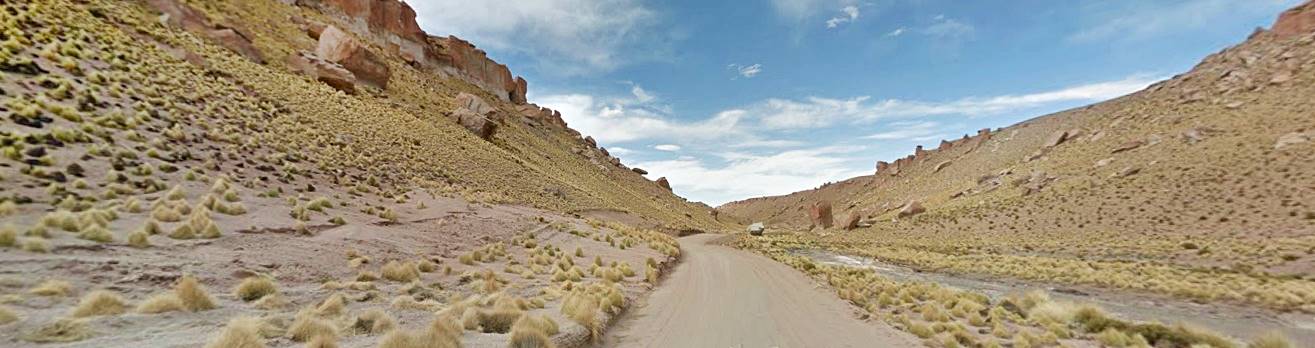
How to get to Talampaya

Talampaya is located the central western Argentina -Red circle in this map
You can get to Talampaya from Villa Union, a town located on Ruta 40's Section from Guandacol to Alpasinche
Villa Unión is a relatively large town, with all the services that a traveller needs (hotels, ATM, police station, first aid, restaurants, stores and service station).
It is a 58 km drive from Villa Union to the park. Head west from this town, along the paved highway Ruta Nacional 76, all the way to Talampaya. See this Map with directions
Fill up your gas tank before leaving town there are now service stations on the highway.
Find your Hotel in > >
Villa Unión
Villa Union
Full details on the town of > > Villa Union [our Spanish language webpage]
Closer to the park is the small village of Pagancillo, with accommodation. A bus daily line links Villa Union and Pagancillo with the provincial capital of La Rioja city.
Find your Hotel in > >
Pagancillo
On the km 148 milepost of Ruta 76 is the Cañón de Talampaya Service Area and the administration of the park. Here is where the excursions that visit the Talampaya Canyon (Cañón de Talampaya) and Don Eduardo Gully (Quebrada Don Eduardo) leave from. It has a place to eat, handicraft stores and a camping area.
From here it is a 80 km drive to the neighboring Ischigualasto Park (59 km along Ruta 76, 4 km along RP 510 in San Juan Province and finally 17 km on Ruta Nacional 150).
Heading south, along Ruta 76, at km 133,5 milepost is the second Service Area, where the tours to Ciudad Perdida and Cañón Arco iris. (Lost City and Rainbow Canyon) depart from.
When Should You Visit Talampaya?
You can visit it throughout the year. High season is Easter and the Winter School Break (July).
Spring and Fall have the best weather, it is not too hot or too cold, but it is sunny and dry.
Winter can be very cold, and snow can fall on occasions. Temperature goes below freezing point.
Summer is very hot and it is the rainy season. Rain can interrupt excursions.
UNESCO World Heritage Site
Both Talampaya and neighboring Ischigualasto Park were designated as a World Heritage Site in recognition of their unique geology which contains the only sequence of continental sediments dating back to the Triassic Period some 200 million years ago.
The Triassic was the period during which a group of reptiles evolved into dinosaurs, who in turn ruled Earth for 150 million years.
The meaning of the name Talampaya
There are several conjectures, but the most accepted one is that it comes from the extinct Diaguita language and means "The dry river of the tala", where "tala" is a local plant, Celtis spinossissima.
Visiting Talampaya
Entrance Fee
You have to pay an entrance fee (cash only) to visit the park. There are different prices (for local residents, pensioneers, foreign visitors, students, etc.)
Open Hours
For those camping there, it is open round the clock.
Excursions
They can be paid with credit or debit card an cash. You can book them at the Service areas. A guide is always necessary.
The excursions operate from 8:30 AM to 7:30 PM during summer (Sep. 22 to Apr. 30) and 9:00 AM to 6:30 PM the rest of the year.
Two Separate Excursion areas
The tours leave from different service areas:
- Tour to the Talampaya Canyon (Cañón de Talampaya). Visiting the Cañón de Talampaya, Quebrada Don Eduardo (Don Eduardo Canyon), Gran Mirador (Great Lookout). It includes a stop to see the native rock art, the forest in the "botanical garden" (Jardín Botánico), the vertical red cliffs at "Puerta de Talampaya" (Talampaya Gateway) and the landforms at "El Monje" (The Monk). At Los Cajones (The Narrows), the canyon becomes very narrow and here you can see the local plants and wildlife as well as fossils -see photo below.
- Tour to the "Ciudad Perdida" (Lost City). Ciudad Perdida and "Rainbow Canyon" (Cañón de Arco iris) with its multicolored rocks with eerie shapes.
"Cañón Los Cajones" where Talampaya canyon narrows...

There are different types of exursions, you can ride the vans of the tour providers, hike or go on bicycle. There is also a Full Moon excursion, on full moon nights.

Fossilized lizard tracks in the red sandstone (arrows). A. Whittall

’La Chimenea’ (The chimney) in the red cliffs. A. Whittall
Advice for those visiting the Park
A map showing the main sites in Parque Nacional Talampaya:

It shows the two service areas and the two excursions that leave from them, and the attractions of each tour.
Rules

Native Rock Art in Talampaya: two men above a ñandú (South American "ostrich") footpring. A. Whittall
You cannot go with your car beyond the parking space in each of the service areas.
You can get your camping permit at the Cañón de Talampaya service area. There is a fee for daytime use and for staying overnight.
Register in the information desk.
No pets allowed
Stay on the trails an follow the signs..
All hikes require the company of a local guide.
The fossils and archeological remains are protected by law (Argentine Law 25.743), so don't touch, remove, dig up, buy or carry this kind of article. It is a crime.
No hunting allowed
Keep your environmental impact to a minimum: don't gather fire wood, light fires or litter. Take your garbage back home with you.
Tips for your comfort
Wear comfy shoes during the tours, you will trek along dry sandy river beds.
There is no mobile signal in the Park.
You can eat at the Service Area and buy food there. There are rest rooms, showers and a camping area there.
Things to pack:
- Wear light comfortable clothes and hiking shoes.
- Take a jacket for if temperature drops in the evening (there is a large daytime-nightime temperature swing in this area).
- Wide brimmed hat, dark glasses and sunscreen. The sky is very clear and sunny
- Plenty of water to keep hydrated in the dry arid climate
- Cash to pay for the park entrance fee.
Cañon Arco iris (Rainbow Canyon), Talampaya

Fossils and Paleontological Resources
This Park and neigboring Ischigualasto Park, are very important sites due to the abundance of Triassic fossils.
The Lagosuchus talampayensis for instance is one of the oldest dinosaurs to roam the Earth, some 250 million years ago (a one-foot-long midget). There are also remains of ancient turtles (Palaeocheris talampayensis) 210 million years old.
Wildlilfe
Birds. Despite its arid climate, you can sight differen birds such as condors, who nest in the walls of the cliffs. As well as a variety of South American ostrich, the Suri or ñandu.
The mammals include gray foxes, a small armadillo (pichi-ciego), a large sized chinchilla (chinchillón) and the ever present camelid, the guanaco.
Guanaco in the red sands of Talampaya

Plants and vegetation
There are different areas within the park with different vegetation:
- Hills. With shrubs, these are rocky, salty or sandy soils.
- The "dry" Chaco area is a wide flat pain that drains to the east, it is covered by trees adapted to the arid conditions there: shrubs and cacti (puqui and cardon) and in the areas with more humidity some trees: retamo, jarilla and the brea -with green bark
On some of the mountain slopes the chica, an endemic tree can be seen, and in the wettest areas, you can see some open woods of the algarrobo tree. In Los Cajones some molle trees grow, with their pepper-flavored seeds.
Native Inhabitants
The sites of pre-Hispanic natives have been dated to to a period spanning from 640 BC to 1180 AD. These people used the caves and rock shelters to live in and to bury their dead.
They left rock art depicting animals, people and geometric motifs.
Native Rock Art in Talampaya
There are four sectors with rock art, not painted, but incised into the rock:
- Puerta de Talampaya. Rock engravings some 400 yards long, see image below.
- Sector ii, 1 km north of Puerta de Talampaya.
- El Bosquecillo (little forest), engravings and seven mortars that were bored into the bedrock.
- Los Pizarrones (the blackboards), in Talampaya valley, 14 km. from La Puerta. It is an engraved panel 47 ft. (14.5 m) long and 3.3 feet high (1 m).
Rock Art at Puerta de Talampaya

Talampaya's Geological History
225 million years ago there was one gigantic continent which during the Triassic Period split into two mega-continents: Laurasia (comprising Asia and North America) and Gondwana (Africa, South Americ, India, Australia and the Atractic).
In what is now the central part of Western Argentina, long and narrow tectonic faults formed (they are known as "rift valleys").
During the Triassic, they filled up with sediments eroded from the surrounding hills. One of these faults was the Ischigualasto-Villa Unión rift, which also included Talampaya.
Triassic
This is the first period of the Mesozoic Era, the "Era of the Reptiles". It got its name from the three different rock formations identified by Friedrich von Alberti in 1834 in Germany when he described this period. He called them "Trias".
It had a warm but dry climate at that time.
Ischigualasto - Villa Unión Rift Valley
It is quite unique because it holds up to 20,000 ft (6.000 meters) of continental sediments. The fault split the ancient Paleozoic rocks, which form the rift's base and runs along the valley of what is now the Bermejo and Guandacol rivers.
Different layers of sediment covered the fault creating what geologists call "Formations". There are six geological formations in the Talampaya, Ischigualasto and Villa Union basin. And they reflect different cycles during which humid periods formed marshes and floodplains and then dry periods created desert conditions.
These formations are, from the oldest to the most recent one, the following:
Talampaya
The oldest (252 to 247 Million years old). Wet period with ephemeral lagoons. The rocks have a pale red and pink tint. They only contain fossil tracks and foot prints of reptiles, that looked like crocodiles or dinosaurs. You can see this formation in the "Cañón de Talampaya" canyon and the "Lost City" (la Ciudad Perdida).
La ’Ciudad Perdida’ - Lost City, rocks from the "Talampaya Formation":

Tarjados
Age: 247 to 237 million years. Dark red and brown rocks can be seen in the uper part of the Cañón de Talampaya canyon and the Rainbow Canyon (Cañón Arco iris). Few fossils (of dicinodonts). Dry arid climate.
The image below shows dark red colored rocks of the Tarjados Formation, overlying older pink rocks of the Talampaya Formation:

Chañares
This formation was deposited in a lake that formed here some 235 million years ago. It has whitish sediments and many fossils of reptiles that lived along its shores. This is the lower and mid Triassic Period, and these reptiles were the ancestors of both dinosaurs and mammals, they were Therapsida.
They can be classed into two groups: the Dicynodontia, the size of a bear with a beak like that of a tortoise; and the smaller Cynodontia from which modern mammals descend.
Gray and bluish rocks from the Chañares in Ischigualasto:

Los Rastros
This formation is made up of sandstone 230 million years old. Some ar black, others dark green or yellowish. They were laid down by rivers during a wet period, during which lakes and marshes with lush vegetation covered this area, the trees formed the veins of coal that have been found here. It was during this period that Gondwana began to split apart, with Africa and South America rifting to form the infant Atlantic Ocean.
Ischigualasto
This formation contains sediments from the Upper Triassic (227 million years ago); they are grayish and brown. Formed in the base of a valley that was flooded by a river during a wet period. Fossils of dinosaurs have been found in the mud of this ancient river, with petrified trees.
The first dinosaur, the Eoraptor was found here.
Los Colorados
The Los Colorados formation spans a period from 227 to 200 million years ago, this is the beginning of the Era of the Dinosaurs: the Upper Triassic.
Dry and humid periods alternated and the red rocks owe their color to the iron oxide in the sediments.
It has fossils of Archosauria, with large herbivore and meat-eating dinos as well as mammals and some trees that resemble monkey puzzles.
"Los Colorados" Formation in neighboring Ischigualasto

Then, after almost 150 million years of supremacy, a meteorite wiped the dinosaurs out 65 million years ago. Shortly after the folding and uprising of the mighty Andes took place. This is now the Tertiary Era, and the sand, clay and rocks eroded from the newly formed Andes lay down the deposits of the "San Nicolás" rocks group.
As the Andean mountain range rose higher, it uplifted the Talampaya area with it, and the Talampaya river eroded the surrounding terrain forming the sheer narrow canyons we can see today.
Tips and suggestions for visiting Talampaya
1. The Weather in Talampaya
It has an arid continental climate, with very low relative humidity. The dryness of the air provokes large temperature swings between night and daytime.
Summers are hot and sun is strong, the temperature can reach a blistering 122°F (50°C) in the sun during January. Winters are cold with the temperature going below freezing point, and temperatures in July can reach a chilly 16°F (- 9°C).
It can freeze at any time between May and October.
Dry conditions prevail and only 6 inches - 150 mm of rain fall each year, mostly during the summer rainy period, in downpours which can flood the dry rivers and interrupt excursions in the Park. The rainy season extends from Nov. to Mar.
The hot dry "Zonda" wind blows from the Andes between July and Oct.
Clothes: carry warm clothes during winter, dress lightly in summer and don't forget a wide brimmed hat, sunscreen, water to keep hydrated and dark glasses.
2. Driving Tips
The roads that lead to the Park, such as the highway Ruta Nacional 76 from Villa Union, are paved, relatively level (not to many ups and downs) and quite straight. Ruta 40 south of Villa Union is also easy to drive. North of Villa Union towards Chilecito is the Cuesta de Miranda, a paved mountain road section, which is very pictouresque and also easy to drive.
Road Conditions
Check the road conditions on our website: Road Conditions.
There are service stations in Villa Unión, Chilecito, Guandacol, Nonogsta, Pataquia, Jáchal, and La Rioja.
›› Location of Ruta 40's Service Stations
Accommodation near Talampaya National Park
There are quite a few hotels in neighboring Villa Union, see below:
Booking.comFind your hotel: > > in Villa Unión
Find your Hotel...
Find hotels in other towns close to Talampaya Park
In La Rioja
Chilecito
Famatina
Guandacol
Villa Unión
Pagancilo
La Rioja city
Aimogasta
In Catamarca
In San Juan


