Over 80 sq. miles of salt
Salinas Grandes
"Top 10 Scenic Attractions along Ruta 40"
Learn All About it
The Salinas Grandes salt flats is located in Jujuy and Salta provinces in Northern Argentina.
The Salinas Grandes spans an area of 212 km2 (82 sq. mi.); it is set at an altitude of 3.400 meters (11,100 ft) avove sea level.
A white salt desert surrounded by the hight peaks of the Puna highlands contrasts with the clear deep blue sky.
Here we will explain its location, distance from the cities of Salta and Jujuy and the villages of Purmamarca and Susques.
You will learn how they were formed and how to reach them, and also, the accommodation near them.
Their name, in Spanish, means "Large (or Big) Salt Flats".
How to Pronounce Salinas Grandes in Spanish
"Suh-lee-nuhs Gran-des" ("des" like in "desk").

Piti Olague
FAQ about the Salinas Grandes

Questions and Answers about the Salinas Grandes
Where are they?
Q: Where are the Salinas Grandes located?
A: They are located in Northwestern Argentina, on the border between the provinces of Salta and Jujuy.
The salt flats are set between national highway Ruta Nacional 52 that links Purmamarca with Susques on its northern flank, and the "old" Ruta 40 (now known as "Ruta 1v40") on its southern and eatern side. Ruta 40 links the towns of San Antonio de los Cobres and Abra Pampa.
How far are they from the main cities?
Q: How far are they from Salta, Jujuy and Purmamarca?
- From Salta 245 km along Ruta 9 and 52.
>> See Map from Salta to Salinas Grandes. - From Jujuy 131 km same highways
>> See Map from Jujuy to Salinas Grandes. - From San Antonio de los Cobres, 100 km along the "old" Ruta 40. Ver detalles en: De S. A. de los Cobres a Salinas Grandes.
- From Purmamarca only 65 km via Ruta 52.
>> See Map from Purmamarca to Salinas Grandes. - From Susques only 82 km along Ruta 52
> > See Map from Susques to Salinas Grandes.
Ruta 52 and Ruta 9 are completely paved. "Old" Ruta 40 is gravel, sand and dirt.
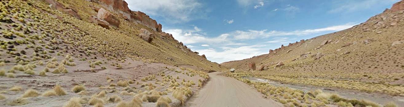
When driving from Purmamarca to the Salinas Grandes you will drive up the winding "Cuesta de Lipan" pictured below:

Loco085
Is a "Salar" the same as a "Salina"?
Q: What is the difference between a "Salar" and a "Salina"?
A: A Salar like the well known "Salar de Uyuni" in Bolivia, is a closed basin or lake that collects all types of salts. This means that Salinas Grandes is also a "Salar".
On the other hand, a Salina is a salt flat where the salt is extracted by dissecation -specially common table salt (sodium chloride).
Where to stay when visiting the Salinas Grandes?
Susques
Full details on the town of > > Susques [our Spanish language webpage]
Accommodation in > Susques
Purmamarca
Full details on the town of > > Purmamarca [our Spanish language webpage]
Accommodation > Purmamarca
The weather in both towns (notice it is cooler in Susques - higher up in the Puna):
The closest towns are Purmamarca and Susques. You can also lodge in any town in the Quebrada de Humahuaca or do a day trip from Jujuy or Salta.
Trivia about Salt
Did you know that 0.4% of your body weight is made up of salt? A person weighing around 150 lbs. (68 kg) has almost 10 ounces of salt in his or her body (272 g), this is the equivalent of 54 tea spoons of salt.
Our bodies lose salt when we pespire, and also through our urine so it has to be replenished daily. Lack of salt (hyponatremia) can cause death.
Even fresh water contains salt: a clear mountain creek may contain 50 parts per milion of salt (50 ppm), sea water has 35,000 ppm (that is 3.5% of diluted salt).
All the seas in the world contain some 47.000.000.000.000.000 tons of salt, enoguh to cover the surface of US' 48 contiguous states with a layer of salt 8,800 feet thick.

Jujuy.gob.ar
Chosen as one of Argentina's 7 Natural Wonders
The Salinas Grandes were chosen in 2019 as one of Argentina's Seven Natural Wonders chosen by popular vote.
Of the other six, three are located on Ruta 40: the Perito Moreno Glacier, Talampaya National Park and Nahuel Huapi National Park)
The remaining thre are the jungle in the province of Misiones, the river at Mina Clavero the wetland marshes of Bañado La Estrella in Formosa.
The different types of Salt Flats
Q: What are the different types of salt flats?
There are "marine salt flats" or "salt marshes", found in coastal areas where sea water evaporates leaving behind their load of salt, and there are "continental salt flats", that accumulate salt washed or leached from the surrounding elevated terrain, like the "Salinas Grandes".
Origin of the Salinas Grandes
Q: How were the Salinas Grandes formed?
A: They are located in a closed basin, a depression that collects the runoff from the surrounding higher areas during a short rainy season.
The rest of the year the dry sunny conditions cause the water to evaporate and the salt is left behind. This happens year after year over millennia, accumulated vast quantities of salt.
Read more about their origin below.
The other "Salinas Grandes" in Argentina
Q: Are there other "Salinas Grandes"?
A: Yes, there is one other salt flat bearing the same name in Argentina and it is located in the provinces of Córdoba, La Rioja, Catamarca and Santiago del Estero. They are even bigger than these, with a surface area of (2,318 sq. mi. - 6.000 km2) and set at a lower altitude (557 ft - 170 m). By size they are the largest in Argentina, and they are second in the world behind the Salar de Uyuni (Bolivia).
The polygonal crust of salt
Q: Why does the crust have a hexagonal shape?
A: (see image above) As the water evaporates, the salt that is left behind shrinks and contracts. This provokes cracks on ths surface of the salt. The tension that builds up makes the cracks grow in length following the crystallization planes until they meet another crack. This creates a polygon.
Salt blown by the wind builds up in the cracks and catches more windblown salt building up an elevated contour or "frame" around the polygon.
Salinas Grandes vs. Salar de Uyuni
Q: How does it compare with the Salar de Uyuni?
A: The Salinas Grandes have a surface area of 82 sq. mi. or 212 km2
The Salar de Uyuni in Bolivia is the largest in the world, covering an area of 4,087 sq. mi. (10.580 km2), that makes it larger than Lebanon.
Uyuni is 50 times bigger than the Salinas Grandes.

www.dipec.jujuy.gov.ar
Geology: origin and formation of the Salinas Grandes
Origin of the Salinas Grandes
During the Cenozoic Era, (period that spans the last 65 million years) thrusting and folding of the Earth's crust formed the mountains located to the west of what is now the salt flats, the Sierra de Cobres range.
This created a large and deep basin on their eastern flank that, during the Miocene period was gradually filled in with sediments eroded from those mountains.
This was followed by another period of geologic activity which created the Sierra de Acay range to the south, the Sierra Alta to the east and the Aguilar range in the northeast.
What is now the Salinas Grandes wasn now enclosed on three of its sides and cut-off from the Quebrada de Humahuaca rift valley which is part of the Atlantic Ocean watershed.
The enclosed basin was then filled in with the sediments carried by the streawms which flowed into it. Over millions of years a layer of sediment several miles thick filled the depression.
Nowadays its surface has an average elevation of 11,100 ft. (3.400 m) and is surrounded by mountains with an average height of 14,800 to 18,000 feet (4.500 to 5.500 meters).
An enormous glacial lake
The Puna wasn't always as dry as it is today. During the ice ages (Upper Pleistocene) the weather was wetter and glaciers formed in the mountains that surround the Salinas Grandes.
The water formed by the melting glacial ice formed a lake in the lowest part of the basin, it was a Paleolake.
Then, some 18,000 years ago, climate changed and a warm period began. The glaciers gradually disappeared forming a vast lake which covered what are now the Salinas Grandes salt flats and the neighboring Laguna de Guayatayoc lake.
It was about 33 feet deep (10 m) some 14.000 years ago.
A Map of the Salinas Grandes
The map below shows, in pale blue, present lake Laguna de Guayatayoc, in blue, the outline of the Paleolake and in violet the Salinas Grandes. The fluvial fan of the río Las Burras River is shown in tan.

A. Whittall
›› See a Google Map of Salinas Grandes
Evaporation of the Salinas Grandes Paleolake
Starting some 14,000 years ago the inflowing streams dried up as their glacial souces disappeared. Climate became drier and the lake began shrinking as it dried up.
The río Las Burras River formed a delta or alluvial fan along its southern bank, which blocked its outflow towards the south. The river shifted its course northwards and eventually flowed into what is now the Laguna de Guayatayoc lake.
The Salt Flats
Lack of permanent inflow of water turned the southern side of the ancient paleolake into a salt flat that only receives water on a seasonal basis.
The dry streams coming down from the mountains bring diluted salt during the rainy season (December to March). This covers the salt flats with abour one foot (30 cm) of water. The vast white flats become a temporary "lake" during summer.
This inflow of water brings fresh salt to the salt flats and "washes" away the dirt.
The rest of the year (April to November) sees no rain and the dry and windy conditions evaporate the water that accumulated during the summer. The salt that sedimented on the lake's bed dries out into shining white polygones.
This cycle of rain, flooding and evaporation is what formed the Salinas Grandes.
Laguna de Guayatayoc lake
The northern lobe of the ancient paleolake receives the inflow of water from the río Las Burras river and therefore has not dried up. It is a lake with a surface area half the size of the Salinas Grandes (42 sq. mi, 110 km2).
It is a "Playa Lake", an ephemeral, salty shallow wetland with very alkaline water in a closed basin (no outflow). Its surface area changes according to the season, and the "playa" (Spanish for flat) or "pan" is covered by a light brown crust of salt. Under it are green clays.
Dry conditions during the 1900s almost led to its complete evaporation.
Wildlife at the Salinas Grandes
Ramsar wetland
Together with the lagoons of Vilama and Palar, it is a designated Ramsar wetland site.
A Ramsar Site is a wetland of international importance due to its biological diversity and because it is a wildfowl refuge, where migrating birds can stopover during their seasonal migrations.
Ramsar is an international convention signed by 144 countries to preserve and protect the wetland ecosystems.
A large variety of birds feed and nest here during summer: horned coots (Fulica cornuta), James's flamingos (Phoenicoparrus jamesi) and Andean flamingos (P. Andinus).
The Puna highland camelids such as the vicuñas (Vicugna vicugna) and the American "ostrich", the suri o ñandú of the cordillera (Pterocnemia pennata garleppi) feed in the "ciénagos", lush meadows that surround the lake, and they drink fresh water from the springs.
Vegetation at the Salinas Grandes
The salt flat itself has no plants at all. But the springs that are located in the hills around it and a fresh water aquifer allow vegetation to grow. You will find squat and stumpy trees known as "churquis" and a local type of cacti, the "cardón" as well as tough grass adapted to the salty environment.
Population
The Native Americans
As lake Guayatayoc is a permanent lake, the original inhabitants settled along its shore in spots where there are fresh water springs. The archaeological site of "El Pasaje" is 4,000 years old. The village of Barrancas, close by, has prehistoric rock art.
The Salinas Grandes Mummy
Eric Borman reported a mummy found by Eleodoro Ursagaste on the western side of the Salinas Grandes in 1903. It carried a golden crown and was a child that had been sacrificed during a relgious ceremony in the salt flats. Nowadays it is preserved in Buenos Aires, in the "Bernardino Rivadavia" Natural Sciences Museum
Read Borman's paper and see a photo of the child mummy.
Nowadays the local natives breed llamas and sheep in the meadows around the Salinas Grandes in winter, and in the high Andean grasslands during the summer rainy season.
They have been extracting salt since prehistoric times and used it in exchange for products from the lowlands. The Inca and later the Spaniards also produced salt. The Spanish called the salt flats "Salinas de Casabindo" after the town of Casabindo, which is quite close to them.
Even today salt is extracted with traditional methods.
Extraction of Salt
Types of salt: Borax, lithium and common salt
Water flooding the salt flats brings not only common table salt (sodium chloride), but also other varieties of mineral salts such as sulfates (gypsum), borats (ulexite) and carbonates.
There are also magnesium and lithium salt, but the locals focus on the mineral known as "Halite", which is basically common salt.
The salts form stratified layers so the separation of common salt and borax is relatively easy.
y carbonatos. Hay sales de litio y magnesio. Pero la más frecuente es la Halita, que es explotada por los lugareños.
Las distintas sales suelen estratificarse separadamente permitiendo explotar el bórax por un lado y la sal común por otra.
Las aguas con sales disueltas, bajan de las sierras circundantes, incluyendo los volcanes Tuzgle y Coranzuli hacia el noroeste. Con rocas que datan del período Precámbrico,
It is quite likely that the sediments beneath the salt flats contain oil or gas, in a geological sequence known as Yacoraite Formation.
Borax
The "Boratera Triunvirato" plant was established in the village of Tres Morros in the early 1900s, it had an oven to calcinate the borate mineral, and the population grew to 47 residents in 1920.
There were mines, now in ruins at Cangrejillos and Niño Muerto.
Lithiuim
The Australian company Orocobre which is extracting lithium from the Olaroz salt flats in Jujuy has explored the Salinas Grandes and purchased large parts of it as a part of a future project to extract lithium. They estimate that there are some 240 thousand tons of lithium carbonate and over one million tons of potassium chloride in the Salinas.

Gonzalo Rivero
Lithium is used as a main component in Lithium-ion rechargeable batteries that power portable electronics (notebooks, smartphones) and electric cars..
The locals are opposed to any lithium mining project due to its potential environmental impact (Further reading).
Traditional Salt mining
Salt is extracted during the dry season, from April to November and there are different ways to do this:
Cut into blocks
Ths salty surface is cut into blocks with axes or pick axes and then shaped into smaller bricks or blocks.
Scraping the surface
The salty crust is scraped with a plow (or a motor grader) and gathered as granules. This is usually sold for animal feed.
Cystallization in evaporation ponds
Ponds or pools are dug into the salt flat. The salt that forms inside them as the water evaporates is a high purity grade that can be sold for human consumption. Once the water has evaporated the salt is dug out of the ponds.
Salt mining is tough, the sun and its reflection on the white salt flats can blind workers ("salt flats illness" or Surumpio) and it also burns the skin. The brine irritates eyes and skin.

Rodrigo Solá (Kachi Yupi: Un ejercicio de autodeterminación indígena en Salinas Grandes).
Sights and tours close to the Salinas Grandes
Barrancas or Abdón Castro Tolay
Small village located 15 km to the north on Provincial Route RP 75.
It has rural lodging, first aid and a pictouresque church. See the local hand woven llama wool textiles.
Lodging in Barrancas Red Espejo de Sal
Visit the village of Susques, located to the West along Ruta Nacional 52.
With its historic church, lodging and service station, restaurants and tourist services.
Coming from the Quebrada de Humahuaca you can visit Purmamarca with its famous "Seven Colors Hill" (Cerro de los Siete Colores) pictured below.

Augusto Sarita
Tips and Advice when you visit the Salinas Grandes
1. Weather in the Salinas Grandes
The Puna highland is very dry and has very low relative humidity (average of 47%).
Rainfall is scarce (12 to 16 inches - 300 - 400 mm yearly). Rain falls in summer, the rest of the year is dry.
Low humidity and altitude lead to very clear and sunny skies. Watch out for sunburn (UV radiation is stronger due to the altitude).
Winds are stronger in the afternoon.
There are wide temperature swings between night and day (36° F or 18°C). Nights are cold, even in summer.
During winter expect freezing temperatures.
The rest of the year the temperature is low (mean annual temperature 47.5°F - 8.6°C). Maximum values for summer are 77°F - 25°C and winter minimums are up to 5°F or -15°C. There is below freezing temperatures 220 days per year.
2. Travel Tips
Tips to bear in mind when visiting the Salinas
Go during the dry season: April to November, in summer they are covered by a layer of water.
Expect dry, sunny, windy and cool weather, so don't forget to pack:
- Wide brimmed hat with a strap to keep it from blowing away in the wind.
- Sun glasses to protect your eyes from the blinding reflection from the sun and the salt.
- Water because the dry climate will dehydrate you
- Warm clothes because temperature will drop, specially during the afternoon.
Don't forget to touch the salt, take off your boots and socks, walk barefoot on it to feel its texture. Wash your skin with fresh water after playing with the salt.
3. Height and Altitude Sickness

Enjoying the "Salinas" (Mintur)
Altitudes in excess of 6,500 feet (2.000 m) can produce nasty symptoms known as "altitude sickness", also known as Acute Mountain Sickness or locally as Soroche.
Lower atmospheric pressure at high altitude means taht there are fewer oxygen molecules in a given volume of air causing your body to suffocate due to lack of oxygen.
A 3.450 metros de altitud (la altura de las Salinas Grandes) hay apenas un 67% del oxígeno en comparación con el nivel del mar (que es del 100%).
Lack of oxygen can cause headache, nausea and dizziness, quickened pulse, fatigue and weakness and shortness of breath.
Read more about How to cope with altitude sickness
4. Safety Tips for Road Trips
National highways 9 and 52 are totally paved and in good condition. They are mountain roads with gravel shoulders, two lanes (one going, one coming) so you should drive with care and respect the speed limits.
Other roads in the area, such as Ruta 40 are difficult because they are unpaved and combine gravel, mountain driving, extreme altitudes and extreme weather in an area with hardly any inhabitants and few villages to seek for assistance.
Your car must be in top conditions and you should be adapted to the high altitude.
Fords, dry river beds and summer rain
There are many "dry" river beds that cut across the dirt roads. These are dry most of the year but can become swift flowing rivers during flash floods in the rainy summer season. They also freeze in winter so be careful with the ice and frost.
Road Conditions
Check the road conditions on our website: Road Conditions.
Important Tips
- Always Keep your gas tank full (below we list the gas stations). Top it up before setting out, the distances are great and there are few service stations in the area, and they may have run out of fuel.
- Take food and water with you. Carry a paper map -don't rely on cellphone signal being available in the Puna.
- During the summer rainy season there may be road closures on Ruta 40, Ruta 9 and Ruta 52.
- Cross the fords carefully especially during the summer flash flood season.
- This is a high altitude journey so factor in that you may suffer from Altitude Sickness.
- Wear apropriate clothes for the area (warm clothes). Pack a blanket in case you have to spend the night out in the wilderness. Even in summer it can get very cold at night (large day to night temperature swings).
Loose Gravel. Drive carefully on the gravel, it is slippery, you can skid, the dust may impair visibility, passing vehicles may fling stones at your windshield (cracking, chipping or even breaking it. Take extra insurance when you rent a car).
There are service stations in Salta, Jujuy, Susques, La Quiaca, Humahuaca, San Antonio de los Cobres, Jamas Pass and Purmamarca.
›› Location of Ruta 40's Service Stations
Accommodation in the Salinas Grandes
There are quite a few hostels and hotels in the area: Purmamarca (65 km) , in the Quebrada de Humahuaca UNESCO World Heritage Site.
The town of San Antonio de los Cobres (100 km - gravel road) and Susques (70 km) west of the Salinas also have lodging options.
Booking.comFind your hotel: > >
Your Hotel in Susques
Find your Hotel...
There are plenty of hotels, hostels and inns in the nearby towns in Salta and Jujuy provinces


