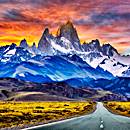
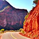
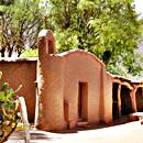
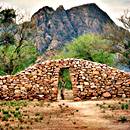
Ruta 40 in the Famatina Mountains
Cuesta de Miranda
Learn All About the winding Road
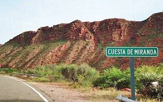
"Cuesta de Miranda" Road Sign, Source
Cuesta de Miranda is located in the eastern slopes of the Famatina Mountains, linking the towns of Villa Unión and Chilecito in La Rioja province, Patagonia, Argentina.
It was until recently well known for its difficulty: a narrow road where barely two vehicles could barely fit abreast, with sheer cliffs falling into the deep canyon of the Miranda River.
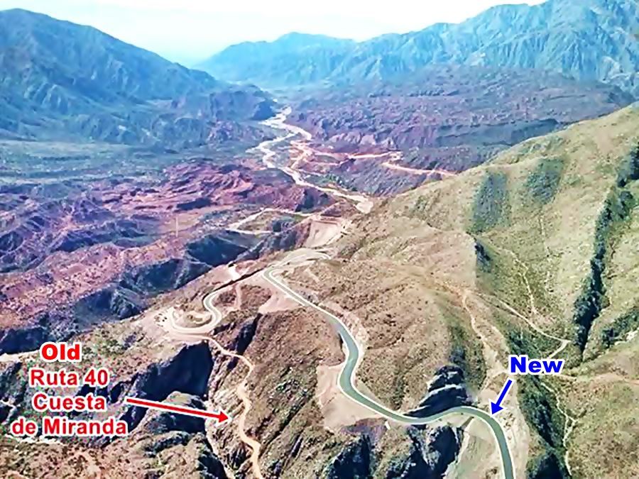
Now it has been made safer, it is completely paved, and much straighter. However the "old" road is there for you to see and walk along.
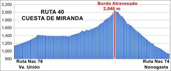
It is relatively low, with a maximum elevation of 7,350 feet (2.040 meters) at Bordo Atravesado Pass.
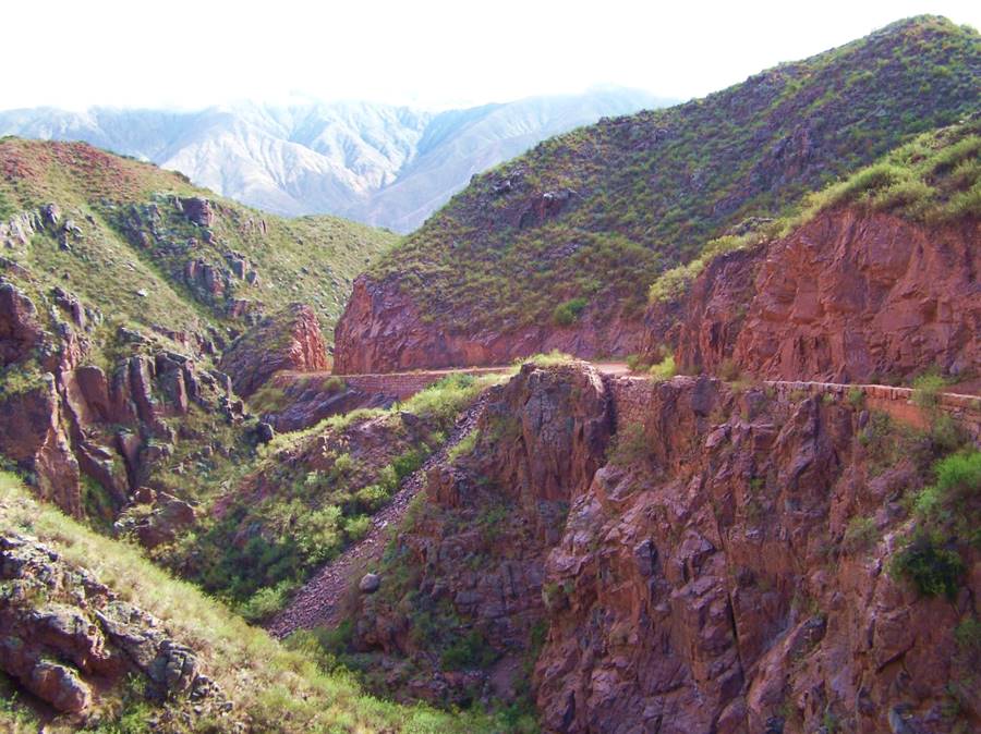
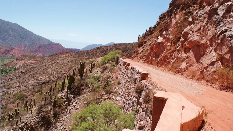
The photograph above shows a preserved part of the original highway at Cuesta de Miranda, after the new paved road replaced it. The site shown in the photo is shown in this map.
Some FAQ about the Cuesta de Miranda
All you need to know about it:
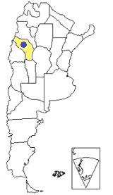
Where is it?
Q: Where is the Cuesta de Miranda?
A: It is located in the La Rioja province in the Cuyo region of Argentina, on Ruta 40, and it links the towns of Villa Unión in the south with Chilecito in the north.
It is called "Cuesta", Spanish word for "slope" or "incline", as it crosses the lowest point between the mighty Sierra de Famatina range to the west and the Sierra de Sañogasta to the east.
The name: Miranda
The name Miranda is the name of the original owner of this land, the Spanish Captain, Don Juan de Miranda who defeated the local natives during the Calchaquí wars in 1667.
What is Miranda Slope
Q: What is the Cuesta de Miranda;?
A: It is the road that crosses the Sierra de Famatina built as a highway between 1918 and 1928 along an ancient trail. It was a technical feat in its time.
Between 2011 and 2015 it was relocated and improved to modern standards, and paved.
Elevation and Highest point
Q: How high is it?
A: Its highest point is known as "Bordo Atravesado" and is 7,350 ft (2.040 m) above sea level.
The road climbs out of Villa Union in the south (3,746 ft - 1.142 m) and climbs all the way to Bordo Atravesado, then it goes downhill, and at Miranda reaches an altitude of 4,839 ft (1.475 m) and at the end of the segment in Nonogasta its elevation is 3,064 ft (934 m).
The image below shows the gradient of Ruta 40 across the Cuesta de Miranda between Villa Unión and Nonogasta.
When to visit Cuesta de Miranda
Q: When is the best time to visit it?
A: You can visit it throughout the year, but in winter it can snow and in summer is the rainy season. The best time of the year is Fall and Spring: sunny, clear skies, dry, and not so hot as it is in summer.
Is it paved
Q: Is it paved?
A: Yes, the whole section of Ruta 40 across the Cuesta de Miranda is paved. It is a new highway, safe and built with modern standards.
Closest Ruta 40 towns to Cuesta de Miranda
There are two main towns one on the northern side, Chilecito, another on the southern side: Villa Union of the slope.
Both have all the conveniencies and services that a tourist may need:
Chilecito
Full details on the town of > > Chilecito [our Spanish language webpage]
Villa Union
Full details on the town of > > Villa Union [our Spanish language webpage]
The "new" Ruta 40 in Cuesta de Miranda
The Famatina and Sañogasta mountain ranges cut across, in a NW to SE diagonal , the province of La Rioja. The only link across these mountains was the old dirt road built in the early 1900s in Miranda.
To improve the internal communication within the province and to link Ruta Nacional 76 which links Villa Unión with Chile and Ruta Nacional 76 through Chilecito, the old road had to be improved.
It was frequently cut by mudslides during the rainy season, and it was too narrow for heavy traffic.
The highway was redesigned and now is a two lane -even three in some parts- paved highway.
Roadwork of the year "2015"
Due to the complexity and the technical innovations used in its construction, the new Ruta 40 in Cuesta de Miranda was designated as "Roadwork of the Year" by the Argentine Association of Highways (Asociación Argentina de Carreteras).
See this video that shows how the road was built.
Southern Section, from Tambillos to Bordo Atravesado Pass
There are two distinct sections in the Ruta 40 at Cuesta de Miranda. The first one begins one mile south of the village of Los Tambillos at kilometer 3.813 of Ruta 40. It is 9 km long (5.5 mi).
It ends at the highest point of Miranda slope, Bordo Atravesado.
It is a mountainous region with relatively low gradients. The shoulders are wider here (2 m / 6.9 ft.)
The Ruta 40 goes through small hamlets: Tambillos, Las Trancas o "Puesto Ciciliano" and Puerto Alegre.

New Ruta 40 in Miranda slope

Another view of Ruta 40 at Cuesta de Miranda
Northern Section, to Miranda
The second segment is 10 km long (6.2 mi.) and crosses a more abrupt area, here the shoulder is only 3.3 ft (1 m) wide. This segment ends at km 3.832, near the place known as Cachiyuyal.
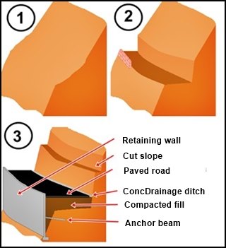
"old" (2) and "new" Ruta 40 (3) at Cuesta de Miranda
A. Whittall
The following image shows how the road was built: the original mountain slope is shown as (1). The "old" road was built with a minimum cut (2), a low stone wall acted as a "guard rail".
The new road (3) required extensive cuts in the slope (which is very steep in some sections, with a 70° slope), concrete retaining walls were built to contain the compacted fill and these were anchored to the mountain slope with concrete beams. In one section a 330 foot (100 m) bridge was built to cross a chasm.
Some sections have steel cable nets to contain any possible rock falls.
Features
As no heavy machinery could reach the area, most of the concrete was premolded and not cast in place.
The new road is 22 ft. (6,70 m) wide; the old one was half as wide.
It cost 92 million dollars.
There are sections with three lanes so that the slow traffic can use the third (right) lane uphill.
Blasting to cut the slope destroyed many of the local cacti, the cardón on the slopes. A program to replace and recover the original vegetation was implemented in Dec. 2012.
The old winding alinment was replaced by a "straighter" one, built higher up in the mountain, but in some sections "old" and "new" roads overlap.
The old road's rock containment walls were ineffective as guard rails, now steel guard rails and New Jersey concrete diviers have enhanced the road's safety.
Concrete shoulders and drainage ditches help reduce erosion and prevent mud and rock slides.
Preservation of the "Old Alignment of Ruta 40" at Cuesta de Miranda
The original alignment was preserved in two separate locations, onee is between km 12,5 and 14,7; the other between km 18,25 and 19,34.
You can't drive along them, but you can walk or cycle.
The Old Road at Cuesta de Miranda
Except those two sections mentioned above, the rest of the old road is now buried under the new alignment.
How was the Old Road?
The original road was built by the Italian engineer Francisco Bolloli between 1918 and 1928, using shovels and pick axes.
It was unpaved, with a gravel surface and it followed the winding contour of the mountains. It had a total of 320 curves, many of them hairpin and cliff-hangers.
It was a narrow road barely wider than one lane. The only thing that kept cars from falling down the cliff was a low stone wall (pictured below).
Meeting an oncoming car head on was an adventure, you'd have to maneouver to fit both cars between the steep mountain slope and the sheer drop into the canyon.
Rain would cause mud and rock slides, in 2011 (see the news article: a family died, crushed by a falling rock.
This was the original Cuesta de Miranda:
New and Old alignments at Miranda, seen from above, looking North:
Geology and Cuesta de Miranda
Sierra de Famatina Mountains
The Famatina Mountain range spans from the north, in the province of Catamarca west of the town of Fiambalá, in the Andean foothills, on the southern tip of the Puna highlands, and runs with an North to South direction for almost 220 miles (350 km), it continues with a southeastern direction as the Sañogasta Range. It is 25 miles (40 km) wide.
The highest "Sierra" in the whole world
These mountains are the highest sierra in the world, with a height that exceeds 20,350 ft (6.200 m.)
Sierra is the Spanish word for saw, and by extension, a jagged mountain range. Such as the Sierra Nevada in California and their namesake in Granada, Spain.
Its southern tip is near the National Park of Talampaya and Ischigualasto Provincial Park.
The Famatina is made up of very ancient rocks, from the Paleozoic Age, some 500 million years ago. The Andes, when they formed 10 million years ago, dislocated and uplifted the Famatina.
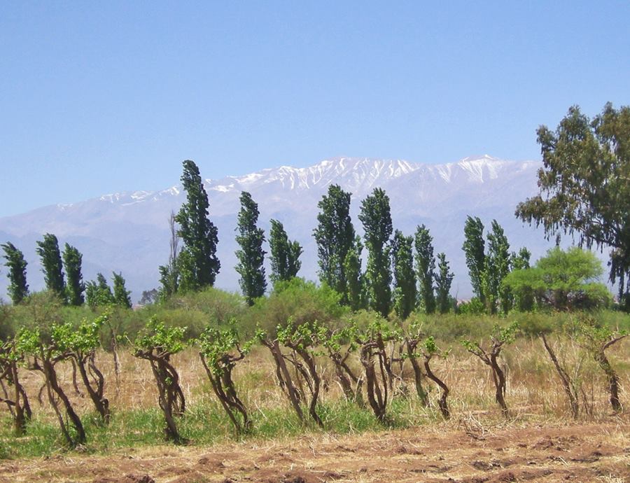
It reaches its maximum height at Mount Cerro General Belgrano with 20,505 ft (6.250 m).
Despite their northern latitude the Famatina's summits have snow above the 6.000 meter snowline even in summer. This snow feeds the creeks that irrigate the grapevines and olive trees that grow in the foothills.
Only one highway winds its way across the Sierra de Famatina: Ruta 40, along the Cuesta de Miranda slope.
Terrain, its rocks
Coming from the south, on the southwestern slopes of the Famatina runs the El Puesto River. Ruta 40 uses this valley to climb into the Famatina.
All along the valley you can see the red colored rocs of the Patquía Formation, from the Permian period.
Origin of the Red sedimentary rocks
Thes rocks are sandstone and conglomerates that were deposited some 290 million years ago. They began as flood plains and in Bordo Atravesado you can see some fossils.
The rocks' red color is due to a variety of iron oxide known as hematite, which dissolved in a shallow sea and was later subjected to pressure and temperature when they were buried by later sediments.
They are very similar to the red stone you will see at Talampaya National Park, but the rocks at Talampaya are older, from the Triassic, some 250 to 200 million years ago.
The base of the canyons are covered with more recent rocks, eroded from the mountains by the rivers.
Bordo Atravesado highest point of Cuesta de Miranda

At Bordo Atravesado, the highway reaches its maximum elevation and crosses the Aicuña Fault, at the southern tip of a range known as "Filos de Aicuña", these are rocks from the Ñuñorco Formation of the Ordovician - Devonic Period some 420 million years old. Devónico. To the south is the Sierra de Sañogasta range, to the north the rugged Sierra de Famatina.
The rocks at Bordo Atravesado are granite of a pink and grey tint.
What does "Bordo Atravesado" mean?
The word "bordo" is an ancient Spanish word meaning "edge", "tip" and also "hill", "long mound", "atravesado" means "crossed", "where it is crossed". So, it means: where you cross the hill.
Beyond Bordo Atravesado, the Ruta 40 runs from west to east and the red rocks of the Patquía Formation reappear.
The fault along which the Miranda River runs towards the east towards the town of Sañogasta. From the south, the Cerro Colorado fault cuts across Ruta 40 before reaching Miranda.
It was Miranda fault which split the Sierra de Famatina from the Sierra de Sañogasta. When the latter rose, it formed a sheer cliff along which the Miranda River runs.
The Miranda runs throgh the region which was known by the natives as "Pocle". Its flow is on average a scantuy 60 gallons per second, and it is used to irrigate the fields downstream in Sañogasta. It ends in a closed basin, where it dries out, the Bajo de Santa Elena.
Tourism, things to do and see
There are differnt types of outdoor activities that you can do in the Famatina and Cuesta de Miranda: rappel, trekking, climbing, bird watching and mining tourism (old mines in the Famatina).
This is the home of an endangered native deer, the Taruca, which appears on Argentina's 100 peso bill, and has been declared a Natural Monument.
National, Provincial parks and UNESCO Site
On the south side of Cuesta de Miranda are the mountain ranges of Sañogasta, Talampaya, Paganzo and Vilgo which comprise two Natural Areas:
Both parks have been declared UNESCO World Heritage Site, they protect fossils, rock art, animals and plants.
Vegetation along the Cuesta de Miranda
The eastern side is less dry than the western one, but rainfall is scarce from 4 to 8 inches per year (100 - 200 mm).
The vegetation is adapted to the dry conditions and there are different types of cactus and some shrubs.
The cardón is one of these cacti, its white flower is the provincial flower of La Rioja. This cactus can grow to heights of 25 feet (7 m).
Cardones, clouds and red hills at Cuesta de Miranda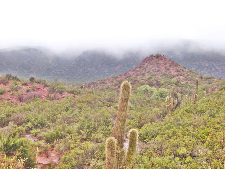
Inca Trail - Camino del Inca
Chapaq Ñan
World Heritage Site of UNESCO
The Inca empire conquered what is now northwestern Argentina in 1450 and expanded south towards Cuyo and into Chile.
They linked these territories with their capital city at Cusco in Peru with a vast highway network, the Inca Trail, or "Chapaq Ñan".
Inca Trail in Cuesta de Miranda
It runs from Guandacol on Ruta 40 south of Villa Unión to the village Pagancillo on the highway that goes to the Talampaya National Park, from where it turns north towards the village of Aicuña.
Then it went through Tambillos whose name is a diminutive of "Tambo" the Inca word for a staging post.
The trail runs along the slopes towards the Nevado de Famatina and splits in to two branches in the Cuesta de Miranda:
- One went along the western flank of the Sierra de Famatina to the fortress of Cerro del Toro close to what is now Villa Castelli, and went north along to Tinogasta and Fiambalá to the Inca settlement of Watungasta crossing the Andes into Chile through the Pircas Negras and San Francisco passes.
- The other branch on the eastern flank of the Famatina went to the large settlement called Tambería del Inca in Chilecito.
Inca Tambo in Chilecito
This is a National Historic site, known as "Tambería del Inca"
It was built ca. 1470 and occupied until 1536. The complex covers 40 acres (16 ha). It stored food, wool and fire wood. Little remains of it as its masonry was used by the Spaniards and local residents to build their homes.
Inca Trail in the Cuesta de Miranda
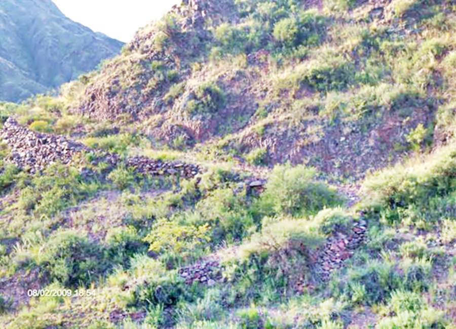
An Ancient Mountain Pass
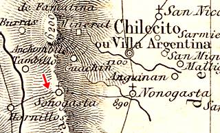
Map by De Moussy from 1864.
This old map was printed in 1864. The red arrow in the map shows the old trail linking Sañogasta and Hornillos (now renamed Villa Unión).
According to Pedro Bazán (1941) the original native name for the road through Miranda was Hatun chumpi huil meaning "the Great Red Canyon road".
Trivia, the albinos of Aicuña
The village of Aicuña is only 8.4 km east of Ruta 40, see map with directions.

Young albino girl from Aicuña. Source
There is a very high proportion of albinos in the vilage of Aicuña. And this is probably due to inbreeding and isolation of the local population.
Francisco Páez de Espinosa married Lorenza de Brizuela and settled there in 1723. Now it has 221 residents and it has a proportion of albinism of 1 in 70, which is 500 times higher than the global average, where 1 out of every 500,000 people is an albino.
Albinism is a mutation that reduces the body's production of a pigment called melanin, so hair, skin and the irides (iris) of the eyes appear white or pink.
Tips and Advice
Getting to Cuesta de Miranda
Cuesta de Miranda the slope is locted on Ruta 40 between the towns of Villa Unión and Chilecito.
From the south you can drive up to it along Ruta 40 from San Juan, Jáchal, Guandacol and Villa Unión. You can also come from the city of La Rioja along Ruta Nacional N° 76 (vía Talampaya National Park).
From the north, take Ruta 40 from Belén, Londres, San Blas de los Sauces and Chilecito or from La Rioja city along Ruta Nacional 74.
All of these roads are paved.
Safety Tips for driving this section of Ruta 40
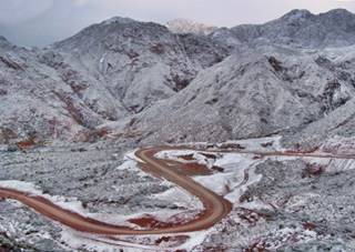
Snow at Cuesta de Miranda. Ing. Ramiro Suárez Taboada
This specific part of the road is relatively easy, it is paved and has a winding alignment with inclines. It is a mountain road.
Snow can fall during winter and low clouds may reduce visibility (mist).
It is relatively low and the Ruta 40 north and south of it is quite flat, making it an easy ride.
Summer Rain and flash floods
During the summer rainy season, it usually rains in the mountains and the dry river beds that the Ruta 40 crosses can flood for a while. Drive with care during rainy days.
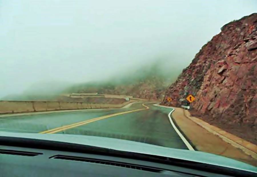
- The weather is mild, with wide temperature swings between day and night. Dry and sunny during Fall, Winter and Spring. Hot during summer.
- Low altitude (not higher than 6,500 ft - 2.000 m) means low risk of mountain sickness.
- Keep hydrated as it is a dry area with low relative humidity. Hat, sunscreen and dark glasses are a must.
Road Conditions
Check the road conditions on our website: Road Conditions.
There are service stations in Villa Unión, Chilecito, Jáchal, San Blas de los Sauces, Nonogasta and La Rioja.
›› Location of Ruta 40's Service Stations
Lodging near Cuesta de Miranda
Find your hotel
Places with accommodation along Ruta Nacional 40 in this area:
>> Accommodation in Villa Unión
Hoteles along Ruta 40
>> Find your room in La Rioja Province

