Maps & Roadmaps
The Maps of Ruta 40
Organizing your Route 40 roadtrip is much easier with maps, on this page you will find maps of each town, village, segment and attraction along the whole of Ruta Nacional 40 in Argentina.
Click on the links to see the maps.
Image maps Maps
Province by Province along Ruta 40
They are listed by region and in each region, by province
To make it easier to find out where are the different scenic places and tourist destinations along the highway, we have included general maps which cover larger areas around Ruta 40:
Patagonia
Neuquén

Click on Map to enlarge
- Norh of Neuquén
- Caviahue and Copahue
- Villa Pehuenia
- Aluminé and Villa Pehuenia area
- Junín de los Andes
- San Martín de los Andes
- Villa La Angostura
- Southern Neuquén
- Ruta de los Siete Lagos (Seven Lakes Road)
Río Negro
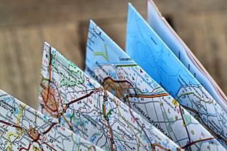
Take a paper map with you, they never fail
Chubut
- Map of Northwestern Chubut
- Villa Lago Puelo
- Parque Nacional Lago Puelo (The National Park)
- El Hoyo
- Epuyén
- Map of the Viejo Expreso Patagónico, La Trochita railroad
- Tecka, Corcovado, Gob. Costa, Río Pico Central-Western Chubut
- Sarmiento, Río Mayo, Alto Río Senguer Southwestern Chubut
- Chubut towns close to Ruta 40
Santa Cruz
- Central and Northern Santa Cruz
- Buenos Aires & Pueyrredon Lakes; Los Antiguos
- Southwestern Santa Cruz
- El Chaltén
- Perito Moreno Glacier lookout
- Río Turbio
- From Río Gallegos to Río Turbio
- Río Gallegos
- Cabo Vírgenes (Mile zero of Ruta 40)
Miscellaneous maps of Patagonia
Cuyo Region (Mendoza, San Juan, La Rioja)
Mendoza
Mendoza province, maps from north to south:
- Northern Mendoza
- North and Central Mendoza
- Upper Río Mendoza wine areas
- Downtown Mendoza City
- Maipú
- South of Mendoza City and Luján de Cuyo
- Potrerillos
- Northwestern Mendoza and Cristo Redentor
- Valle de Uco San Carlos, Tunuyán and Tupungato
- El Sosneado to Pareditas
- El Sosneado area
- Malargüe and Bardas Blancas

Travel with your mind looking at a map...
San Juan
La Rioja
Northern Region (Salta, Jujuy, Catamarca)
Tucumán
Catamarca
- Antofagasta de la Sierra
- Santa María
- Cuesta de Zapata, Tinogasta, Londres Belén
- Belén, Londres, Hualfin and Andalgalá
- Ruta de los Seismiles, Tinogasta and Fiambalá
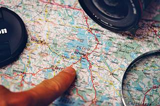
Use a map to plan your Ruta 40 roadtrip
Salta
- San Carlos and Cafayate
- Map of the Quebrada de las Flechas
- Angastaco and Molinos
- Cachi, Seclantas & "Parque Nacional Los Cardones" National Park
- Cuesta del Obispo and Quebrada de Escoipe
- Abra del Acay map and elevation profile
- Cachi to San Antonio de los Cobres
- Northwestern Salta and San Antonio de los Cobres
Jujuy
Maps of the Puna highland plateau, the northern part of Ruta 40:
The alignment of Ruta 40 in each Región
Google Maps de la Ruta 40
Tips and Suggestions about Maps
Always carry a map
Yes, your smartphone has maps (Google Maps, and Waze), but when you go out into the South American hinterland, carry a printed map. They are reliable (while mobile phone signal may vanish in the vast wilderness).
GPS maps have gradually pushed printed maps into oblivion, but a good roadmap which you can buy at a service station beats a GPS hands down when you have no signal.
It is a good practice to read your map before setting out: check the locations of the towns, the distances, work out how much fuel you may need, see if the road is paved or unpaved (that will impact on your speed and your travel time).
See which tourist attractions are marked on your map so that you can stop and enjoy them.
I plot my trip on a map, with a highlighter, it gives you a nice feeling of accomplishment.
Hotels & Accommodation along Ruta 40
Find your room in each province along the highway
Find Lodging
>> Hotels in City of Salta
Hotels in each province along Ruta 40
Must-See stops near Ruta 40
>> Find your room in Salta Province

