Itineraries on Ruta 40
Last Updated: Austin Whittall
Short Trips along Ruta 40
Ruta 40 takes you through Argentina, from North to South, and its alignment allows for many short trips and circuits which will allow you to experience the culture, nature and scenery along the highway without having to drive the whole of it.
Sights like the Valles Calchaquíes, the Patagonian Lake District, the vineyards of Mendoza or the volcanic summits of "The six-thousands" of Catamarca are all within reach of a short Ruta 40 road trip.
Here we will give you a quick summary of these excursions and short trips along Ruta 40.
Drive along Route 40
Northern Region ¦
Cuyo region ¦
Patagonia
For train enthusiasts
Those who are rail fans or train buffs will find plenty of interesting train related stuff along Ruta 40:
- The narrow gauge industrial railroad in southern Patagonia, from the coal mine in Río Turbio to the port of Río Gallegos (See Section #2 of Ruta 40).
- The abandoned rails in Mendoza, San Juan, La Rioja
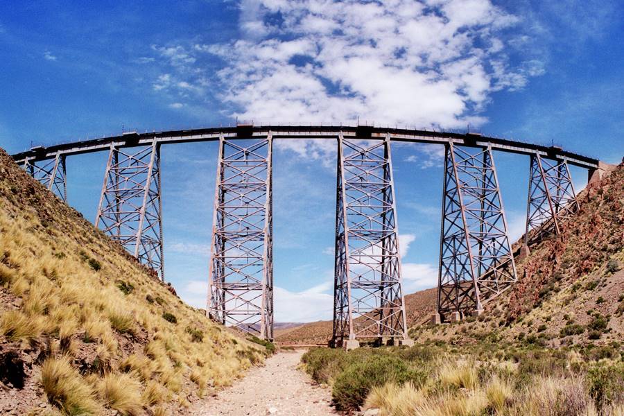
- The amazing Tren a las Nubes "Train to the Clouds" that links the city of Salta with the Puna highlands in San Antonio de los Cobres [Our Spanish language webpage] on the Last Leg of Ruta 40. Its steel "Polvorilla Viaduct" is pictured above, as it spans a canyon along which Ruta 40 runs.
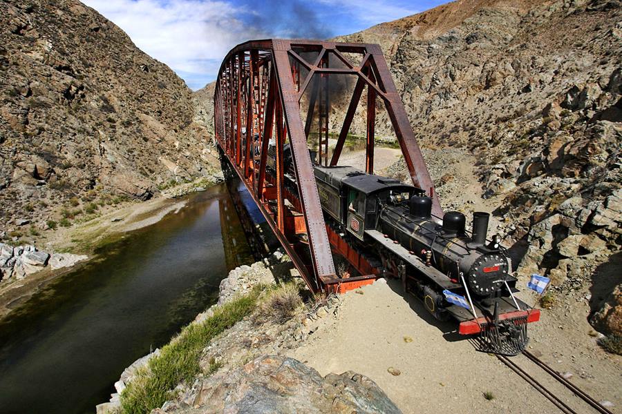
- The old steam engine drawn train known as the Viejo Expreso Patagónico ("Old Patagonian Express") or La Trochita [Our Spanish language webpage], which means "the Narrow Gauge", in Esquel and El Maitén, on the Esquel to Bariloche Leg of Ruta 40.
Short Trips and Circuits along Ruta 40
From North to South
Northern Argentina on Ruta 40
We propose three short trips that you can do in the North, starting out from the city of Salta:
First Tour: Cafayate vineyards, nature and pre-Hispanic sites
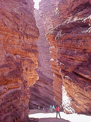
"El Anfiteatro", near Cafayate, Alejandro H
To do this drive you should head north to the city of Salta (there are flights from Buenos Aires, Mendoza and Iguazú Falls). You can rent a car in Salta and drive the circuit detailed below.
Leave Salta (see this Map with directions), and head south along Ruta Nacional 68 along the valley of the Río de las Conchas, climbing out of the lush jungle setting upwards into the drier Andean foothills.
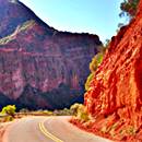
The scenery becomes drier, and the mountains adopt a red and ochre color as you enter the narrow Canyon of the Las Conchas River. Here is the famous Garganta del Diablo and the "Amphitheatre"
After a three hour drive (189 km - 117 mi.) drive, you will reach the irrigated vineyards of the town of Cafayate, which can be your base to explore the region, the road from Salta to Cafayate is paved.
Learn all about the sights and attractions in Cafayate [Our Spanish language webpage].
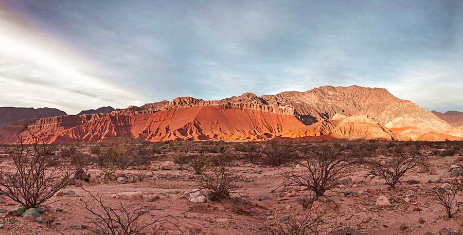
Tours from Cafayate
1. South to Santa María, Los Quilmes Ruins, Yocavil and Amaichá del Valle
A 3 hour drive, 177km - 110 mi. round trip. See map with directions.
Almost completely paved (except for the short section of Ruta 40 from Quilmes to the Catamarca border which is being paved, but for now it is a gravel highway: map of unpaved segment of this segment which is 13.4 km long).
Explore the ancient history and see the vineyards at Tolombón. The cardon cacti growing on the mighty Calchaquí Mountains are worth seeing.
Take Ruta 40 and head south from Cafayate, along the way you will enter the province of Tucumán, where you can visit the pre-Hispanic Ruinas de los Quilmes [Our Spanish language webpage], a town and citadel razed by the Spaniards in the 1600s during the Calchaquí Wars.
Ahead along Ruta 40 in the province of Catamarca are more archeological sites at Santa María [Our Spanish language webpage].
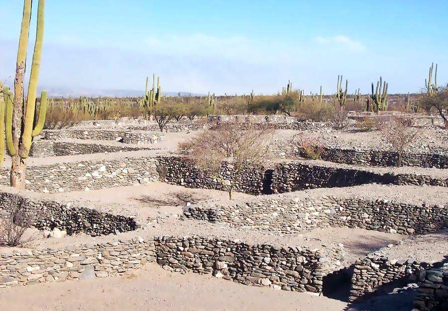
Return from Santa Marí by heading into the small town of Amaichá del Valle [Our Spanish language webpage]
2. Cachi and Cuesta del Obispo Slope
A drive into the sleepy towns of the Calchaqui River Valley along the gravel surfaced Ruta 40. Outstanding natural beauty.
A 310 km drive (Map with directions. It is a good idea to spend the night in Cachi.
Along the way you will visit one of Ruta 40's top-ten landmarks, the " Quebrada de las Flechas " (Arrows Canyon):
"Top 10 attractions on Ruta 40".
A Lunar landscape in the heart of the "Valles Calchaquíes" region . Strangely ash colored slanted layers of rock jut-out up to 150 feet above the surrounding terrain.
Its name means "Gully of the Arrows" where the "arrows" are the sharp angular slabs of rock.
They are part of the protected area, the Angastaco Natural Monument (Monumento Natural Angastaco).
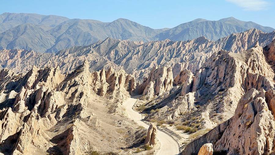
Read more about the Quebrada de las Flechas
Visit our page where we provide full information on it:
The Ruta 40 will take you through the colonial towns of Molinos and Seclantas [Our Spanish language webpages]with their National Historic Sites and handwoven textile handicrafts.
The town of Cachi is ideal for a stopover. Don't miss its historical church.
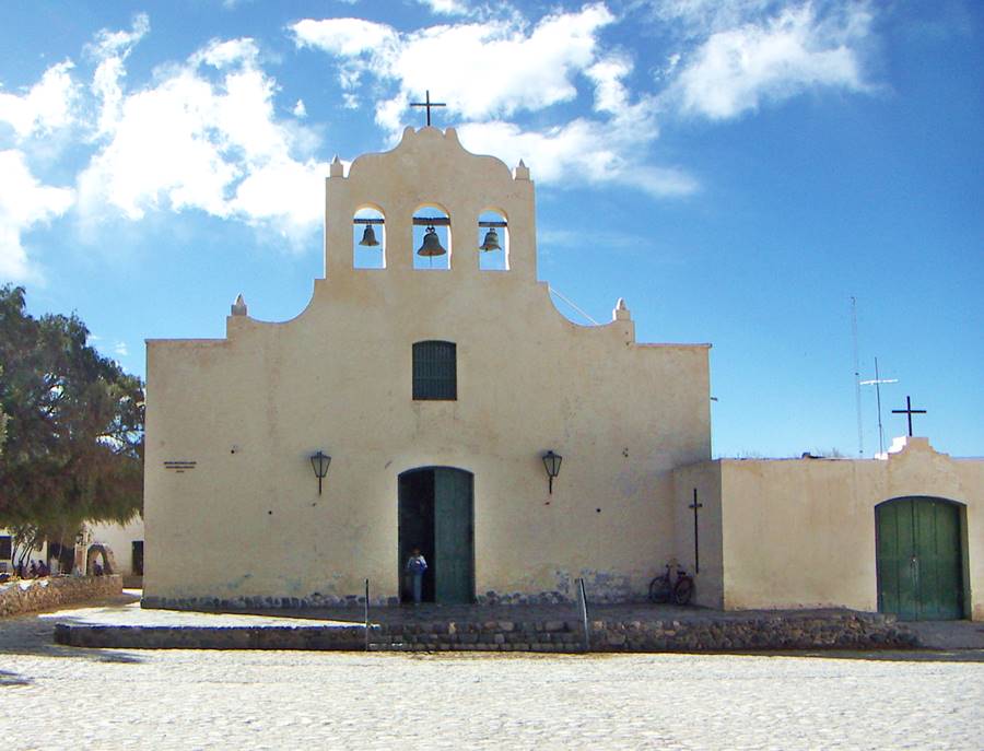
>> Find your hotel in Cachi
The following day you can head north out of Cachi and visit the Los Cardones National Park, with its cacti, wild donkeys and llama, and head down towards the city of Salta Cuesta del Obispo [Our Spanish language webpage] (Bishop's Slope), a winding road that heads into Quebrada de Escoipe (Escoipe Canyon) and the jungles in the Andean foothills.
> > Complete information on Cuesta del Obispo [Our Spanish language webpage]
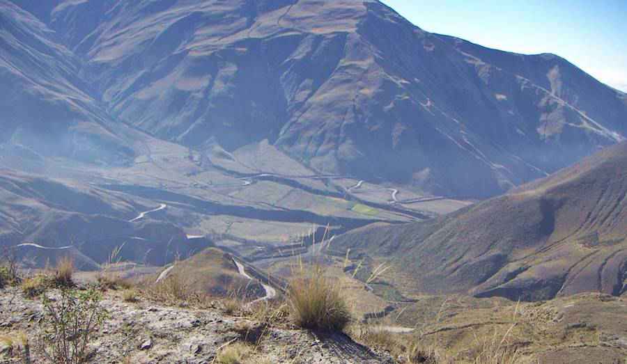
Bonus Trip "Abra del Acay" Pass
North of Cachi is another "Top-10 Attraction", the Abra del Acay, The highest point along Route 40:
The Abra del Acay is the highest pass on a national highway in the whole world and the highest road pass outside of Asia: it is set at 16,050 ft. (4,895 m) above sea level.
Located in the Nevado del Acay Range of the Andes, it is a difficult mountain road drive between the towns of San Antonio de los Cobres and Cachi.
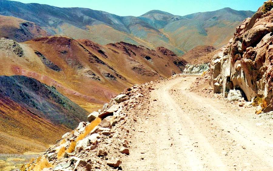
Complete information about the Abra del Acay
Visit our page on the Acay Pass to learn about its difficulty, when to drive it and what safety tips to bear in mind:
This is the end of the First Tour.
Second Tour: Jujuy, Cerro de los Siete Colores, Purmamarca and Salinas Grandes
After returning to the city of Salta you can take a second trip to visit Jujuy province with the famous "Salinas Grandes" salt flats and the "Seven Colors Hill" at Purmamarca:
Into the Quebrada de Humahuaca
This is a fully paved drive 250 km (one way to the Salinas Grandes), shown in this map. You can drive another 70 km (45 minutes) to stopover at Susques, or turn back to Purmamarca (65 km - 1 hour) to spend the night.
The drive from Salta city to San Salvador de Jujuy is relatively easy, flat and there is plenty of traffic along the highways. Stop at San Salvador de Jujuy to visit its downtown area. It is the provincial capital.
The Ruta Nacional 9, "Panamerican highway" then heads north, climibng into the Quebrada de Humahuaca [Our Spanish language webpage], a long canyon, which links the jungles in the lowlands with the arid Puna highland.
The Quebrada de Humahuaca has been designated as a UNESCO World Heritage Site , at the junction with Ruta Nacional 52, you must turn left towards Purmamarca.
You can also take a round trip up the Quebrada to visit the towns of Iruya, Tilcara and Humahuaca [Our Spanish language webpages].
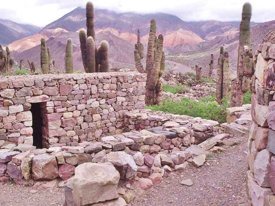
Purmamarca and the "Cerro de los Siete Colores"
Purmamarca [Our Spanish language webpage] is a tiny rural village at the foot of the " Cerro de los Siete Colores " (Seven Colors Hill):
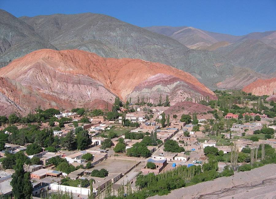
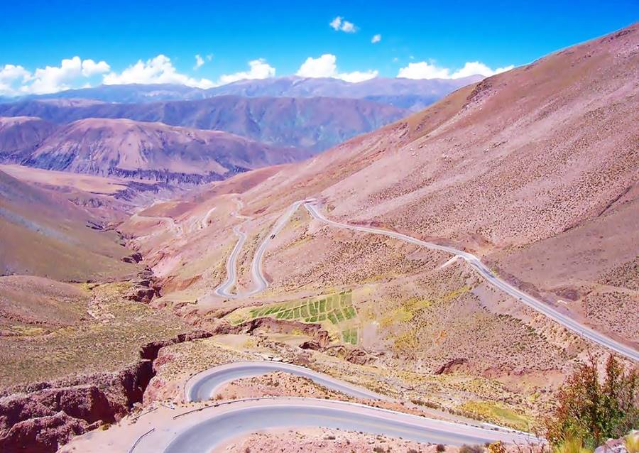
As you head west from Purmamarca along Ruta 52, you will drive up into the Puna plateau, along the the winding "Cuesta de Lipan" (Lipan Slope) pictured below:
Not far from the end of the slope is another "Top-10 of Ruta 40", the Salinas Grandes salt flats:
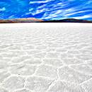
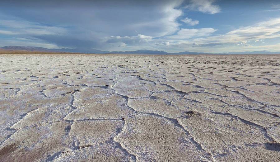
The "Salinas Grandes" (which means "Large Salt flats") span 82 sq. miles (212 km2) in the Puna highlands at 11,300 ft. altitude (3.450 meters) .
The vast white salt surface contrasts with the deep blue sky. It is a temporary lake when it rains, and the salt is harvested using traditional methods. It lies on the border of Jujuy and Salta provinces and the "Old" Ruta 40 runs along its southern and eastern shore. Paved Ruta Nacional 52 cuts across it linking Susques and Purmamarca.
More information on Salinas Grandes:
Our webpage on the salt flats has detailed information on its origin, history, location and how to get there:
Option: visit Susques
You can now turn back to Purmamarca and retrace your steps to Jujuy, or expand your trip west, visiting the town of Susques:
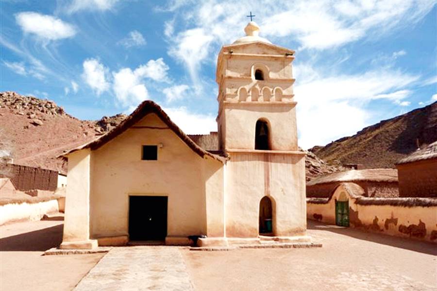
> > Full details on Susques [Our Spanish language webpage]
Side trip to Paso de Jama and San Pedro de Atacama in Chile
Leaving Ruta 40 and heading left (west) along paved Ruta Nacional 52, it is a drive of 124 km to the international border crossing into Chile at Paso de Jama Pass.
On the Chilean side, it is a drive of 157 km along Chilean highway 27 to the tourist town of San Pedro de Atacama
Jama Pass has 160 residents, and is located at an altitude of 4.200 m. The pass is open daily from 8:00AM to 11 PM. And there is a YPF service station there
Make sure that you can take your car out of Argentina and into Chile. Do so when you rent it, it will avoid problems at the border.
>> Find your hotel in San Pedro de Atacama
Atacama, Chile, fantastic scenery

Option Return to Salta via San Antonio de los Cobres
Another option is to drive from Susques back to Salta city along Ruta 40 and Ruta Nacional 51. See this Map with directions.
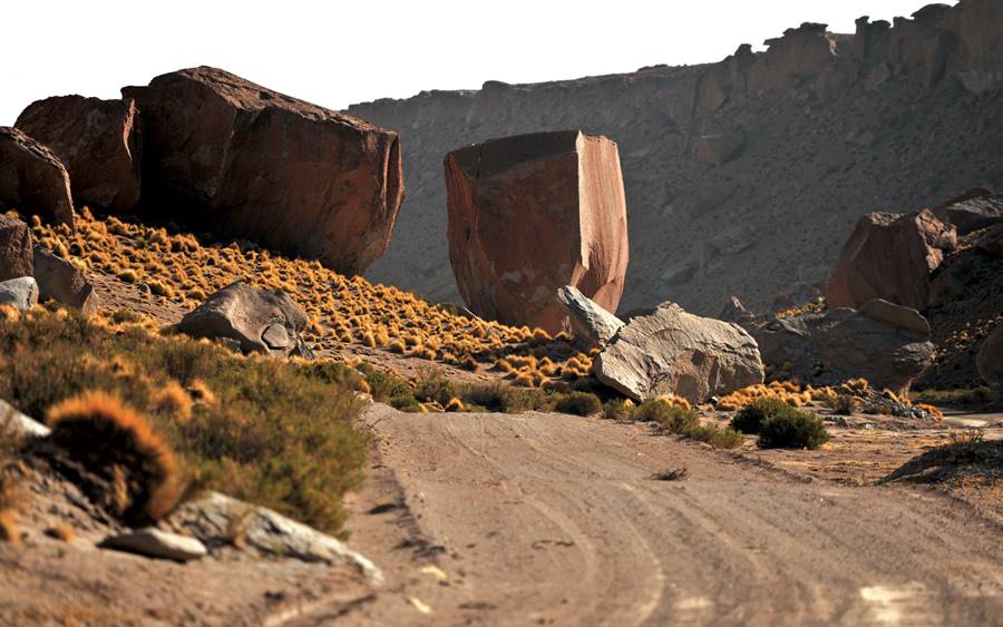
The Ruta 40 is unpaved from Susques to San Antonio de los Cobres; we describe this leg of Ruta 40 in our Final leg of Ruta 40 English language webpage.
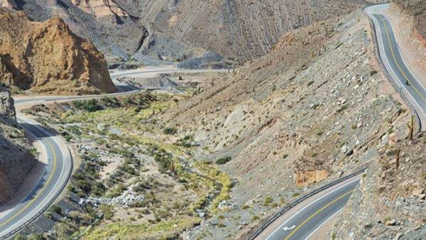
Andrew and Rob Corbett
The paved highway begins at the town of San Antonio de los Cobres [Our Spanish language webpage].
There is accommodation and fuel there.
From here you can head back to Salta (see our detailed itinerary: San Antonio de los Cobres to Salta city [Our Spanish language webpage]. This road also gives access to the Abra del Acay Pass on Ruta 40 and the Ruins of the Inca town of Tastil.
The excursion ends in Salta.
"Ruta de los Seismiles" - "The Route of the Six-Thousands"
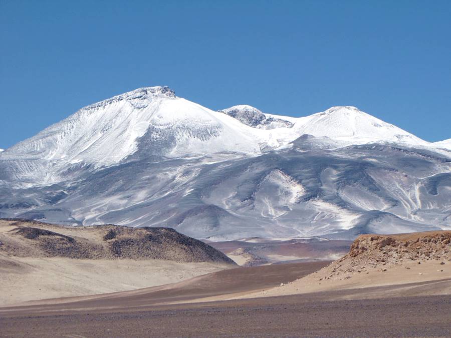
This is the third, and last of our "Northern Argentina Excursions", it runs from Ruta 40 at Alpasinche, to the Chilean border at the San Francisco Pass. Due to the height of the final part of this trip, it is best to do it in summer. There is fuel at the towns of Tinogasta and Fiambala.
The Ruta de los Seismiles [Our Spanish language webpage]. is a Fully Paved section of RutaNacional 60 west of the town of Fiambalá [Our Spanish language webpage], well known for its thermal baths.
See this Map from Tinogasta through Fiambalá to the border with Chile. You return along the same road or, you can head into Chile.
Its name " Six-Thousands " comes from the fact that it runs between 14 volcanoes over 6,000 meters high (19,700 feet) among them is Monte Pissis, con 6.792 m (22,269 ft), the tallest inactive volcano in the world and the second highest peak in the Americas
This is the second highest region of the world after the Himalaya
Adobe Route
You reach it from Ruta 40 from Londres or Chilecito and drive through the town of Tinogasta [Our Spanish language webpages].
On the way, between Tinogasta and Fiambalá you can also drive along the pictouresque Ruta del Adobe (Adobe Route)
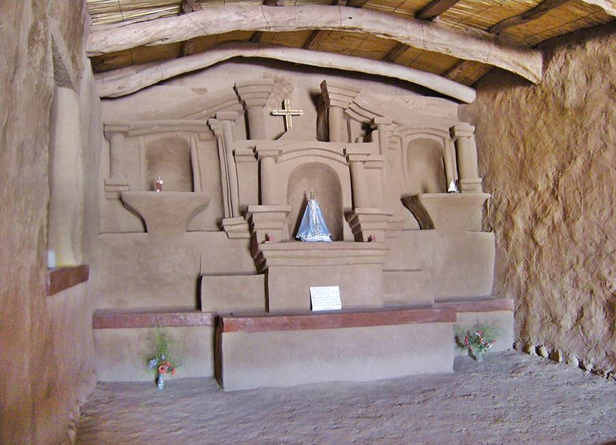

This concludes our Excursions in the Northern part of Ruta 40, next we will see what options Cuyo Region has to offer.
Excursions and short trips in Cuyo
The Cuyo Region is Argentina lies next to the Andes, the two tours that we propose visit some great Natural Scenic sites and the Wine producing areas of Mendoza:
First excursion in Cuyo: Talampaya, Ischigualasto and the High Andes
This tour includes two of Ruta 40's "Top-10 Attractions" the World Heritage Sites of Talampaya and Ischigualasto, and the Cuesta de Miranda slope.
The best place to stay at to visit these attractions is the town of Villa Unión [Our Spanish language webpage].
1. Vinchinas, Laguna Brava and the Andes
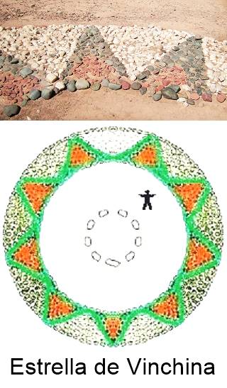
"Vinchina Star" detail and size comparison. A. Whittall
This is a trip along Ruta Nacional 76 which heads north out of Villa Unión along the valley of the Bermejo (Red in Spanish) River towards the Puna and the Andes.
To the east are the mighty peaks (over 19,600 feet high - 6.000 m). Stop at the village of Vinchinas to visit its enigmatic multicolored stars built by the natives in red, black and green boulders.
The highway climbs up along the Canyon of the La Troya River, through the village of El Jagüe, passes colonial mountain huts and reaches the protected area of Laguna Brava lake at a height of 13,110 ft. (4.000 m) above sea level.
The name means "wild", "ferocious" in Spanish, and is the home of flamingos.
Part of this road is paved: from Villa Unión to Vinchina. Then there is a dirt section 9 km long, being paved at the narrow cut into La Troya Canyon. From the upper part of the canyon, through the village of Alto Jagué and all the way to Mulas Muertas ("Dead mules" in Spanish) at the north tip of the Laguna Brava Lake the road has been recently paved (109 km).
So basically it is almost totally paved.
There are vicuñas along the road. Report your trip at Vinchina and buy your tickets to enter the Provincial Park at Alto Jagué. Regarding the altitude, check our webpage on Altitude Sickness
This is the Map with directions.
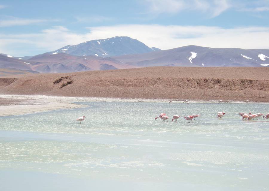
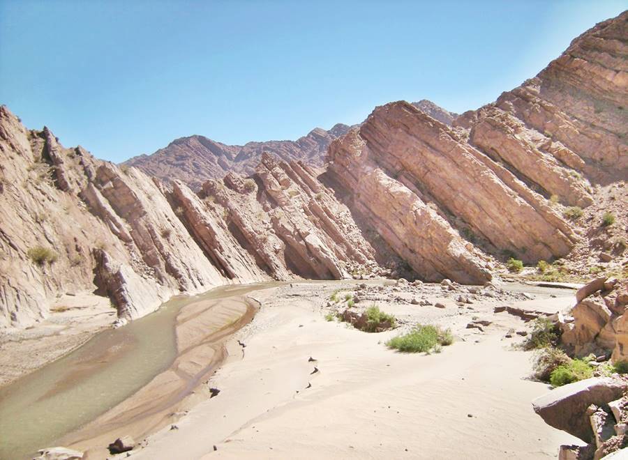
>> Find your hotel in Villa Unión
2. Talampaya and Ischigualasto UNESCO World Heritage Sites
This is a full day tour, fully paved circuit, and if you plan to include the scenic drive along Ruta Nacional 150, consider a 2 day trip.
See the Map with directions.
It is a 58 km drive from Villa Union to the park. Head west from this town, along the paved highway Ruta Nacional 76, all the way to Talampaya. See this Map with directions
Fill up your gas tank before leaving town there are now service stations on the highway.
On the km 148 milepost of Ruta 76 is the Cañón de Talampaya National Park Service Area and the administration of the park. Here is where the excursions that visit the Talampaya Canyon (Cañón de Talampaya) and Don Eduardo Gully (Quebrada Don Eduardo) leave from. It has a place to eat, handicraft stores and a camping area.
From here it is a 80 km drive to the neighboring Ischigualasto Park (59 km along Ruta 76, 4 km along RP 510 in San Juan Province and finally 17 km on Ruta Nacional 150).
Heading south, along Ruta 76, at km 133,5 milepost is the second Service Area, departure point for the tours to Ciudad Perdida and Cañón Arco iris. (Lost City and Rainbow Canyon).
"Top 10 attractions on Ruta 40".
Talampaya and neighboring Ischigualasto Park are UNESCO World Heritage Sites. This park is well known for its red cliffs, colroed rock formations, wildlife, fossils and rock art.
Cañon Arco iris (Rainbow Canyon), Talampaya
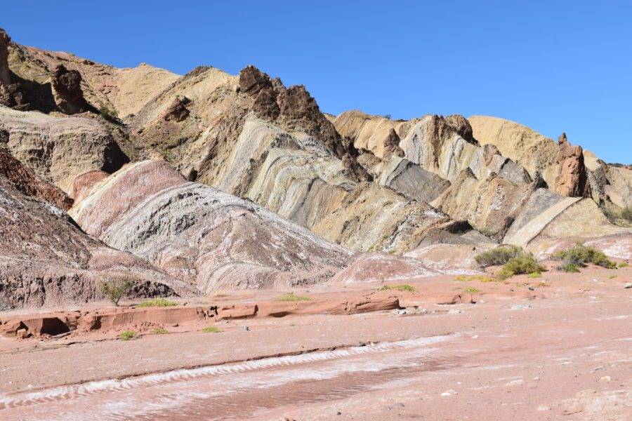
Continue east along Ruta 76 to visit Ischigualasto, at the junction with Ruta Nacional 150 in the province of San Juan, turn right along it, drive through the tiny village of Baldecitos and then right, into Ischigualasto Park.
"La Cancha de Bochas" - Bowling Field
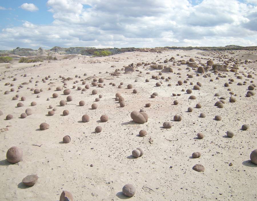
"La Esfinge", landform that resembles an Egyptian Sphinx (lion whith a human head)
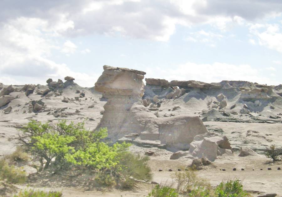
Complete the circuit by heading east along the brand new Ruta Nacional 150 to visit the towns of Jáchal, Huaco and Guandacol [Our Spanish language webpages] to return along Ruta 40 to Villa Unión.
The "Mushroom" Landform "El Hongo" and behind it, the "Barrancas Coloradas" (Red Cliffs)
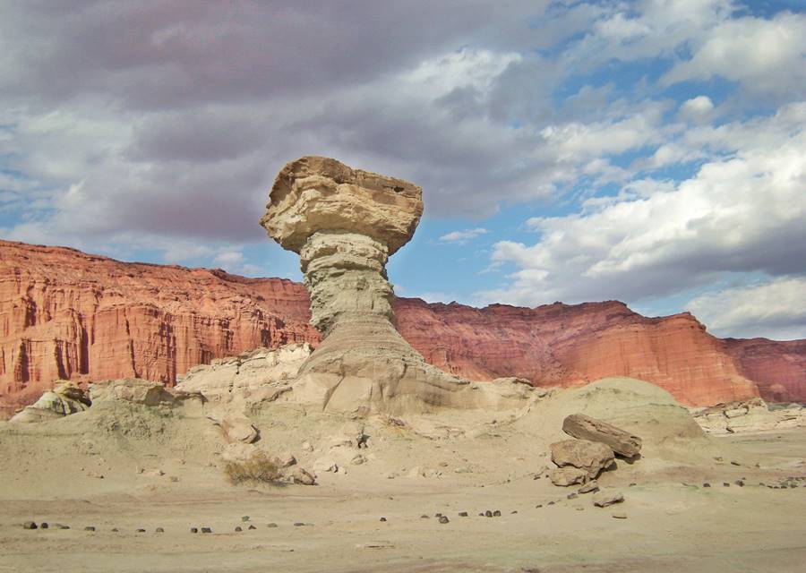
3. Cuesta de Miranda, Chilecito and Famatina
The final tour from Villa Union visits the Miranda Slope on Ruta 40 and takes you across the Famatina Mountain Range. Visit the Winery and vineyards of Bodegas La Riojana, the town of Chilecito with its circuit of historical colonial churches, see: Chilecito Historic Colonial Churches [Our Spanish language webpage], built in the 1600s and 1700s.
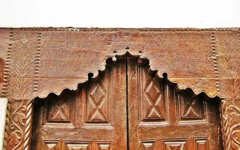
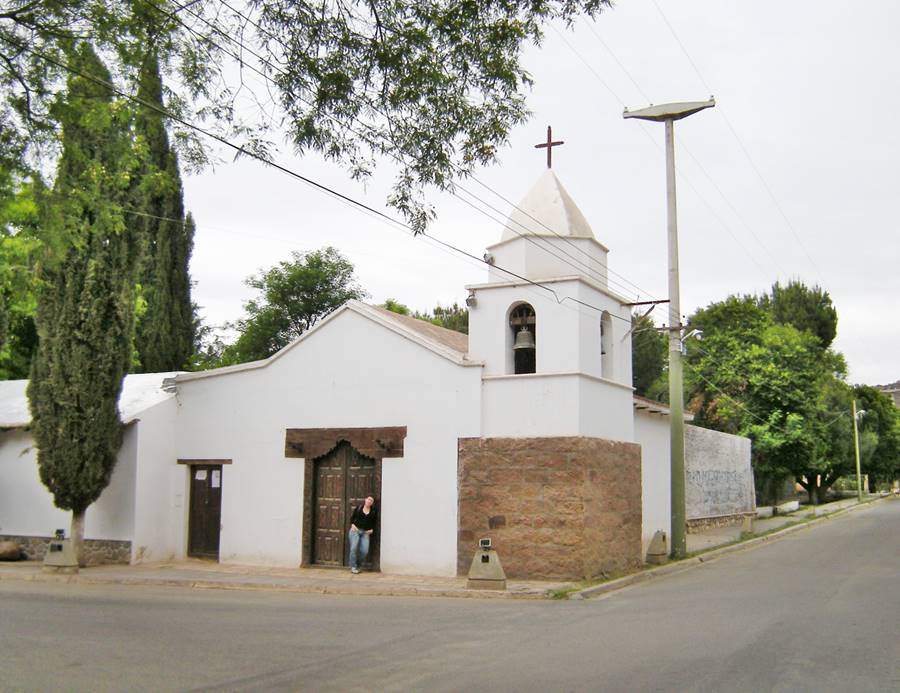
The road is completely paved, see the Map with directions.
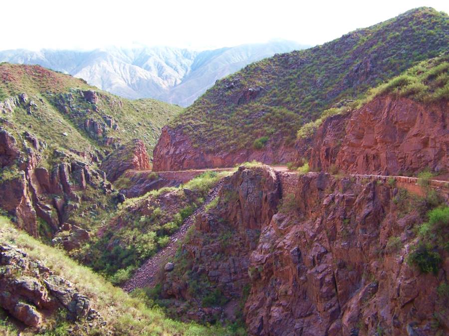
The photograph below shows a preserved part of the original highway at Cuesta de Miranda, after the new paved road replaced it.
The Cuesta de Miranda , is a section of Ruta 40 that was famous for its danger: a narrow one-lane winding cliffhanger highway on the Miranda River Canyon. It crosses a gap between the 19,000 ft. high Famatina Mountains and the Sañogasta Range.
Now it is a paved highway and is safe and easy to drive. It is located between the towns of Chilecito and Villa Unión in La Rioja province and its maximum altitude is 6,690 ft. (2,040 m) above sea level.
Cuesta de Miranda
Location, elevation profile, the Inca Road at Miranda and the original preserved roadbed: Read more
This ends the excursions in La Rioja province. Below we detail the Mendoza Wine Tours.
Second Tour: Valle de Uco Wines & Vineyards
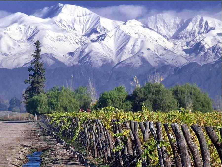
This tour explores the home of Argentine Malbec, in the Andean foothills of Mendoza province.
Ruta 40 runs through this region, from the capital city of Mendoza in the north, through Maipú and Luján de Cuyo and then through the Valle de Uco (Uco Valley), with the towns of Tunuyán, Tupungato and San Carlos [Our Spanish language webpages].
You can fly to Mendoza and rent a car there. There are flights from Buenos Aires, Iguazú, Sao Paulo in Brazil, Santiago de Chile and Lima Peru.
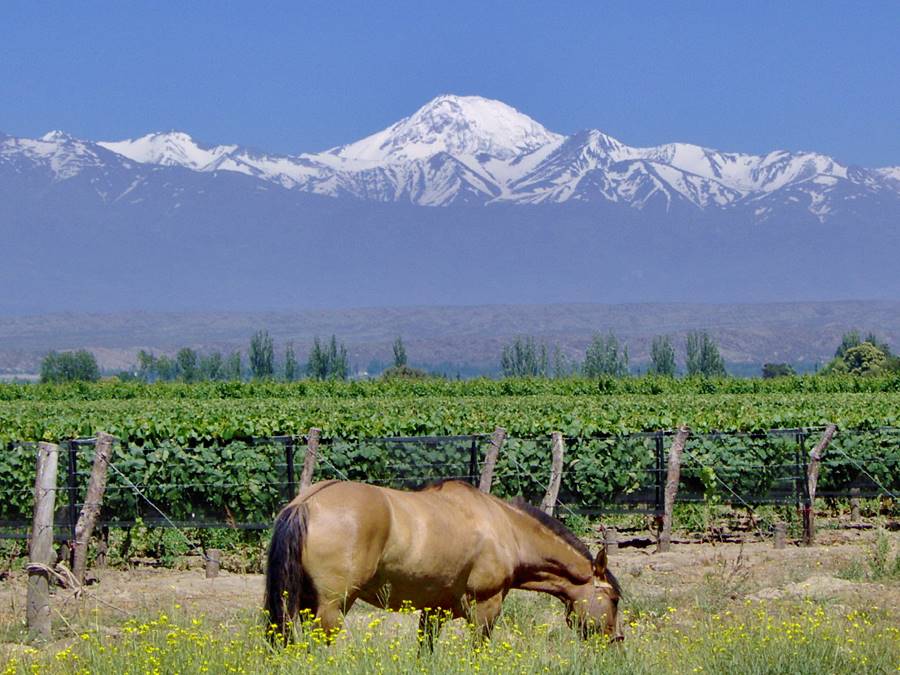
The El Valle de Uco lies at the foot of the Andes along the basin of the Tunuyán River which irrigates the grape vines.
We describe this circuit of wineries, which you can visit and taste the wines at, in our Valle de Uco Wine Route, [Our Spanish language webpage].
There are other circuits, which you can explore and which we detail in our
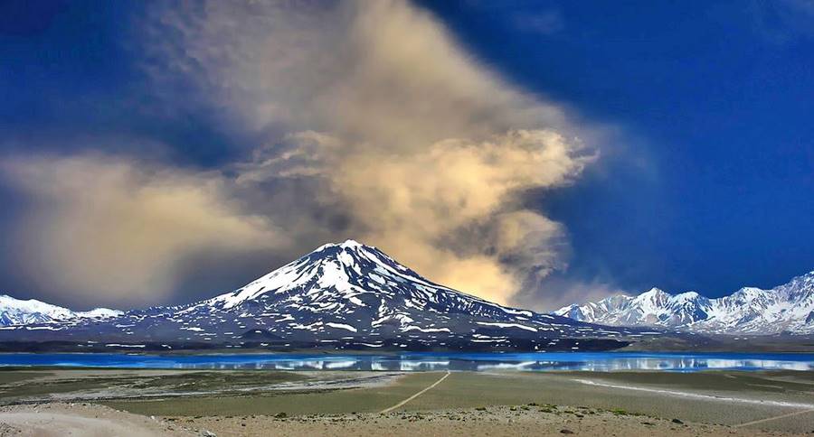
To crown the trip you can also drive to the Maipo Volcano which we describe in Section #9, of Ruta 40, from Barrancas to Pareditas, pictured below, or up Ruta Nacional 7 which links Mendoza city with Santiago de Chile in Chile via the Paso del Cristo Redentor, to visit the highest mountain outside of Asia, which is also the highest peak in the Americas, the Western and Southern hemispheres: Cerro Aconcagua with (6,962 m or 22,841 ft), its name means "Stone Centinel". (Learn more about this [Our Spanish language webpage]).
Ruta 40 in Patagonia: some short trips
The Lake District
Ruta 40 runs through the Lake District between Junín de los Andes and Esquel [Our Spanish language webpage].
This is where the lush andean forests with their crystal clear glacial lakes meet Ruta 40. To the east is the arid windswept Patagonian steppe.
The city of Bariloche, known as "The Capital of the Southern Lakes", is the best place to use as a base when you visit this region.
You can fly to Bariloche from Iguazu, Salta, Buenos Aires and rent your car there.
Some short trips:
1. Mount Tronador
We describe this full day tour along Ruta 40 (paved) and then a dirt road in our Excusion to Tronador Spanish language webpage.
The road runs along the coast of the Gutiérrez and Mascardi lakes, the Manso River and you can visit the "Cascada de los Alerces" waterfall and the retreating "black" glaciers of this extinct volcano, capped with glaciers, Cerro Tronador .
The mountain is 3.554 m high (11.652 ft.), and marks the border between Argentina and Chile.
You go and come along the same road, shown in this Map with directions
2. Circuito Chico - Small Circuit
Short scenic drive on paved roads, 3 hours. From Bariloche to Llao Llao, along the coast of Nahuel Huapi Lake, visiting its Campanario Arm, the San Pedro Peninsula, Llao Llao and Puerto Pañuelo port, Lake Moreno, the Cerro López and the scenic lookout at Punto Panorámico with a spectacular view of Moreno and Nahuel Huapi lakes, Llao Llao, the forests and the Andes:
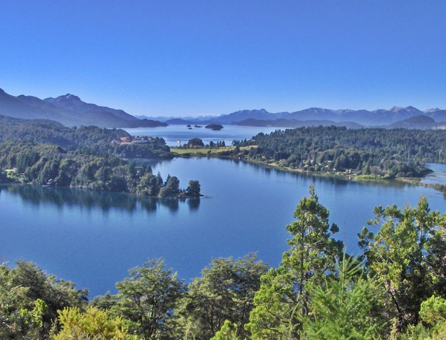
Take the dirt road to visit Colonia Suiza, a village settled by Swiss pioneers in the early 1900s (hence its name, "Swiss Colony").
This is the Map of the Circuito Chico.
3. Circuito Grande - Big Circuit
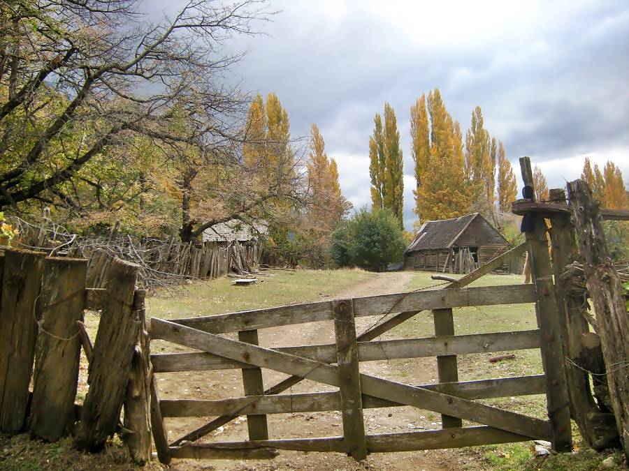
Is a circuit which overlaps the Camino de los Siete Lagos (Seven Lakes Road) which we describe below, but then turns back coasting along lake Traful and visits the Valle Encantado (Enchanted Valley), with cypress forests in a basaltic setting with eroded landforms in the Limay River Valley.
This is Map of the Circuito Grande.
4. Camino de los Siete Lagos
"Top 10 attractions on Ruta 40".
Fully paved road from Bariloche to San Martin de los Andes and Junin de los Andes. See this Map with Directions.
You can stop along the way at Villa la Angostura or even in San Martin de los Andes .
Ruta 40 betweeen the towns of Bariloche, Río Negro and San Martín de los Andes in Neuquén is known as the "Ruta de los Siete Lagos".
Its name means "The Seven Lakes Road", it is completely paved and it runs through two National Parks, in the Andean forests and runs along the shores of actually more than seven lakes.
The highway is aligned in the Andes, with its forest covered slopes, a pristine area protected by the Nahuel Huapi and Lanín National Parks.
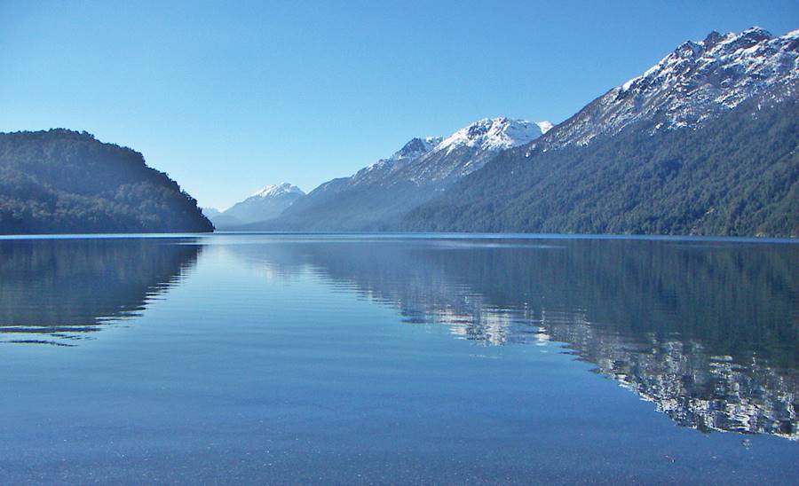
Ruta de los Siete Lagos
A detailed itinerary, mile by mile with each of its lakes, landmarks and attractions:
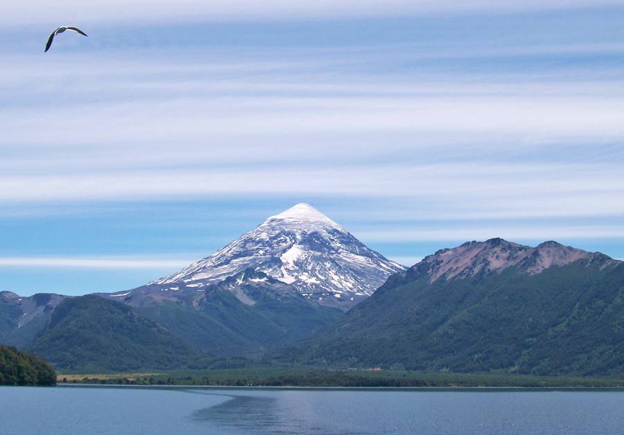
You can drive back from San Martin de los Andes to Bariloche via Junin de los Andes (shown in this map), and on the way take a side trip to visit the Lanin National Park with its conical Lanín volcano:
Second Tour: Esquel Forests and Patagonian Steppe
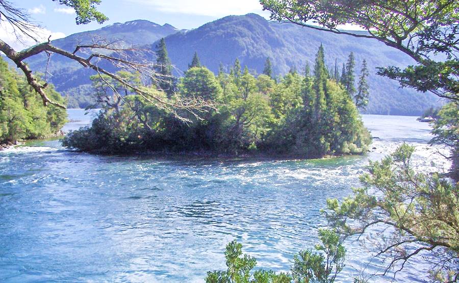
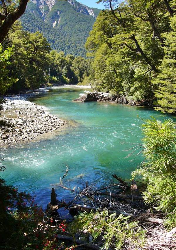
Head south from Bariloche and drive to Esquel [Our Spanish language webpage] but leave Ruta 40 at the junction that leads to Cholila. This scenic road will take you into the lake district of the UNESCO World Heritage Site of Los Alerces National Park.
This is a 316 km drive (5 hours) - Map with directions.
The leg from Cholila to the southern tip of Lake Futalafquen" (which means "Big Lake" in the native Mapuche language) is unpaved.
Los Alerces National Park protects more than 15,000 acres of Alerce forests. This tree, the Fitzroya cupressoides is related to the North American redwood. Some trees are over 2,600 years old, and that is why it was designated a UNESCO World Heritage Site.
From Esquel you can take a ride on the old steam engine drawn train known as the Viejo Expreso Patagónico ("Old Patagonian Express") or La Trochita [Our Spanish language webpage], which means "the Narrow Gauge".
Head back to Bariloche along Ruta 40, on the steppe from Esquel to Epuyén, and there along the same road you drove before on your way south.
Southern Patagonia, Río Gallegos, Sea and Patagonian Steppe
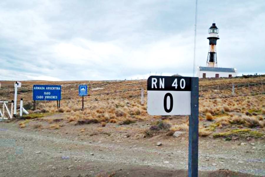
From the city of Río Gallegos [Our Spanish language webpage] you can drive to the "Kilometer Zero" of Ruta 40, at the Cabo Vírgenes Cape, an itinerary we describe in our Ruta 40’s first leg webpage.
This takes you to the northern coast of the Strait of Magellan, the southernmost point of Argentina's continental territory (to the south, across the Strait is the island of Tierra del Fuego, the "End of the World").
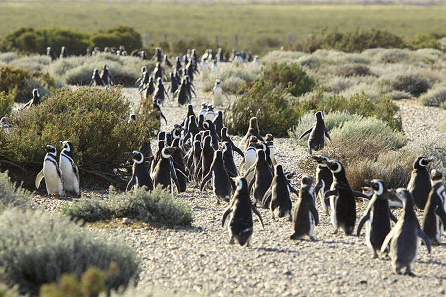
There is a natural reserve with penguins at Cabo Vírgenes.
El Calafate, El Chalté the Perito Moreno Glacier and Mount Fitz Roy
Fly to the town of El Calafate [Our Spanish language webpage] and rent a car there or drive there from Río Gallegos along paved provincial Ruta 5 and Ruta 40 (Map), a 305 km drive (3.5 hours). Or drive Ruta 40's Ruta 40’s Rio Gallegos - Rio Turbio and Rio Turbio - Tres Lagos legs.
At El Calafate you can visit another "Top Ten of Ruta 40", the Perito Moreno Glacier
"Top 10 attractions on Ruta 40".
The Perito Moreno glacier is unique because it is not retreating, instead it moves forward, damming Lake Argentino, bursting periodically in a spectacular ice-dam rupture when the lake's water pressure breaks it .
It is located in the Los Glaciares (Glaciers) National Park , a UNESCO World Heritage Site close to the town of El Calafate.
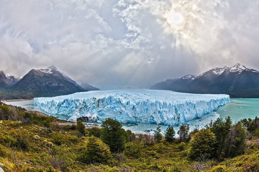
Perito Moreno Glacier
All you need to know about it: its periodic ruptures, surface, location, how to get there, when to visit it and where to stay:
Don't miss navigating on Lake Argentino to visit the other glaciers (Upsala, Spegazzini) and see the icebergs close up as the boat navigates between them.
Hotels in El Calafate:
>> Find your hotel in El Calafate
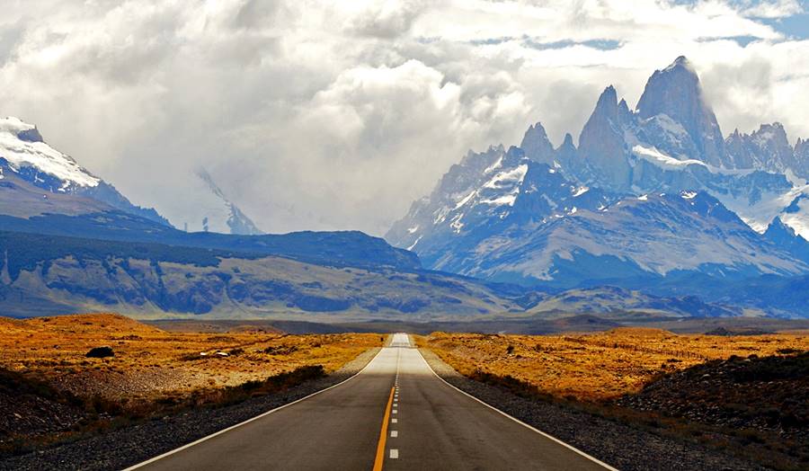
Visit El Chaltén and Mount Fitz Roy
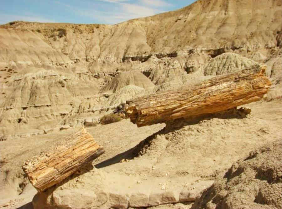
From El Calafate head north to visit the village of El Chaltén [Our Spanish language webpage], nestled in the slopes of Mount Fitz Roy, and stop to visit the Petrified Forest on the way.
See this Map with directions, it is quite close, only 214 km along a Paved highway.
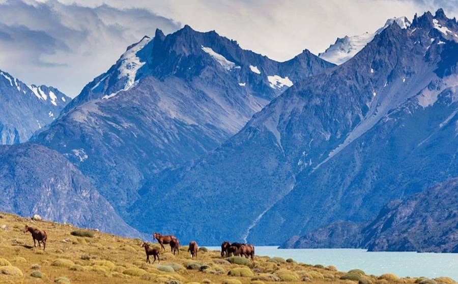
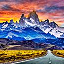
Below is an image of Mount Fitz Roy from the highway, harsh Patagonian weather and the amazing jagged granite peaks looming tall with an elevation of 3.405 m (11,171 ft) above sea level:
Closing comments
These are only some of the short trips that you can do to get a clear impression of Ruta 40's natural and cultural attractions: the arid north, the irrigated vineyards of Mendoza, the rugged Patagonian steppe and the lakes and forests of the Andean region of Patagonia. Sights, landmarks and plenty to do and see.
We look forward to your visit! Argentina has plenty to offer...
Hotels & Accommodation along Ruta 40
Find your room in each province along the highway
Find Lodging
>> Hotels in City of Salta
Hotels in each province along Ruta 40
Must-See stops near Ruta 40
>> Find your room in Salta Province

