The Top 10 Sights of Ruta 40
Last Updated: Austin Whittall
Attraction # 1: Cusi Cusi
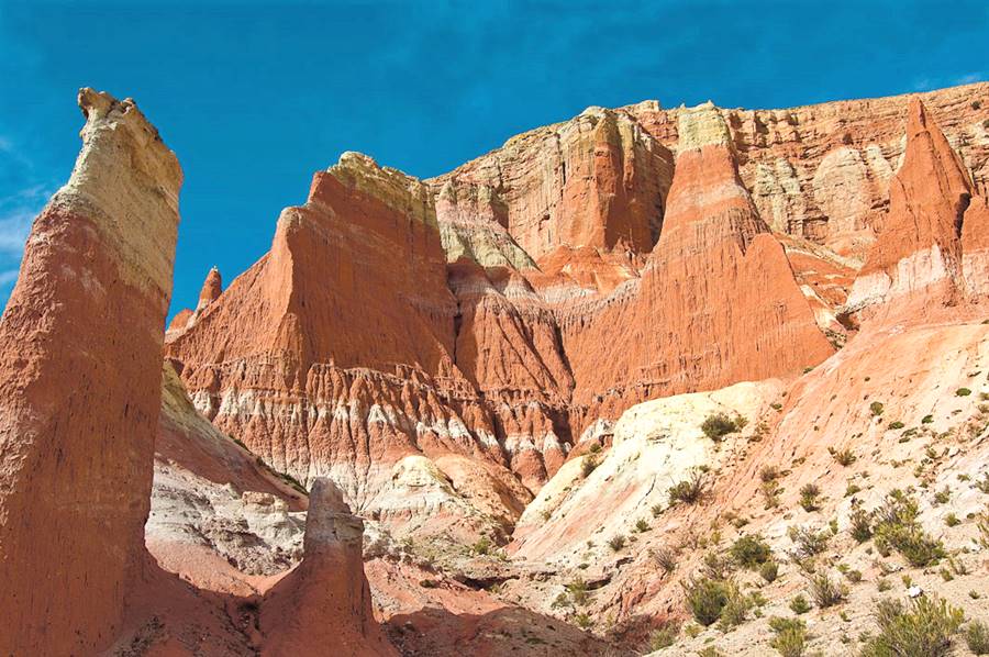
The "Valley of Mars"
Jujuy province
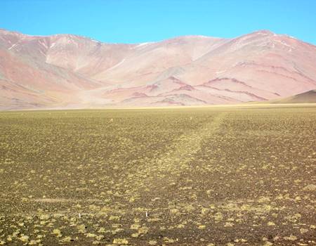
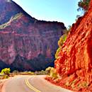
A multicolored valley with ochres, reds, pinks, hues of white and gray set in the Puna Plateau in Jujuy province.
It is also known as "Valley of the Moon 2" (where the Valey number 1 is Ischigualasto in San Juan - we list it below as our number 7 in the list). Cusi Cusi Valley is located at an altitude of 3,800 m - 12,460 ft. on a rough gravel section of Ruta 40 between Susques and La Quiaca.
Drive along Route 40
Northern Region ¦
Cuyo region ¦
Patagonia
Attraction # 2: Salinas Grandes Salt Flats
Salinas en la Puna
Jujuy and Salta
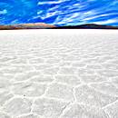
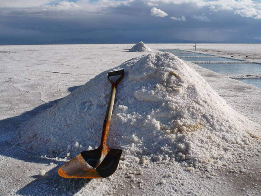
The "Salinas Grandes" (which means "Large Salt flats") span 82 sq. miles (212 km2) in the Puna highlands at 11,300 ft. altitude (3.450 meters).
The vast white salt surface contrasts with the deep blue sky. It is a temporary lake when it rains, and the salt is harvested using traditional methods. It lies on the border of Jujuy and Salta provinces and the "Old" Ruta 40 runs along its southern and eastern shore. Paved Ruta Nacional 52 cuts across it linking Susques and Purmamarca.
More information on Salinas Grandes:
Our webpage on the salt flats has detailed information on its origin, history, location and how to get there:
Attraction # 3: Abra del Acay
The highest point along Route 40
Salta
The Abra del Acay is the highest pass on a national highway in the whole world and the highest road pass outside of Asia: it is set at 16,050 ft. (4,895 m) above sea level.
Located in the Nevado del Acay Range of the Andes, it is a difficult mountain road drive between the towns of San Antonio de los Cobres and Cachi.
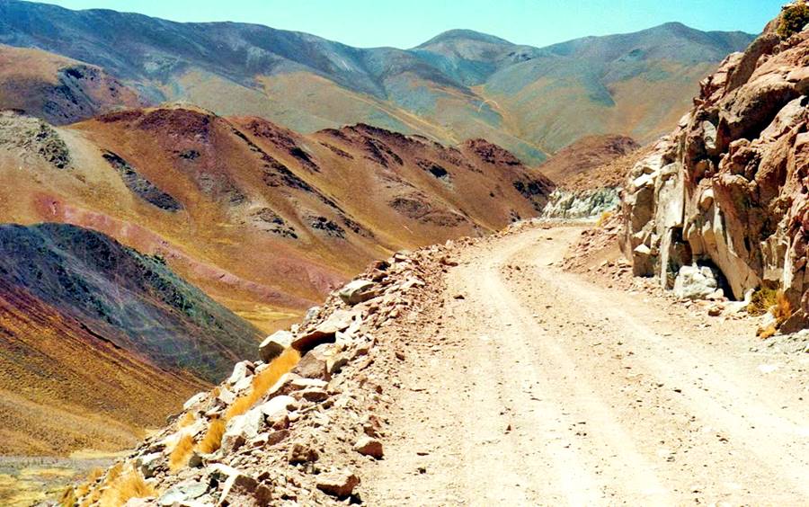
Complete information about the Abra del Acay
Visit our page on the Acay Pass to learn about its difficulty, when to drive it and what safety tips to bear in mind:
Attraction # 4: Quebrada de las Flechas
Amazing rock formations in the Calchaquí River Valley
Salta
A Lunar landscape in the heart of the "Valles Calchaquíes" region. Strangely ash colored slanted layers of rock jut-out up to 150 feet above the surrounding terrain.
Its name means "Gully of the Arrows" where the "arrows" are the sharp angular slabs of rock.
They are part of the protected area, the Angastaco Natural Monument (Monumento Natural Angastaco).
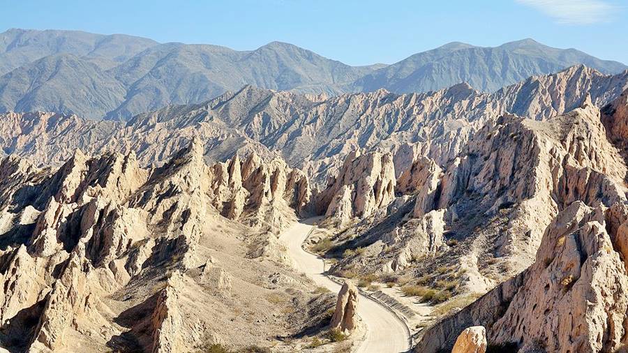
Read more about the Quebrada de las Flechas
Visit our page where we provide full information on it:
Attraction # 5: Shinkal de Quimivil
Prehispanic Ruins
Catamarca
The Shinkal (o Shincal) is a National Historic Monument that preserves Inca ruins.
It covers almost 50 acres of what once was a provincial capital in the Inca Empire. Over 100 buildings including a "pyramid" are located on the site.
It is located in the outskirts of the town of Londres (London), next to Ruta 40.
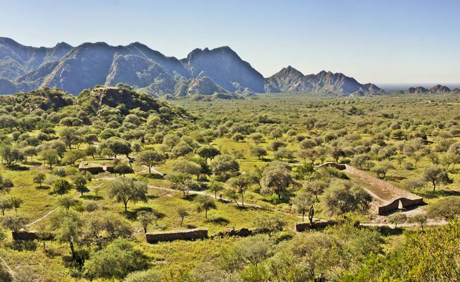
El Shinkal de Quimivil
Its history, a map and much more... learn all about this historic monument:
> > Shinkal Ruins
Attraction # 6: Cuesta de Miranda
A Cliffhanger Highway in the Famatina Mountains
La Rioja
The Cuesta de Miranda, is a section of Ruta 40 that was famous for its danger: a narrow one-lane winding cliffhanger highway on the Miranda River Canyon. It crosses a gap between the 19,000 ft. high Famatina Mountains and the Sañogasta Range.
Now it is a paved highway and is safe and easy to drive. It is located between the towns of Chilecito and Villa Unión in La Rioja province and its maximum altitude is 6,690 ft. (2,040 m) above sea level.
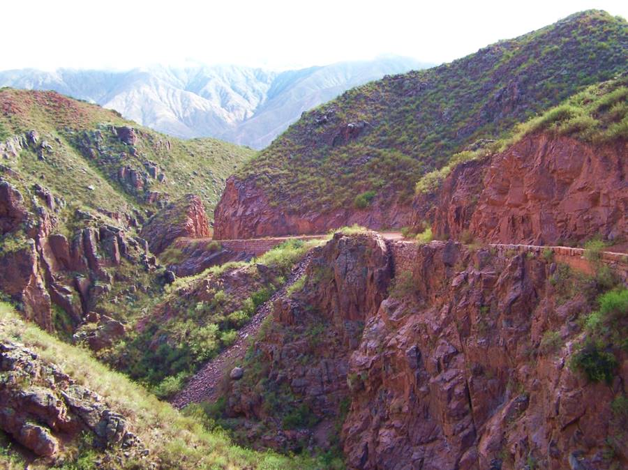
Cuesta de Miranda
Location, elevation profile, the Inca Road at Miranda and the original preserved roadbed: Read more
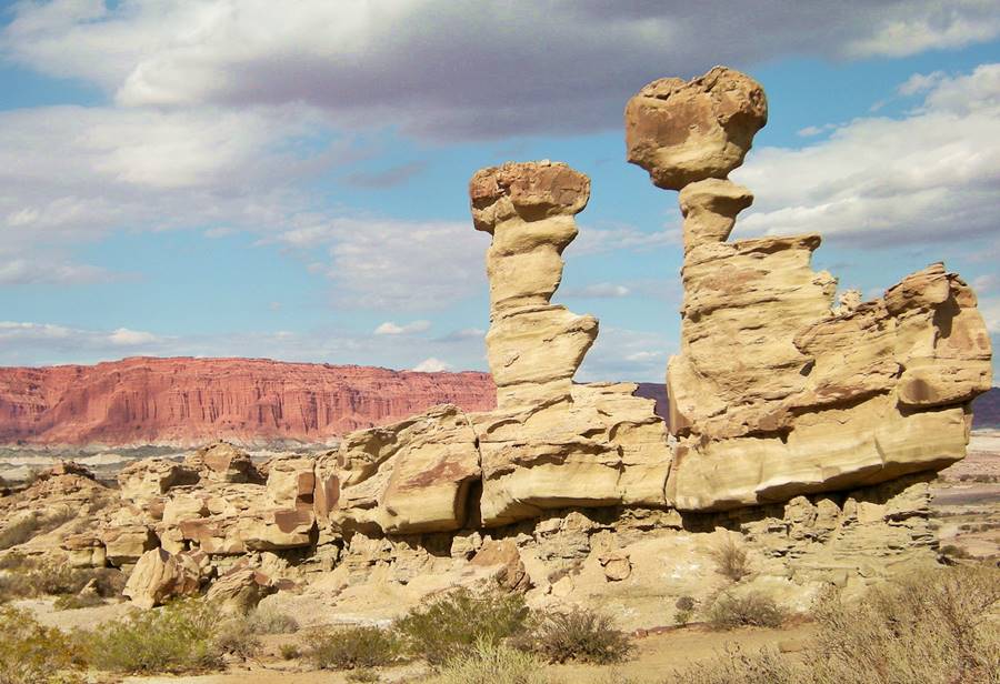
Attraction # 7: Talampaya and Ischigualasto
National and Provincial Parks and a UNESCO World Heritage Site
La Rioja and San Juan
Both parks are part of a UNESCO World Heritage Site the Talampaya National Park is in the province of La Rioja, and is next to the Ischigualasto Provincial Park in San Juan province.
They are renown for their rock formations, dinosaur fossils, prehispanic rock-art and its native animals and plants. It can be reached from Ruta 40 at Jáchal, Huaco or Villa Unión.
Attraction # 8: El Payén
La Payunia Provincial Reserve
Mendoza
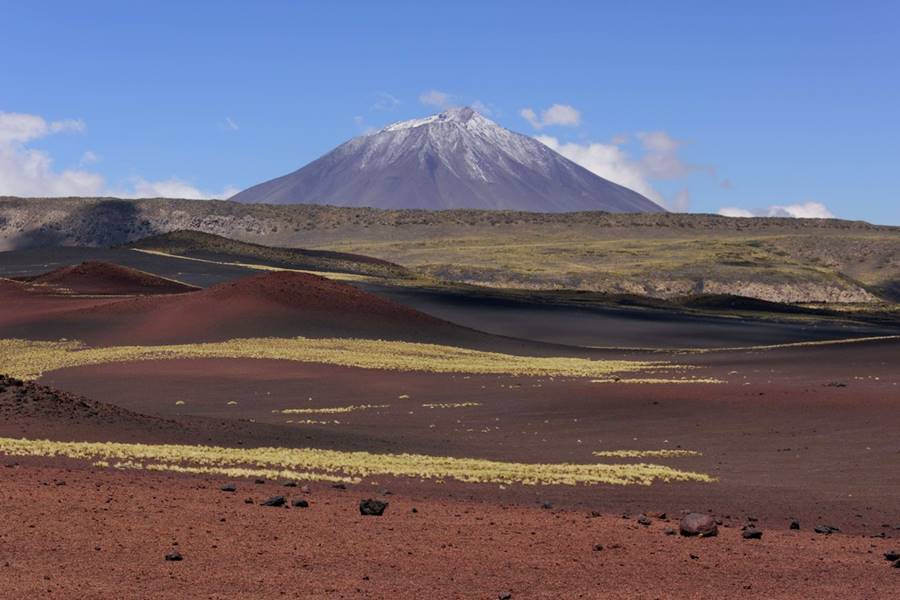
El Payén or Payunia, is a volcanic region with vast lava flows, basaltic rocks and volcanoes.
It has on average 2.75 volcanos every 10 sq. miles and disputes with the Siberian Kamchakta Peninsula the title of "most volcanos in a given area" in the whole world.
Its lava flows and lava fields are among the largest in South America.
Attraction # 9: Ruta de los Siete Lagos
Route 40 in the Patagonian forests and Lake District
Neuquén and Río Negro
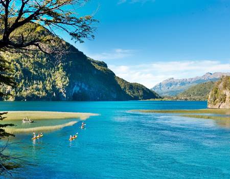
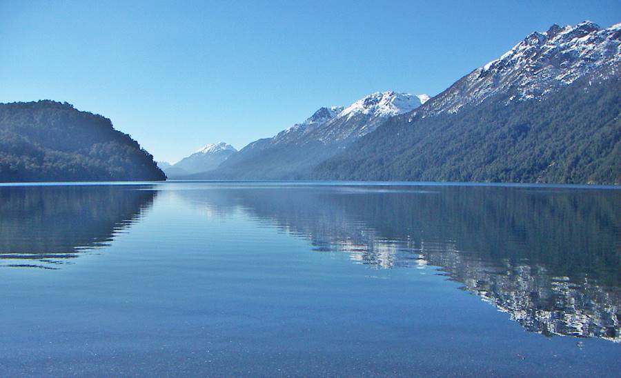
Ruta 40 betweeen the towns of Bariloche, Río Negro and San Martín de los Andes in Neuquén is known as the "Ruta de los Siete Lagos".
Its name means "The Seven Lakes Road", it is completely paved and it runs through two National Parks, in the Andean forests and runs along the shores of actually more than seven lakes.
The highway is aligned in the Andes, with its forest covered slopes, a pristine area protected by the Nahuel Huapi and Lanín National Parks.
Ruta de los Siete Lagos
A detailed itinerary, mile by mile with each of its lakes, landmarks and attractions:
Attraction # 10: Perito Moreno Glacier
Patagonia's most famous glacier
Santa Cruz
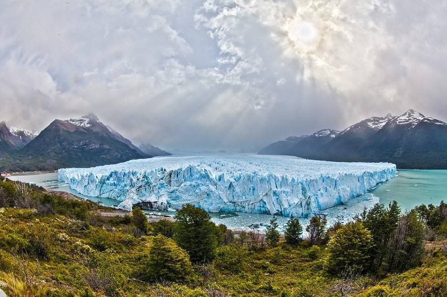
The Perito Moreno glacier is unique because it is not retreating, instead it moves forward, damming Lake Argentino, bursting periodically in a spectacular ice-dam rupture when the lake's water pressure breaks it.
It is located in the Los Glaciares (Glaciers) National Park, a UNESCO World Heritage Site close to the town of El Calafate.
Perito Moreno Glacier
All you need to know about it: its periodic ruptures, surface, location, how to get there, when to visit it and where to stay:
Bonus Track: Another Top Five Attractions
5 More Spectacular Sights on Ruta 40
These are the five runners-up to our top ten list of Route 40 amazing landmarks:
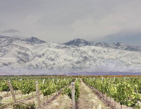
Vineyards and the Andes. www.benvenutodelaserna.com
Mendoza, Andes & Wines
The "Valle de Uco", Tunuyán, Tupungato, Luján de Cuyo, Maipú are terroirs where the great Mendoza wine estates are located. This is the land of the Argentine Malbec. And Route 40 links them all.
UNESCO World Heritage Site
Los Alerces National Park protects more than 15,000 acres of Alerce forests. This tree, the Fitzroya cupressoides is related to the North American redwood. Some trees are over 2,600 years old.
Inca Trail. www.cultura.gob.ar
Camino del Inca: Inca Trail
UNESCO World Heritage Site the "Qhapaq Ñan is the Inca Empire's vast road network.
Steam engine, La Trochita. Juan Macri
Expreso Patagónico Railroad
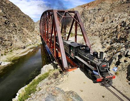
Narrow gauge in Patagonia is a National Historic Monument, you can still ride in in Esquel.
Cueva de las Manos
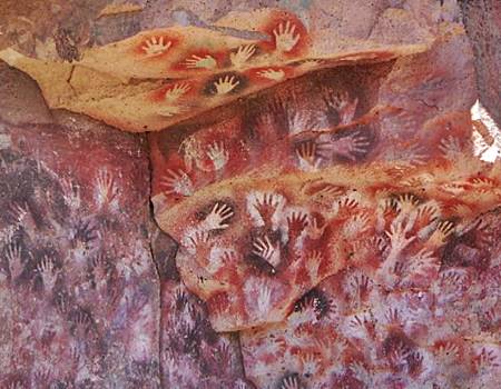
Rock art painted by paleoindians thousands of years ago.
Some of the painted hands are 9,300 years old. The "Cave of Hands" is a UNESCO World Heritage Site.
Hotels & Accommodation along Ruta 40
Find your room in each province along the highway
Find Lodging
>> Hotels in City of Salta
Hotels in each province along Ruta 40
Must-See stops near Ruta 40
>> Find your room in Salta Province

