
Valley of the Moon
Ischigualasto "Moon Valley"
Provincial Park & UNESCO Site
"One of the best 10 Attractions on Argentina's Ruta 40"
The Ischigualasto Provincial Park is unique, it is the only place in the world where Triassic continental sediments can be found. They are ash, white, gray, red and vermillion colored rocks,
with fossils of reptiles and dinosaurs.
Odly shaped rocks known as landforms with names that resemble their shapes: The Submarine, The Mushroom, the Bowling Field and the remains of the oldest dinosaur
are some of the attractions of this World Heritage Site.
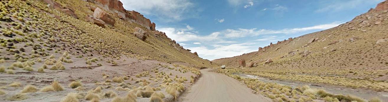
It is quite close to Ruta 40 which passes nearby, to the west, through Jáchal and Huaco in San Juan.
"Los Colorados" Formation in the Ischigualasto park, red cliffs on the Sierra Morada.

What is Ischigualasto?
It is a Natural Reserve, a Provincial Park established in 1971 (Provincial Law N° 3.666). In 1995, the National government designates it National Historical Site.
It has been managed by an autonomous body since 2004. Its main purpose is to protect the paleontological resources of the site.
In 2008 it was designated a UNESCO World Heritage Site with the neighboring Parque Nacional Talampaya National Park.
- Surace area 7,200 acres (2.916 ha.)
- Location: Northwestern San Juan province
- Map showing location
How to get to Ischigualasto

Ischigualasto is located the central western Argentina -Red circle in this map
You can reach it from Ruta 40 along two different highways, both paved:
- From San Juan, coming from the South: via the towns of Jáchal and Huaco heading east along Ruta Nacional 150 (This section of Ruta 40 is described in our page covering the Section from Mendoza to Guandacol
- From the north, coming form La Rioja's town of Villa Unión, described in Section from Guandacol to Alpasinche.
Getting there from Jachal and Huaco
Totally paved highway (Map) Ruta Nacional 150. Jáchal is a town with gasoline, hotels and other services for the tourist.
Find your hotel in > >
Jáchal
Jachal
Full details on the town of > > Jachal [our Spanish language webpage]
Ruta Nac. 150 overlaps with the alignment of Ruta 40 between Jáchal y the access to the village of Huaco.
Find your Hotel in > >
Huaco
The road is new and the distance is 133 km.
Fill up with gasoline in Jáchal there are no services or guel along the highway.
From Villa Unión
Villa Unión in the province of La Rioja is a town with service stations, travel agencies, restaurants, stores and hotels.
It is a drive of 137 km from Villa Unión to Ischigualasto. Take Ruta Nacional 76 eastwards.
Find your Hotel in > >
Villa Unión
Villa Union
Full details on the town of > > Villa Union [our Spanish language webpage]
Ruta 74 (see Map) goes through the small village of Pagancillo
It reaches the access to the Parque Nacional Talampaya National Park and continues west to the junction with Ruta Nacional 150 in the province of San Juan, turn right along it go through the small village of Baldecitos and then right, into Ischigualasto Park.
When should you visit the "Valle de la Luna"

A. Whittall
You can visit the park throughout the Year and there are also excursions on nights with full moon.
The best time is Autumn (Fall) and Spring because the weather isn't too hot or too cold it is also sunny and dry.
Easter and July winter holiday period is the "high season" and you will encounter a lot of visitors. Winter is cold, with freezing temperatures, yet sunny. It is very unusual to encounter snow.
From July to October is the Zonda wind period (dry hot wind from the Andes).
Summer is hot and also the rainy season with downpours which can cut your visit short.
Open Hours
Summer and Spring: Sept. 21 to Mar. 20: 08:00 AM to 05:00 PM.
Fall and Winter: 09:00 AM to 04:00 PM
World Heritage Site of UNESCO
The combined site "Parque Provincial Ischigualasto - Talampaya" is the only place in the whole world where you can find a complete sequence of continental sediments dating back to the Triassic Period. For this reason it was designated a World Heritage Site by UNESCO.
The meaning of the name Ischigualasto
It is said to come from the now extinct Kakán or Diaguita language and supposedly means: "Place where the Moon rests". But this is a guess because nobody has spoken Diaguita since 1780.
The word "Gualasto" appears in many place names in the region written as "Hualasto" and "Balsasto" (see for instance Punta de Balasto on Ruta 40 in Catamarca). Scientist Lafone Quevedo wrote that places whose names include the root "Hual" or "Bal" always have someting round or are surrounded by something. The word "Asto" is a mystery, but on Ruta 40, nearby, is a place named "Talacasto". The other words "ichil", "ischil", "ischilín" are names associated with plants.
It is also known as the "Valley of the Moon" (In Spanish: Valle de la Luna). It came from an article published in 1967 by Federico B. Kirbus, who gave it that name due to its dry, dusty and rugged landscape.
There is another Valley of the Moon on Ruta 40, the amazing Cusi Cusi in Jujuy, also known as "Valley of Mars" (to avoid confusion with Ischigualasto).
"El Valle Pintado" (Painted Valley), with a lunar appearance which seems to justify the name of "Valley of the Moon" (Valle de La Luna)

Visiting Ischigualsto Park
Access Fees Parque
You will have to pay an access fee (cash only) to enter the park, on the www.ticketischigualasto.com website, you can buy the entrance tickets and pay with debit or credit card (print the voucher and carry it with you).
There is a "general" entrance fee and other fees for the Alternative Circuits such as trekking (Cerro Morado and Short Circuit), Nocturnal Full Moon, Bicycle circuit.
There is a museum with dinosaur replicas (entrance fee charged) and if you wan to camp in the park you can do so, paying a fee.
Tours and Excursions inside the Park
Traditional Circuit - See the Map
Daytime trip shown in this map: Map of the Circuito), it is a 39 km drive and takes 3 hours to compelte. It is a closed loop that starts and begins at the Service Area at the park's entrance.

Diurnal Circuit

The circuit covers different "stations" and you visit the following attractions: fossiles Station 1 (El Gusano -"The Worm"), concretions (Cancha de Bochas - "Bowling Field"), landforms (such as "The Sphinx" - La Esfinge , "The Submarine" - El Submarino, "The Mushroom" - El Hongo), panoramas with Triassic sedimentary rocks: in tones of gray, blue green and white in the Moon-like Valle Pintado - "Painted Valley" and in ochres and reds in La Catedral - "The Cathedral" and Barrancas Coloradas - "Red Cliffs"). It also includes a stop at the site's Dr. William Sill Museum, located close to the "submarine" at Stations 4 and 5.
"La Cancha de Bochas" - Bowling Field

Full Moon Circuit
At night, with a duration of 2 hours, it takes place on the Full Moon night of each month, the 2 previous nights, and the night following the Full Moon. Moonlight and the clear crisp air gives the sandstone an eeire moonlike appearance.
"La Esfinge", landform that resembles an Egyptian Sphinx (lion whith a human head)

Cerro Morado Circuit
"Morado" is Spanish for "Purple" so Cerro Morado means "Purple Mountain". It has a panoramic view from the hill and you will get a close up view of plants and animals, specially the birds. A 3 hour tour.
Bicycle Tour
A circuit including bikes (provided by the park), check out full details at the information desk.
Trekking Circuit
Easy -low difficulty- trek to a lookout point, with a view of the sand dunes and "Las Ventanitas" (the small windows).
The "Mushroom" Landform "El Hongo" and behind it, the "Barrancas Coloradas" (Red Cliffs)

Tips and recommedations when you visit the Park
Rules
In case of doubt or if you need assistance, contact the Park Ranger (In Spanish: Guardaparque).
Walk along the trails, don't go beyond the marked areas: at each station the black stones mark the area where you can walk around.
Obey the rules and signs.
Report any anomaly to the Park Ranger.
All activities must be done in the company of a Guide. No "solo" tours are allowed.
Pets are allowed on a leash.
The fossils and archeological remains are protected by law (Argentine Law 25.743), so don't touch, remove, dig up, buy or carry this kind of article. It is a crime.
No Hunting inside the Park.
No Fire.
Watch the local animals at a prudent distance, don't bother them.
LEave no trace: don't pick flowers, rocks, twigs and take your garbage back home with you.
Tips for a a safe and enjoyable Visit
The terrain is dry, rocky and sandy, so wear comfy shoes.
There is no mobile signal in the Park, no internet either.
The main Service Area has a bar, store, camping area, restrooms and showers.
Do not forget to bring...
- Comfortable clothes and footwear for your hikes.
- Light clothes and something warm too (There is a great day-to-night temperature swing throughout the year).
- It is very sunny: wear a hat, dark glasses and use sun screen.
- Plenty of water to avoid dehydration, the relative humidiy is low. It is a dry area. Bring a snack.
- Binoculares, extra battery for your smartphone (camera) and a plastic bag to pack your litter.
- Fill up your gasoline tank either in Jáchal, San Agustín de Valle Fértil o rVilla Unión because there is no service station at the park or nearby.
- Cash to pay the entrance fee and whatever you want to buy at the park.
Ancient Triassic Rocks
Triassic Period dinosaurs are over 200 million years old, and in most of the world they are buried deep underground, covered by thousands of meters of sediments of later periods..
But, at Ischigualasto (and neighboring Talampaya) they appear on the surface because 70 million years ago, when the Nazca tectonic plate under the Pacific Ocean, collided with the South American tectonic plate, it provoked an uprising, which lifted these Triassic sediments upwards. Later, erosion removed the overlying younger sediments and exposed the Triassic rocks.
It is this unique feature that led to its designation as a UNESCO World Heritage Site.
Interested?, read more about the Local Geology.
Triassic Period
The Mesozoic Era is divided into three periods, and the first of them was the Triasscic.
It was during this period that the reptiles evolved into dinosaurs.
The first of these, ancient ancestors to the T-Rex and velociraptors, were two primitive carnivore dinos found in Ischigualasto: the Eoraptor lunensis and the Eodromaeus murphi.
There are also fossil remains of plant eating reptiles (that were not dinosaurs) rhynchosaurus like the Hyperodapedon; aetosaurus; cynodonts like the Probelesodon, dicynodonts like the Ischigualastia; and traversodontids such as the Exaeretodon.
There were meat-eating dinosaures like the Herrerasaurus (carnívoros) and the Pisanosaurus.
Eoraptor

The "Eoraptor" belongs to the order of the Saurischia and lived during the late Triassic's Carnian period 231 to 228 million years ago
Its name comes from the Greek words: "Eos" = "dawn" and "Raptor" = "hunter"; The "dawn hunter". "Lunensis" is Latin for "inhabitant of the Moon".
At that time Argentina was part of the mega-continent of Gondwana (which comprised, South America, Africa, India, Australia and the Antarctic). Ischigualast was a flood plain with active volcanoes, it had a warm and humid climate and forests covered the area.
The petrified trunks of the Protojuniperoxylon ischigualastianus trees, over 130 feet tall (40) m de altura grew here, with horsetails and fern trees.
The Eoraptor was discovered in 1993 and is one of the oldest known dinosaurs.
It is tiny, only 3.3 feet tall (1 metro de altura) and it weight 22 lb. (10 kg), it stood on its hind legs and was omnivorous.
The World's oldest dinosaur
The honor of being the oldest known dinosaur goes to the Panphagia protos which lived in Ischigualasto 228 million years ago.
At that time it was a rocky savannah, like those that exist nowadays in Africa.
This plant-eating dino was a tiny: it stood 1 foot (30 cm) tall and was 4.5 feet long (1.5 m), yet it is the oldest known sauropod, a lineage which would include the largest beasts that have ever roamed the earth.
Vegetation
The dry climate limits the plants to cacti such as cardones, and trees like the algarrobo, jarilla, retamo, brea, chaguar, chañar and zampa. The Chica, is a tree that only grows in San Juan province can be seen on the slopes and it has very hard wood.
Wildlife
There are South American camelids such as the guanaco, and a rabbit-like animal, the "mara" (also known as Patagonian hare). Foxes and puma. Small armadillos (called "mulitas") and birds like the cóndor, carancho and the American ostrich (ñandú). There are some snakes too: yarará chica, coral snake and rattlesnake.
Tips and Advice for your Trip
1. Weather in Ischigualasto
Dry continental climate with extreme temperatures in summer and winter. Large temperature swings between day and night. Hot and sunny summers with a daytime maximum which can go above 122°F (50°C) in the sun. Winter is very cold dropping to a freezing 16°F (- 9°C).
Expect frost from May to October.
Little rain falls (6 inches - 150 mm yearly) but if is concentrated in torrencial downpours during summer -rain and hail are common. Rainy season: Nov. to Mar.
Dry rivers and gullies can fill up with water, mudslides can block highways.
Very arid and dry, with low relative humidity, keep hydrated (avoid dehydrating).
Windy most of the time, but the local hot and dry Zonda wind blows from July to Oct.
Clothes: in winter keep warm and wear a warm hat because it gets quite cold. During summer dress lightly use a hat, sunscreen and sun glasses.
2. Driving Tips
The roads are paved and relatively flat (from Villa Unión and from La Rioja) so Ruta 40 and Ruta Nacional 76 offer no difficulties. From Jáchal the new Ruta Nacional 150 is also paved, but it has some curves, winding alignment and tunnels. Drive carefully.
Road Conditions
Check the road conditions on our website: Road Conditions.
There are service stations in Villa Unión, Chilecito, Guandacol, Nonogsta, Pataquia, Jáchal, and La Rioja.
›› Location of Ruta 40's Service Stations
Accommodation near Ischigualasto
There are many hotels in neighboring Villa Union, see below:
Booking.comFind your hotel: > > in Villa Unión
Find your Hotel...
Find hotels in other towns close to Ischigualasto
In La Rioja
Chilecito
Famatina
Guandacol
Villa Unión
Pagancilo
La Rioja capital
Aimogasta
In Catamarca
In San Juan


