Ruta 40 Section 16
Ruta 40 in Jujuy
This is the last leg of Ruta 40 and one of the most difficult sections due to its lonely gravel, sand and dirt alignment in an area devoid of towns. Only some scattered settlements with the most basic services. The Puna highland also has a very harsh climate and extreme altitude: on average 13,100 feet (4.000 meters).
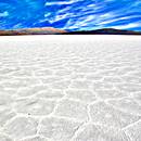
However, it has some of Ruta 40's best landmarks, such as the famous Salinas Grandes the Cusi Cusi "Valley of Mars" and the mighty La Polvorilla Viaduct of the Tren a las Nubes (Train to the Clouds) railroad.
Ruta Nacional 40 en Northwestern Argentino, Argentina
A Summary of this Road Section
It is a long leg, of 276 miles (444 km) crossing the Puna at great altitude.
It links the town of San Antonio de los Cobres in Salta province with the "end of the Road" for Ruta 40, the city of La Quiaca in Jujuy, right on the border with Bolivia.
Heights along this leg
- 12,374 ft (3.774 m). At its starting point: San Antonio de los Cobres, Salta.
- 11,344 ft (3.460 m). At its ending point: La Quiaca, Jujuy.
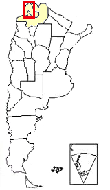
Section 16 is located in NW Argentina,
see red box at the top of this map
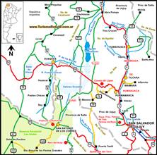
Road surface: Except for a short 2 mile (3.2 km) section where Ruta 40 overlaps Rua 52 at the village of Susques in Jujuy, the road is completely unpaved, and has a gravel, sand or dirt surface. This is map of the paved part in Susques.
Difficulty: High. Almost no towns or villages along the road. Lacks most basic services (service stations, lodging, etc.); it is a high altitude highway.
Villages along this leg of the road
Apart from La Quiaca and San Antonio de los Cobres, there are some tiny villages along the way:
- Sey
- Susques
- Coranzuli
- Mina Pirquitas
- Cusi Cusi
- Santa Catalina
La Puna Highlands
After Tibet, it is the world's second highest plateau
In the native Quechua language, Puna means "High Terrain". The name is very descriptive, this is a geographic region that is a vast plateau, a highland that is over 11,000 feet high, is 1,100 miles long (1.800 km) and up to 250 mi wide (400 km).
It forms a long arch running north to south from Lake Titicaca in Bolivia (where it is called the "Altiplano"), across northern Chile as the "Puna de Atacama" and into Argentina's provinces of Salta, Jujuy and Catamarca.
It is a tectonic plate, uplifted when the Andean mountain range formed some 25 Million years ago, and covers 70,000 sq. mi., or 180.000 km2.
The Argentine Puna region is one third of the total Plateau, and is larger than the state of West Virginia or Maryland and Massachusetts combined.
It is an extremely arid area because the humid winds from the Atlantic are blocked by two mountain ranges to the east: the Sierras Subandinas and the Cordillera Oriental. Rainfall in the foothills of these mountains sustain the lush Yunga jungles, home to jaguars and tapir.
The plateau is surrounded by peaks that exceed 16,300 ft. (5.000 m), it forms an enclosed drainage basin, and its dry creeks flow into former inland lakes, now dry salt flats.
Dry air and altitude give it a cold climate, from -2°F (-20°C) in winter to a balmy 94° F (20°C) during daytime in summer.
Altitude can cause mountain sickness, which is known in Quechua as "Soroche", and chewing coca leaves is the traditional remedy for this acute illness.
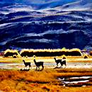
Its vegetation consists of low lying shrubs adapted to the dry, windy and cold weather. And wildlife is mainly grazing South American camelids such as the llama and the vicuña. The few lagoons and wetlands support three species of flamingos.
When should you drive this leg of Ruta 40?
The best time of the year to visit this region
- Summer. This is the rainy season. Sudden downpours can cause flash floods and mudslides, blocking highways. Summer is cool (due to the altitude).
- Winter. Dry period. Clear sky and sunny. No snow, but expect frost and very cold -below freezing- temperatures. Winter holiday period is high season, avoid it (July) and book accommodation before traveling.
- Fall and Spring. From March to November it does not rain. Nice weather, cool during daytime, cold at night. Sunny. Best time to visit the region. Easter and long weekends may bring more tourists to the area, mostly local visitors.
Some Attractions along the way
Things to see in the Puna
- Viaducto La Polvorilla of the "Tren a las Nubes" (Train to the Clouds)
- Cusi Cusi, the "Valley of Mars"
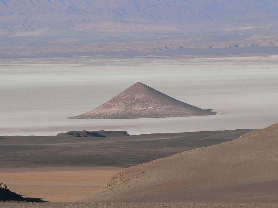
- The Puna in Salta and Catamarca: Cono de Arita
- Salinas Grandes Salt Flats
- Multi-colored mountain at Paicone
- Laguna de los Pozuelos Natural Monument
The "Cono de Arita" (Arita Cone) in the Arizaro salt flats, Salta
Description of the itinerary
Drive Ruta 40 from San Antonio de los Cobres to La Quiaca
We describe the journey from south to north, starting off at the town of San Antonio de los Cobres [our Spanish language webpage], in the province of Salta, and ending at the city of La Quiaca [our Spanish language webpage], in Jujuy.
San Antonio de los Cobres
Full details on the town of > > San Antonio de los Cobres [our Spanish language webpage]
>> Find your hotel in San Antonio de los Cobres
How to get to San Antonio de los Cobres?
You can reach San Antonio de los Cobres by driving along Ruta 40 from the sotuh, crossing its highest point at the 16,340 foot high Abra del Acay Pass, which is quite a difficult drive. Another option is to come from Salta city, along paved Ruta Nacional 51:
> > From Salta to S.A. de los Cobres along Ruta 51 [our Spanish language webpage]
The "Old" alignment of Ruta 40
Until 2012 Ruta 40 had another alignment north of San Antonio de los Cobres, it ran along the Salinas Grandes and ended on Ruta Nacional 9 -Panamerican Highway- at Abra Pampa.
But it was moved further west, forming a highway devised to promote mining in the western Puna and northwards, all the way to the town of La Quiaca.
The "old" alignment was designated as Ruta 1V40, see this Map of the Old Ruta 40 from San Antonio de los Cobres to Abra Pampa.
Leaving San Antonio de los Cobres
Remember to fill your gasoline tank before leaving.
Drive south and leave the town along the overlapping alignments of Ruta Nacional 40 and 51.
Our km 0 starts here. Head west and at km 5, Ruta 40 forks to the north (right) leaving Ruta 51
Ruta 51 into Chile
Ruta Nacional 51runs westwards all the way to the Chilean border, a tour which we describe as Tour into the Puna [our Spanish language webpage], visiting salt flats and the Arita Cone among other remarkable sights.
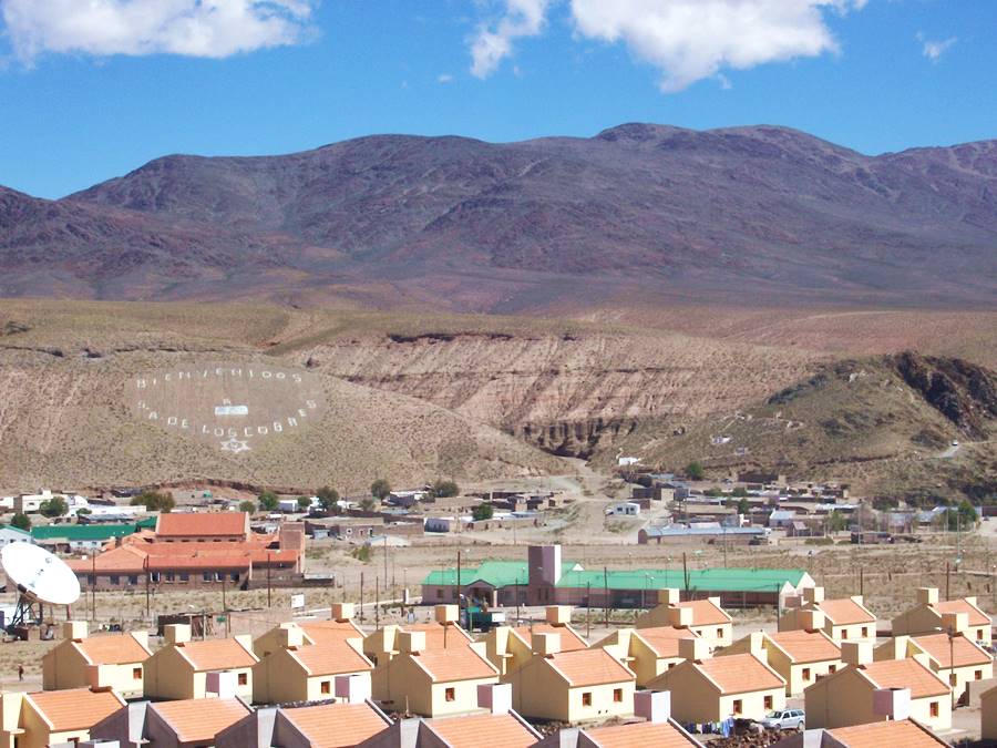
Towards the "La Polvorilla" Viaduct
Turn right at the fork and head north along Ruta49, one kilometer ahead, on the right side of the road are the abandoned thermal baths of Pompeya, in ruins
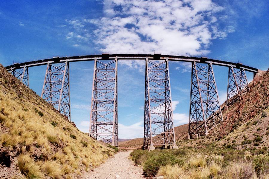
Continue north and the Ruta 40 will pass under the Viaducto La Polvorilla Viaduct [our Spanish language webpage], at km 17.
Viaducto La Polvorilla Viaduct
A magnificent engineering prowess , it is a steel railway bridge with a very slight curve built into it. It spans a deep canyon. And Ruta 40 runs along the base of the canyon.
It is 734 feet long (224 m) and 207 feet tall (63 m). The famous "Train to the Clouds" or Tren a Las Nubes uses it (you can buy tickets for this train at Salta city, it runs during the "Dry season" only. Some cargo trains carrying mineral also cross the viaduct.
Head north, and at km 24 you will reach the provincial border, leaving Salta province to enter Jujuy province.
The road to Susques
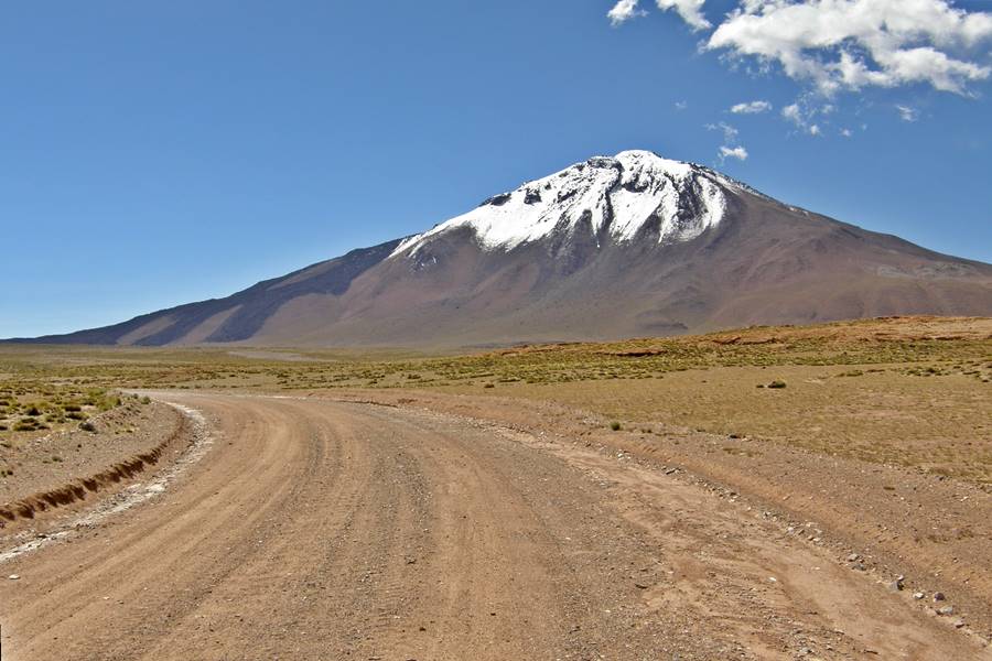
The dirt road has a nortwestern course and passes (km 35) along the western slopes of the Tuzgle volcano, following a 7 km long circle around its cone. The image below shows the gravel surface of Ruta 40 and behind it the snow-capped peak of Tuzgle volcano. On its left flank is a relatively recent dark black lava flow.
La Juguetería - The "Toy shop"
The road then heads north follwoing the Agua Caliente River (its name means "hot water") and at km 44 Ruta 40 enters the Quebrada de Agua Caliente canyon.
Just ahead (km 46) the shallow and narrow canyon's walls and base are littered with enormous boulders which have broken off the rocky crest of the canyon.
The Ruta 40 then fords the river to its western shore.
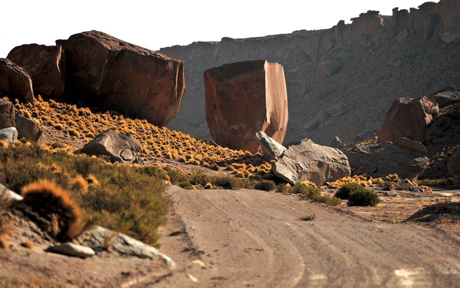
The canyon ends at km 51 widening into open terrain and at km 55 you reach the tiny village of Sey:
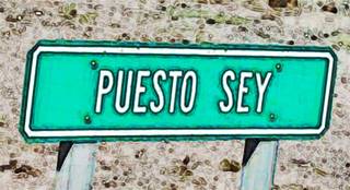
Sey or Puesto Sey
Set on the occidental bank of the Agua de Castilo river, which is the continuation of the Agua Caliente river. To the east, the red summits of the Sierra del Cobre (Copper range) mark the border between Jujuy and Salta provinces. You can see the Cerro Colorados mountain (5.440 m) and to the west the Cerro de Punta del Viento (5.226 m), its name means "Tip of the Wind" -both are over 17,000 feet high.
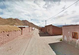
Ruta 40 in Sey: Its main street
Sey has 150 residents, a school, police station and health post. Ruta 40 is its main street, and humble adobe homes line it.
The highway continues norht with a straight alingment running close to the river. It fords the Taraste creek at km 68 and further ahead it fords the El Cacao river. At km 75 is the southern access to the village of Pastos Chicos, located one mile (1.600 m) east -to the right- of the highway, beside the river. You can drive into the village because the road meets Ruta 40 just north of it.
Pastos Chicos
The name means "Small grasses" it is set at 12,622 ft (3.850 m) and has over 250 residents, a school and a health post. Map showing its location.
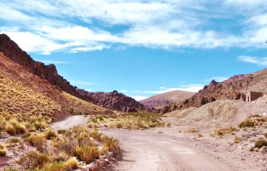
After the village the road runs with a straight course, to meet the Pastos Chicos River (continuation of the Agua de Castillo river) at km 79. Here begins a winding but relatively flat section where the highway crosses many dry river beds. At km 103 it reaches the village of Huancar becoming its main street.
Huancar
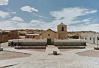
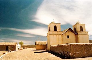
Church on Ruta 40, in Huancar, Jujuy
With around 300 residents, has a post office and a school. Its name Huancar has two meanings in the native Quechua language one is: "sand deserts where the wind makes strange sounds" and the other is the name of a musical instrument. See Huancar location on a map.
To the east of Ruta 40 you can see the Cerro Cobres mountain (16,331 ft. - 4.981 m) on the border with Salta. The road heads north, following the winding course of the Pastos Chicos river. At km 113 junction with Ruta Provincial 74a which heads southeast to the hamlet of Cobres, (30 km away) in Salta.
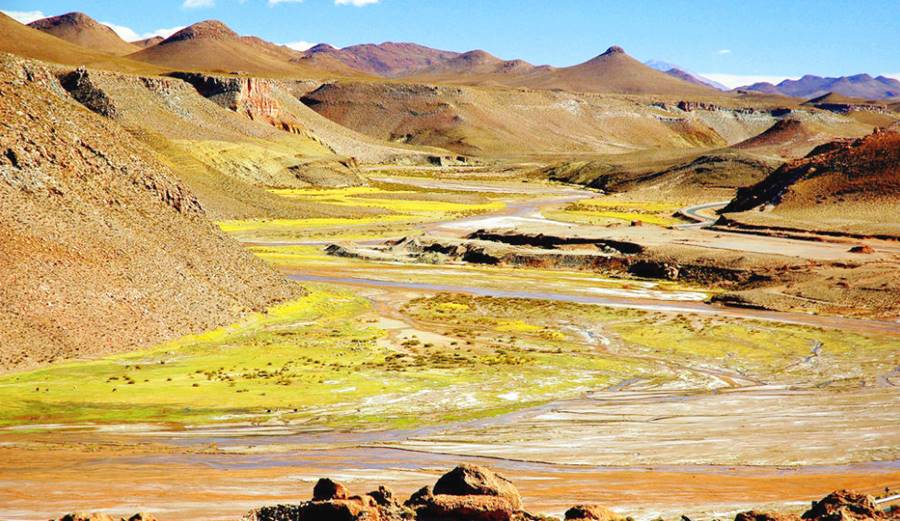
Junction with Ruta Nac. 52: Paved highway
The road follows a very winding course until it reaches km 123 its junction with the Ruta Nacional 52, a paved highway in a place called Casa Quemada (Burned House).
Ruta Nacional 52 is a main highway that links the Quebrada de Humahuaca [our Spanish language webpage], which is a UNESCO World Heritage Site, with Chile.
Fuel
To the left of the junction is the Pastos Chicos Hotel with gasoline. Fill up your tank here.
Side trip to Paso de Jama and San Pedro de Atacama
Leaving Ruta 40 and heading left (west) along paved Ruta Nacional 52, it is a drive of 124 km to the international border crossing into Chile at Paso de Jama Pass.
On the Chilean side, it is a drive of 157 km along Chilean highway 27 to the tourist town of San Pedro de Atacama
Jama Pass has 160 residents, and is located at an altitude of 4.200 m. The pass is open daily from 8:00AM to 11 PM. And there is a YPF service station there
>> Find your hotel in San Pedro de Atacama
Atacama, Chile, fantastic scenery

Back to Ruta 40
This is the only paved part of the itinerary: 2 miles - 3.2 km into Susques.
Turn right, eastwards into the small town of Susques.
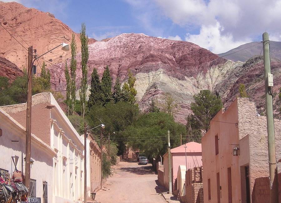
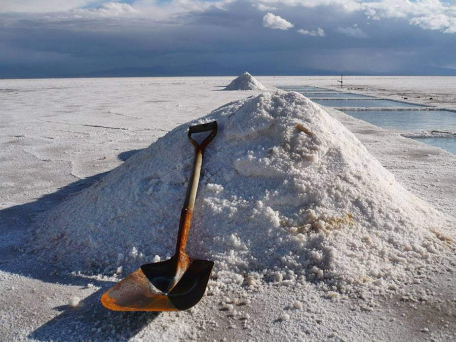
Ruta 40 overlaps with Ruta 52 here. The Ruta 52 runs all the way to Purmamarca close to Ruta Nacional 9. Purmamarca is well known for its Cerro de los Siete Colores (Seven Color Mountain), and is located in the Quebrada de Humahuaca. Ruta 52 also goes through the renown Salinas Grandes which are located 65 km east of Susques.
Purmamarca
Full details on the town of > > Purmamarca [our Spanish language webpage]
>> Find your hotel in Purmamarca
A view of the Salinas Grandes, one of the "Top 10 attractions Ruta 40".
We strongly recommend that you do this drive down to Purmamarca, visiting the Salinas Grandes, and the winding slope of "Cuesta de Lipán" and also tour the Quebrada de Humahuaca where nature and ancestral native cultures blend together.
Quebrada de Humahuaca
Full details of this region > > Quebrada de Humahuaca [our Spanish language webpage]
>> Find your hotel in Humahuaca
Going back to our itinerary on Ruta 40:
At km 126, you reach the village of Susques.
Susques
Located on the junction of Ruta 40 and 52, it is 204 km northwest of the city of San Salvador de Jujuy, the provincial capital. It has around 700 residents. The only village along this leg with plenty of services for the traveler. It has a health post, police station, grade school and high school, register office and post office.
Susques is a tiny settlement set at an altitude of 12,057 ft. (3.675 m), it is the head of Susques District.
Don't miss its historical church:
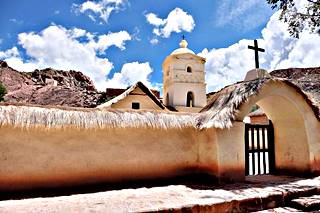
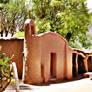
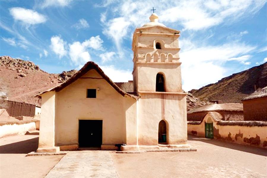
Colonial Church Our Lady of Belen - Nuestra Señora de Belén
It has been designated as a Historical National Monument
Nuestra Señora de Belén is an adoe building that dates back to the sixteenth century, a reminder of the Spanish colonial domination over this region.
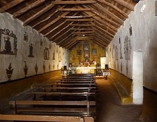
Its roof is held up by beams made from Cardón wood; the cardón is a natvie cactus. They are tied together with leather straps.
It was consecrated in 1598, making it the oldest church in Jujuy.
Its interior is decorated with paintings of local birds and flowers and has a very low organ (you have to kneel down to be able to play it).
Local lore tells us that an image of the Virgin of Belén, patron of Susques, was found under a stone, and that site was chosen to build a church in her honor.
It is a very austere building, with a single nave and one steeple. Its walls are made of aobe brick, plastered with mud. The murals and the images of saints are quite remarkable.
Susques
Full details on the town of > > Susques [our Spanish language webpage]
Northwards from Susques
This is an extremely difficult leg, with hardly andy services along the way
Ruta 40 heads north, now as a gravel road along the Susques River valley. This river flows east and its water ends up in the Salinas Grandes - Laguna Guayatayoc basin.
Afte 5 km the road climbs into a relatively flat plateau running next to the dry bed of the Susques river. It leaves it (km 145) at an altitude of 4,000 m, following dry rivers that feed the Coranzuli river, heading towards the northwest.
The road climbs and at km 158 reaches an altitude of 14.470 ft (4.410 m), and descending from there towards then north. It runs along the canyon of a mostly dry river that drains westwards into the Salar de Olaroz salt flats, and follows it till it reaches the place known as Lever at km 175 (alt. 4.100 m)
Lever
This is a road junction, the "ramal B" highway heads west to the Salar de Olaroz. There is an Archeological site at Lever: a cave with paintings and stone tool remains at a basaltic rock shelter. They are 8,000 years old.
At the junction turn right, towards Coranzuli; the road takes a northeastern direction following a dry stream and climbs up to 4.300 m at km 181; dropping from there into the village of Coranzuli along the Coranzuli River.
Coranzuli
Elevation: 12,894 ft. - 3.930 m. 975 residents. Location map.
The town is located on km 201 (72 km north of Susques) on the western side of the Coranzuli River (forded by Ruta 40).
Formerly a mining town, but hit by mine closures, most inhabitants breed llamas. It has a police station, post office, health post, school and register office. Basic services for the tourist. No service station.
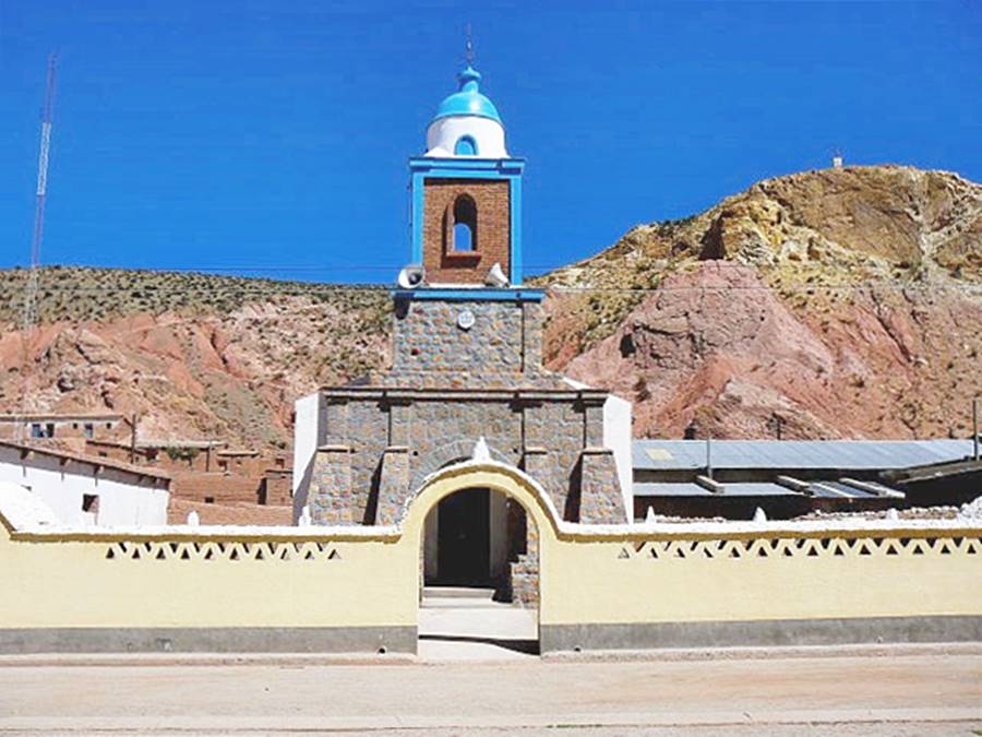
Visit its church, built in 1897, it is next to the village square.
The name Coranzuli is Quechua: Kora (weeds) y kulli (purple): "place of purple weeds". It was established by people who left Susques to find better land to cultivate. There are some thermal baths 6 km north of the village. It was also a battle site during Argentina's independence wars (Battle of Coranzuli, Nov. 25, 1817) the forces of Col. Arias defeated the Spanish troops of Olañeta.
North into the deep Puna
Ruta 40 climbs out of Coranzuli following the river and at km 208 peaks at 4.200 m, heading downhill to reach a fork at km 213: Ruta Provincial 74 branches left towards the town of Abra Pampa on paved Ruta 9.
Keep northbound along Ruta 40 (left), to the east is the mighty Cerro Coranzuli mountain with 16,962 ft. (5.170 m), a volcano with the Coranzuli thermal baths.
Abra Grande Pass
The road heads towards this mountain pass, reaching it at km 233, its name is "Wide Pass", it altitude is 14,534 ft. - 4.430 m. The road descends along the Porvenir River Valley northwards and where the river meets the San José river is a small village (km 249), Coyaguayma, at 4.082 m above sea level.
Coyaguayma
Rosario Church, in Coyaguayma, Source
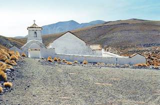
It is a new settlement, established by the ancient colonial church in 1992 junto a la antigua iglesia. Location map.
The old church is in an atrium enclose by an adobe wall. It has a thatched roof.
The road crosses the Ajedréz river, next to a small settlement (km 254) and then climbs up along the Pirquitas river reaching the entrance of Mina Pirquitas mine at km 259 (4.075 m). The mine is 5 km from Ruta 40, to the left (west). The village of Nuevo Pirquitas is just ahead at km 261:
Mina Pirquitas
Located at an altitude of 14,012 feet or 4.271 meters above sea level, it is the highest village in Argentina.
It has around 700 residents but during the mining boom it had two thousand.
Mina Pirquitas: the highest town in Argentina
No other permanently peopled place in Argentina is located higher than Mina Pirquitas.
It has a health post, hospital, police station, register office, post office, grade school and highschool. Tourists can find basic services here. No gasoline.
Mining was the main employer and the Mina Pirquitas mine produces casiterite a mineral that contains tin, silver and zinc.
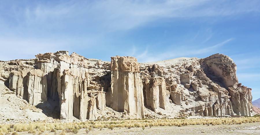
Archeological Site
The Mina Pirquitas site was a pre-Hispanic gold mine. There was an Inca gold mine at the current mine which was rediscovered by Uriondo Tochón leading to the present mining operations.
The road heads to the northeast and heads downwards along a river valley to ford the Salitre river km 268 (4.000 m).
Further ahead it meets the Ajedréz river (km 273) and reaches at km 281 the hamlet of Orosmayo:
Orosmayo
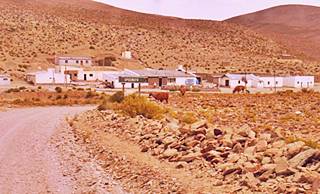
Ruta 40 in Orosmayo. Source
Located on the south side of the Ajedréz river, where it meets the Orosmayo river at an elevation of 3.880 m. See its Location map.
It has a few houses and some 40 families live in the area, breeding llamas.
The Quechua word 'Mayu' means "River" and "Oros" is the name of the ancient native people that lived here, the"Urus".
La Ruta 40 crosses the Ajedréz river and follows the Orosmayo along its eastern side; at km 287 it reaches the village of Liviara (3.947 m):
Liviara
It is quite new as it was founded by Santos Eugenio Trejo in 1997. He left Orosmayo after a family dispute with his father. Less than 80 residents. Most of them pan for gold in the river.
There is the junction of Ruta Provincial 70, which heds east reaching (48 km away - Map with directions) the Laguna de los Pozuelos lake:
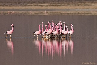
Flamingos in the Laguna de los Pozuelos, Jujuy
Source
National Monument and Bird Sanctuary
The lake is protected as Monumento Natural Laguna de los Pozuelos, a National Monument managed by the National Park Service. It was created in 1981.
It protects the wetland where 44 bird species, including flamingos (a population of 25,000 individuals). It is a Ramsar Site, Wetland of International Importance.
Ruta Provincial 70, then heads east and along Ruta Provincial 7 reaches the village of Abra Pampa (124 km), see Map.
Returning to our Ruta 40 itinerary: the road crosses the Orosmayo River at km 291 heads northwest leaving the river behind and after a divide heads downhill towards the Tiomayo river. It crosses many dry streams, fording them, passes by the hamlet of Santa Ana (km 300); see location map nexts to the ford actross the Palca Huasi river. After another 5 km junction with Ruta Provincial RP 85. And at km 311 is the village of Tiomayo:
Tiomayo
Small village (Map with location). Its name combines the Quechua words: 'Mayu': river and 'Tíu': "sandy area"
The highway descends northwards along the river's valley among rock formations that combine red, granate and vermillion with white.
Ahead is a magnificent view km 315 of an amazing valley:
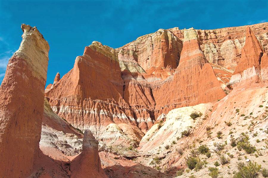
Cusi Cusi: The "Valley of Mars"
"Top 10 attractions Ruta 40".
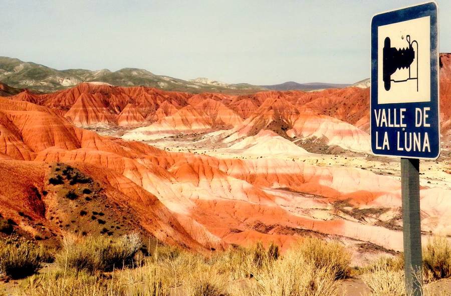
A multicolored valley in ochre, red, pink, gray and white in the lonely Puna plateau.
Also konwn as the "Second Valley of the Moon" (the first is the one at Ischigualasto Provincial Park in San Juan). It is located at almost 3.800 m altitude.
Learn all about Cusi-Cusi
Where to lodge, what to do and all you need to know about it:
> >Cusi Cusi
The Valley of Mars is called so because its red, pink, and ochre rocks look like those of the Red Planed. In the native language, it is known as "Puca Ukúqai" which means "Red Valley".
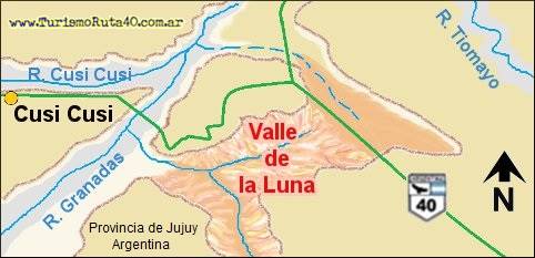
Map of the Vally of Mars, Cusi-Cusi. A. Whittall
The valley is to the left and south of the access road into the village of Cusi Cusi. This road links Ruta 40 with the town, from the bridge over the Granadas River (see map).
The water flowing into the river eroded the volanic rocks of the plateau, river which is dry most of the time and which in turn flows into the Granadas River.
See this 360° Street View.
Ruta 40 runs along the eastern edge of the Valley along a flat divide between the Grande and Tiomayo rivers. The Valley is 160 feet deep (50 m) and contains lava, volcanic rock and pinnacles.
The Geology of Cusi Cusi
Sedimentary rocks from the Ceozoic Era's Miocene period are continental riverine deposits that oxidized them to a red color. The Peña Colorada (Red Cliff) formation is made up of older continental sedimentary rocks that were broken into smaller pieces some with a reddish others gray-green or whitish color.
You can see these in the valleys of the rivers. The volcanoes that surround the area erupted during the Upper Miocene providing dacite, a volcanic rock.
Continuing our Journey
Just ahead at km 316 access road to the tiny village of Cusi-Cusi:
Cusi Cusi
3.773 m and 1.117 hab (in 2010), Map with its location.
Cusi Cusi, is Quechua and means: "happy and good luck place". It was founded in 1954 close to the ancient Chapel of San Juan built in the 1700s. It has a school and a health post. The town is located in the Cusi Cusi River valleys which with the Granadas river are great trout fishing areas.
Locals breed llama and use their wool in hand woven textiles which can be purchased at the store of the Awatiri Community in Cusi Cusi.
Ruta 40 heads north, descending and at km 321 fords the Granadas river. It does so another two times until it reaches the village of Paicone (km 335) after another ford, across the Paicone River:
Paicone
Basic services. The village is on the north side of the river. The eroded slopes of the mountains resemble multicolored claws: yellow, white, pink, red and purple rocks form the slopes. Amazing!
They belong to the same "Peña Colorada" formation rocks seen at Cusi-Cusi.
500 yards west of the village you can see the dark black and gray acid volcanic rocks that cover the region all the way to the border with Bolivia.
The Ruta 40 heads towards the Northeast, to cross the Granadas River at its junction with the Oros River. Both form the río Grande de San Juan whose water will eventually reach the Atlantic Ocean after flowing thousands of kilometers along the Pilcomayo, Paraguay, Paraná and River Plate rivers.
At km 339 junction, the road to the left heads to the Bolivian border and the Argentine village of Ciénaga de Paicone (5 km). There is a pass there but it is not open to border traffic.
So take the right turn and ford the Granadas river here. It is a 500 yard ford along the gravel, sand and water of the river.
After crossing the road turns sharply right, south, and after 1 km reaches the village of San Juan de Oro:
San Juan de Oro (or Oros)
140 residents. Altitude: 3.620 m. Map with location.
On the west shore of the San Juan de Oros River. Health post and local native community (though most of the native people moved to neighboring Misa Rumi -5km south. Don't miss the colonial church built in 1750 which is pictured below.
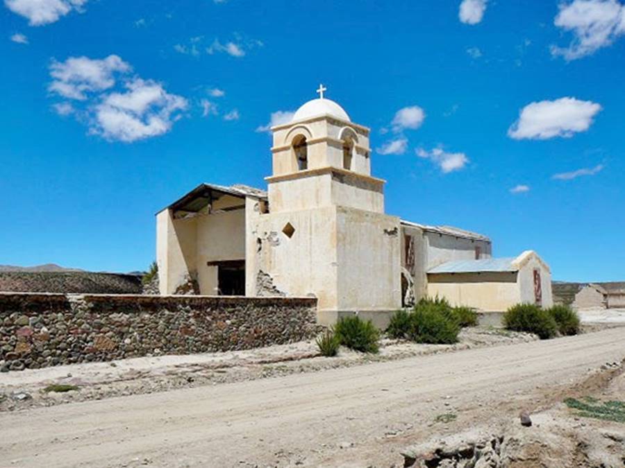
Here there is a "T" intersection, head straight and you will drive along Provincial Hwy 7 to Misa Rumi, but Ruta 40 turns left to cross a ford over the Oros River. Then it runs east, turns southeast and goes uphill to avoid the dry gullies. It reaches the Oros river upstream (at a higher altitude - 3.800 m) runs next to it (km 347) and 1 km north, drops down into the river bed.
Ruta 40 runs along the Oros River bed
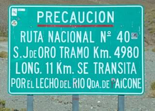
Ruta 40 road sign about the river bed alignment on Oros River, Source
This is quite an unusual situation for a National highway: the road is aligned along the natural river bed of the río Oros river (or, as the sign says "río Qda. de Paicone" -river of Paicone Canyon).
This is a 12 km segment that climbs eastwwards in a winding course (the dry river bed's course) leaving it at an altitude of 4.050 m at the hamlet of Oros.
It is there that you can see the road sign that you can see in the image, which says (translated): "Danger Ruta Nacional N° 40 - Section Km. 4980 - S.J. DE ORO- Length. 11 Km. You drive along the river bed of the Paicone Canyon River"
San Juan y Oros
A few scatterdhouses on the south side of the river. The road climbs out of the river heading north, zig-zagging. It turns esast to reach at km 363 an altitude of 4.290 m. And reaches the village of Timón Cruz:
Timón Cruz
Pop 60, altitude 4.152 m. Map showing position.
There is a health post, school and native community. The road climbs north to the plateau to avoid the river gullies.
After fording the Oratorio river it reaches a crossroads at km 385 (3.870 m), meeting Ruta Provincial 64 which runs east to west (eastwards it overlaps Ruta 40). Ahead is Ruta Provincial 65 which goes to the village of Santa Catalina, 21 km to the north.
Santa Catalina
Pop. 332 and a marvelous church from the 1700s. It is Argentina's northernmost town (21°55’S 66°4’W)
Santa Catalina
Full details on the town of > > Santa Catalina [our Spanish language webpage]
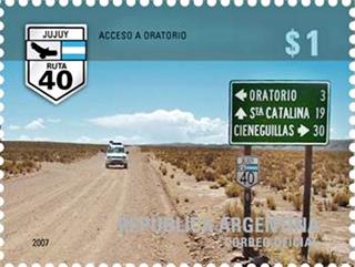
Access to Oratorio, Jujuy, Ruta Nacional N°40
Argentine Postage stamp issued in 2007
You can visit the tiny village of Oratorio, just 2 km west of the crossroads:
Oratorio
250 residents, elevation: 3.915 m. Map with location.
Police station, health posts and aboriginal community.
At the crossing, turn 90° towards the right and heard east towards Cienaguillas and La Quiaca, 2 km ahead ford across the Santa Catalina River.
Northernmost Point of Ruta 40
After crossing the Santa Catalina River, just 850 meters from its eastern bank, at an altitude of 3.865 meters, is the Most Northern point of Ruta 40 at 22° 05’ 13" South.
See this Map showing its position.
Ruta 40 winds across the sumit of the slope and then drops along a dry river eastwards to reach at km 402 a place known as "Los Cruces" where there are two crossings, with Ruta Provincial 7: one from the South (from Monumento Natural Laguna de los Pozuelos) which heads north into Hornillos. And a second one, 1 km east, that ends here.
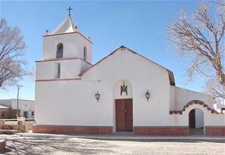
Chapel at Cienaguillas Source
Final section into La Quiaca
The road now runs relatively level, at an elevation of 3.670 m; at km 414 it reaches Cienaguillas:
Cienaguillas
779 residents (2009). Map with location.
The name means "small bogs" in Spanish. Its residents breed llamas. There is a police station, school and border patrol squadron. It was designated as a "Village that protects Vicuña" in 2002. Visit its pictouresque chapel.
Ahead lies a winding section known as "Taquero Slope" (cuesta del Taquero) with a maximum height of 3.700 m.
The slope is less than one kilometer south of the Argentine - Bolivian border which runs parallel to Ruta 40, north of it. The road continues east and reaches Tafna.
Tafna
Tafna (Map showing Location). Elev. 3.600 m. School and Register Office.
Tafna Church
Built in the early 1700s and refurbished in the 1800s it has two steeples and an unpainted mud plaster. Simple and austere. Don't miss the painting of el Señor de los Temblores (Taitacha Temblores), the "Lord of the earthquakes", which is said to placate them.
Tafna Archeological Site
With ceramic from the first settlers.
The road runs straight through the Pueblo Viejo (km 435) a name that means "old town" and is used to designate pre-Hispanic sites.
End Point of Ruta 40: La Quiaca
Ruta 40 descends gradually and at km 448 it reaches the End Point of Ruta 40, La Quiaca.
It enters the city along Paraguay avenue and, at the roundabout on Ruta Nacional 9, at an altitude of 3.460 meters, at 22°06’28"S, 65°35’58"W is the "end of the road".
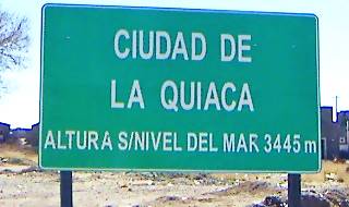
Road Sign at "La Quiaca".
A. Whittall
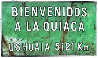
An amazing road sign: distance from La Quiaca and Ushuaia.
A. Whittall
The End of Ruta 40
This is the end point of the longest highway in Argentina, it comes to its end after covering 5.144 km from Cabo Vírgenes [our Spanish language webpage].
This is the end of this section and of the whole of Ruta 40.
Maps of the Area
Other maps of the area and Ruta 40
- Plan of La Quiaca
- Plan of Yavi
- Salinas Grandes map
- Quebrada de Humahuaca map
- Purmarmarca and Cerro de los Siete Colores map
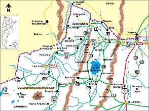
Map of this Section #16
>> Interactive Map of Ruta 40 in Jujuy, and Interactive Map of Ruta 40 in Salta.
Map showing Ruta 40 from San Antonio de los Cobres to La Quiaca via Ruta 40
Tips and Advice for visiting the Region
1. Weather in the Puna
The Puna highland has an extremely dry climate with very low relative humidity (averages less than 47%): keep hydrated.
Rain is very scarce: some 300 - 400 mm (12 - 16 in.) yearly which mostly falls during summer. Dry and suny weather the rest of the year.
The low humidity and the high altitude (over 3,500 m - 11,500 ft) make the atmosphere very clear: protecte yourself from the sun's UV radiation with a high SPF sunscreen and wear a hat.
Wind is persistent and stronger in the afternoon. There is a great temperature difference between day and night (around 18°C or 32.4°F). Nights are cold, even in summer.
During the winter the temperature is well below freezing point.
2. When to Drive Section #16
Best during the dry season, from April to November.
3. Altitude and Mountain Sickness
When you move above 2.000 meters (6,500 ft) you may experience the unpleasant symptoms caused by the lack of oxygen. This is a condition known as Altitude Sickness, and locally as "Soroche" or "Apunamiento".
The low atmospheric pressure means that there are fewer molecules of oxygen to breathe in each breath you take. for instance, at 5.000 meters altitude (16,400 ft), there is only 50% of the sea level oxygen content.
This lack of oxygen causes nausea, headache, dizzyness, fatigue and confusion.
Read more about how to reduce the impact of Altitude Sickness
4. Safety Tips
This is a difficult road because it combines gravel, mountain driving, extreme altitudes and the tough Puna weather. To make matters worse the area has no big towns to provide assistance. There are villages scattered along the highway with basic services.
You should verify the road conditions with the locals before attempting drive this leg of Ruta 40.
You should be well adapted to the high altitude conditions.
Fords, dry river beds and summer rain
There are many "dry" river beds that cut across the highway in this section, these are dry for most of the year but during the summer rainy season can flood suddenly.
Road Conditions
Check the road conditions on our website: Road Conditions.
Important Tips
- Keep your gas tank full (below we list the gas stations). Top it up before setting out and whenever you can. There are few service stations in the area, and they may have run out of fuel.
- Take food and water with you. Carry a paper map -don't rely on cellphone signal being available in the Puna.
- During the summer rainy season there may be road closures on Ruta 40 and Rutas 9, 51 and 52
- Cross the fords carefully especially during the summer flash flood season.
- This is a high altitude journey so factor in that you may suffer from Altitude Sickness.
- Wear apropriate clothes for the area (warm). Pack a blanket in case you have to spend the night out in the wilderness. Even in summer it can get very cold at night (large day to night temperature swings).
Loose Gravel. Drive carefully on the gravel, it is slippery, you can skid, the dust may impair visibility, passing vehicles may fling stones at your windshield (cracking, chipping or even breaking it. Take extra insurance when you rent a car).
There are service stations at San Antonio de los Cobres, Susques, Purmamarca, La Quiaca and Paso de Jama, Humahuaca, Salta.
›› Location of Ruta 40's Service Stations
Hotels in the final leg of Ruta40
Book your Room
>> Find your accommodation in La Quiaca
Along Ruta 40 in Jujuy
Jujuy, close to la Ruta 40
>> Book your hotel in Jujuy Province
Road Trip Journeys
Liniers 440, B1602 Florida Buenos Aires, Argentina
www.turismoruta40.com.ar
E-mail: info@turismoruta40.com.ar
Copyright © 2009 - 2025 TurismoRuta40.com.ar
TurismoRuta40
Ruta 40 (Argentina) Online Travel Guide: Information on accommodation, sights, attractions and destinations. Itineraries, tours and resources for planning your Route 40 Road Trip.
Updated V.21

