In the empty steppe
Ruta 40 in the vastness of Patagonia
In this leg, the alignment of Ruta 40 runs far to the east of the mighty Andean peaks, lakes and forests.
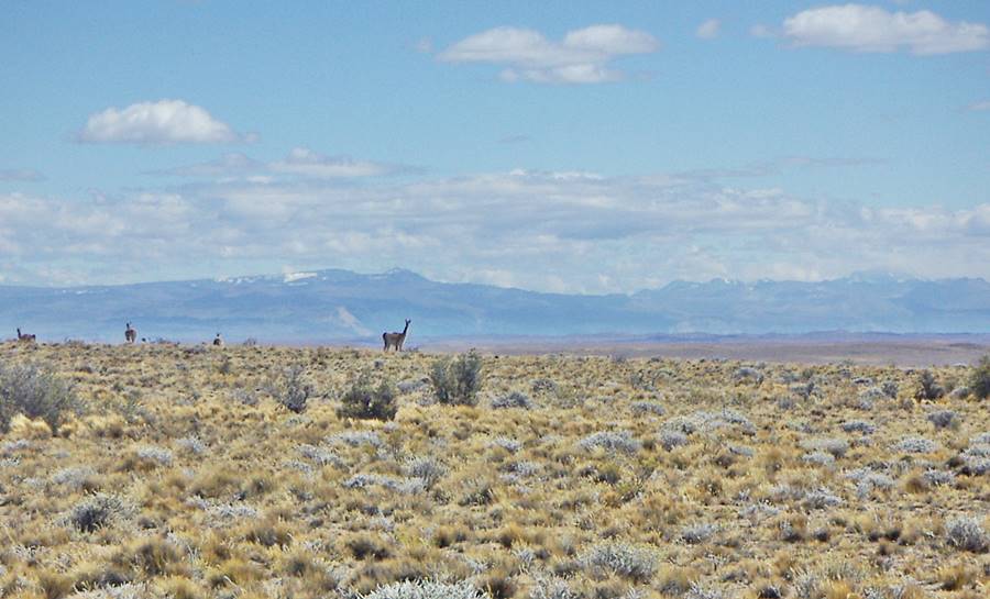
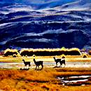
It crosses the steppe, passing next to the windswept Lake Cardiel, then it runs along Rio Chico River Valley following the ancient Indian "traces" across the desolate plateau where an occasional ñandu (South American rhea, a relative of the African ostrich) or a herd of guanaco graze on the dry shrubs.
It is almost completely paved, save for a gravel segment along lake Cardiel.
It is the gateway to the magnificent (least visited of Argentina's national parks) , Parque Nacional Perito Moreno National Park, with glaciers, turquoise lakes and the Andean forests.
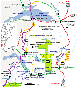
It runs close to the brand new Patagonia National Park with basaltic outcrops and the Monte Zeballos scenic highway, lakes San Martín and Pueyrredón, and also the UNESCO World Heritage Site of Cueva de Las Manos.
A Patagonian ostrich, or rhea, in the Valley of the río Pinturas near Cueva de las Manos:
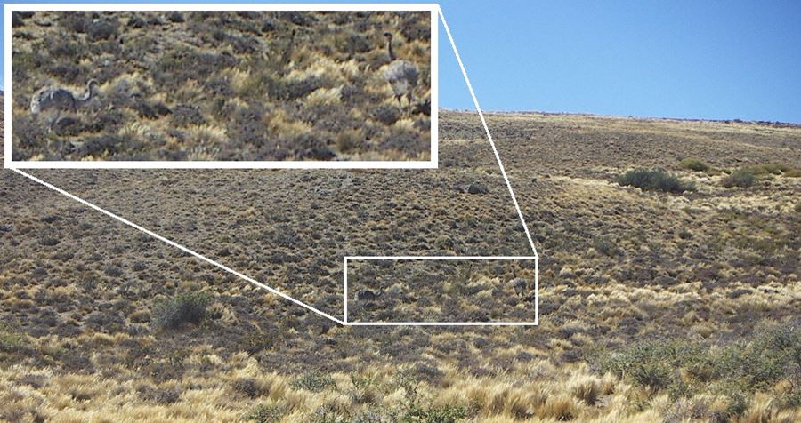
Rhea or Ñandú
The rheas are large flightless birds native to Southern South America which are related to the African ostrich and the Australian emu.
The Patagonian species R. p. pennata can weigh up to 40 kg (88 lb) and is 90 cm (35 in) tall at the back. They run and use their wings as sails.
The native Mapuches of Northern Patagonia called them "choique", the Aonikenk of Southern Patagonia: "Oóiu".
Ruta 40 in the Steppe
4th Section
Map of this Section
>> Interactive Map of Ruta 40 in Santa Cruz
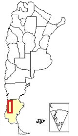
Section 4 is located in southern Argentina,
see red box at the bottom of this map
Map of the segment from Tres Lagos to Perito Moreno: Google map.
This is an image format: Map of Central and Northern Santa Cruz.
Other maps of the area:
Description of the itinerary: Section 4
This leg of Ruta 40 runs across a very empty and remote part of Patagonia between the small town of Tres Lagos and the town of Perito Moreno. There is only one town on the alignment (Gobernador Gregores) and a small hamlet with some very basic services (Bajo Caracoles). There are no other towns along the way.
Until very recently this road was a tough gravel surfaced highway.
It will give you a real taste of the "genuine" Patagonia, with its strong and permanent wind and its plateaus, known as "Mesetas covered with basaltic flows and glacial gravel.
Tough low lying shrubs adapted to the arid conditions brave the wind and are the staple diet of the ñandú and small herds of guanaco that live in the solitary steppe.
This leg is 519 km long (323 mi.) Almost totally paved, except for a gravel stretch 72 km long between km 860 some 40 km north of orte de Tres Lagos y km 932 Cruce Lago Cardiel.
Paved and gravel Surfaced
As of 07 August 2025/p>
- Gravel, there is a gravel section 72 km long from a point 40 km north of Tres Lagos to Lago Cardiel junction which is being paved. Completion day uncertain.
- Paved The remainder of this leg is paved.
Elevation along this section
- 232 m. 761 ft. at its starting point in Tres Lagos [see our Spanish language webpage].
- 385 m. 1,263 ft. at its end point: Perito Moreno [see our Spanish language webpage].
Maximum elevation on this segment
797 m. Maximum Height: 2,615 ft. between Las Horquetas and Bajo Caracoles.
Gravel and Paved sections of Ruta 40
This section is paved.
Learn all about which parts of Ruta 40 are not yet paved:
Tres Lagos
Tres Lagos is a small town with very basic services for the traveller, it has a service station.
Ruta 40 south of Tres Lagos is the gateway to the village of El Chaltén and the city of El Calafate [see our Spanish language webpages].
You can also use it as a base to visit Lake San Martín, in the Andes, on the Chilean border:
Side Trip to visit Lago San Martín
For a detailed itinerary visit Excursion to Lake San Martín [our Spanish language webpage]
Lake San Martín, the Andes meet the steppe:
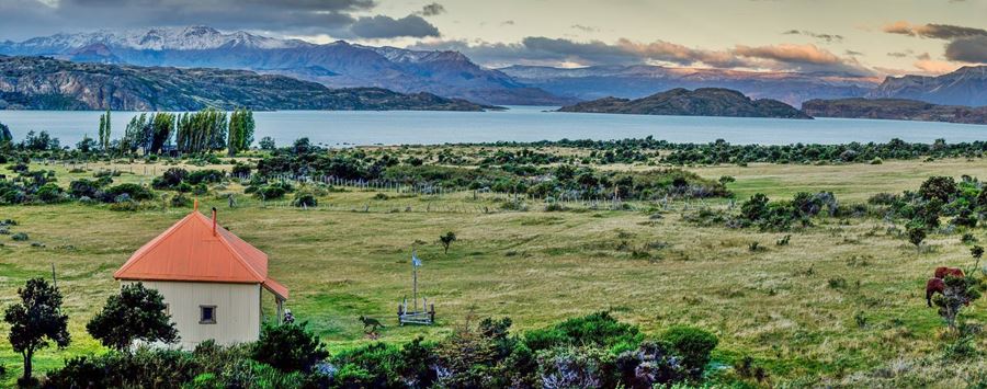
Ruta 40 South towards El Chaltén and El Calafate
We describe Ruta 40 south of Tres Lagos in our Section Tres Lagos to Río Turbio page.
Leaving de Tres Lagos
Important. Fill up your gas tank before leaving town and top it up whenever you find a service station.
Tres Lagos
Full details on the town of > > Tres Lagos [our Spanish language webpage]
We describe this segment of the highway from South to North. Leave the village of Tres Lagos (km 0 del tramo) heading east. Just km 1,5 ahead the road forks. Ruta Nacioinal 288 continues straight, towards the Atlantic Ocean and Ruta 40 heads north (Left).
Towards Lake Cardiel
The distance to the next town of Gobernador Gregores is 173 km. There is only one gravel surfaced section 72 km long leading up to "Cruce Cardiel" junction the rest of this leg is completely paved.
Map showing the gravel segment.
Ruta 40 heads north following the slopes of Sierr del Bagual (to your right) and passing by a small lake, laguna La Cantera. At km 40 the gravel begins.
This is the "real" Patagonia, solitary, desolate, empty. At km 53, an "estancia" (Spanish for ranch, and in Patagonia, a sheep farm. This estancia, La Lucía, has a camping area.
The road heads north and then turns towards the northeast.
Lake Cardiel
Ruta 40 reaches the lake and runs along its eastern shore. At km 104 junction on the right with dirt surfaced Ruta Provincial 73.
Towards the west lies the vast basin of the lake lago Cardiel. Ruta 40 will run along its shore for the next 30 km.
Lake Cardiel - description
It is shaped like a heart with a diameter of 20 km (12.5 mi); its surface area is 370 km2, 145 sq.mi. It is shallow: only 76 m deep (250 ft.)
It was named after a Jesuit missionary who explored the area in the late 1700s.
It is set in the Patagonian plateau in a volcanic area, and is fed by the Cardiel River, a permanent course of water in the arid steppe.
Scenery at lake Cardiel, an ancient volcanic neck or chimney:
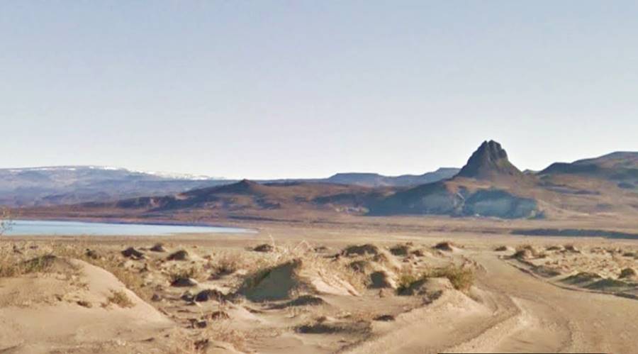
Volcanic necks form when the soft cinder cone of a volcano is eroded and all that remains is the harder lava flow that solidified inside its chimney.
Unlike the great Andean lakes, it was not formed by the Ice Ages glaciers. Although the area is volcanic, it isn't a crater either. It formed in a tectonic depression, a deep basin in the Earth's surface.
Though its coast is barren and windswept, its slightly alkaline waters are home to magnificent fish (rainbow and brook trout), making it a great fishing spot.
Lodging in the estancias at Lake Cardiel
There are several estancias scattered around the lake where you can book a room.
"Cruce Cardiel" Junction
Ruta 40 and Ruta Provincial 29 and the Río Chico River Valley
At km 115 Ruta 40 reaches a junction and crossroad:
- Ahead, coming from the north, gravel surfaced Ruta Provincial 29. If you take it, you will reach Casa Riera on the Chico River (and Ruta 40), bypassing the town of Gobernador Gregores.
- To the left, Ruta 29 heads towards Lake Cardiel (12 km away), and runs along its northern shore.
- To the right, Ruta 40 heads east, and the paved surface begins, towards Gobernador Gregores.
There are no other gravel segments north of this point in the rest of Patagonia, only in southern Mendoza province will you reach another gravel surfaced segment.
Alternate route: North along Ruta Provincial 29 ("old" Ruta 40)
Alternative gravel road, without fuel or services (only at the estancias will you find support).
This is the original (or "old" Ruta 40) which took a shorter course and bypassed Gobernador Gregores. It heades due north to Rio Chico River which it met at Casa Riera.
"New" paved Ruta 40 from Cruce Cardiel to Gobernador Gregores
La ruta 40 takes a longer course than the "old" road: it follows a wide arch towards the east, and then returns west meeting the older alignment at Casa Riera.
It is 62 km from Cruce Cardiel to the town of Gobernador Gregores. At km 263, junction, Ruta 40 heads north. Four km east is the junction with the paved Ruta Provincial 27 which links Gobernador Gregores with the Atlantic coastline. At km 173 is Gobernador Gregores.
Gobernador Gregores
This town offers the traveler all the necessary services (fuel, lodging, stores, hospital, police, mechanic shops). It is located by an island on the Chico (Spanish for "small") River.
Gobernador Gregores
Full information on > > Gobernador Gregores [see our Spanish language webpage].
>> Book your hotel in Gobernador Gregores
Volcanic chimney near Gobernador Gregores:
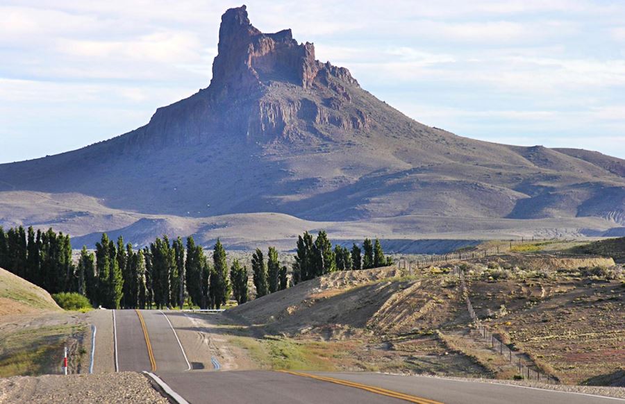
Cerro Ventana or "Window Hill"
This volcanic "neck" is located 38 km south of Gob. Gregores. It has a "window" on its summit, hence its name.
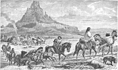
It was mentioned by British explorer George Musters in 1869 as "Window Hill and also by its native Tehuelche name: Mowaish (o Mawaish), of unknown meaning.
The image shows the engraving published in Musters' book and the party of Tehuelche people he rode with across Patagonia, from Puerto Santa Cruz to Carmen de Patagones.
Northwards along the río Chico River
Fill your gasoline tank in Gobernador Gregores (Last Chance!) and head west along Ruta 40 (km 167). The paved road passes by the estancia La Primitiva (left) km 178.
Then it describes a long curve towards the north following the winding valley of the Chico River. It runs along the top of the valley's rim, in the steppe crossing the "Meseta" or plateau.
At km 211 is the Estancia Santa Thelma (right) with tourist accommodation.
Casa Riera
This is where Ruta Provincial 29 coming from the south (the "old" Ruta 40") meets the "new" alignment.
Ruta 40 descends the valley's slope approaching the Chico River and meets Ruta Prov. 29. There are nice views of the river and Ruta Prov. 29's bridge across it. Head west along Ruta 40.
At km 253 estancia Silvina to your right, at the foot of the valley's steep slope. Ruta 40 continues with a westerly course, with the Tamel Aike "mesta" to your right, and it reaches the estancia Tamel Aike (km 267), also to your right.
Las Horquetas
Ruta 40 follows the base of the plateau, curving around a hill, cerro Las Horquetas (963 m - 3,157 ft.) to reach the spot known as Las Horquetas at km 283.
Here is the Countryside Hotel and Spa which repurposed the original stone building which in the past (early 1900s) was an inn and pub frequented by traveling salesmen and local ranch hands.
Ruta 40 turns towards the north, and here (km 288) is a crossroads with two provincial highways:
- Ruta Provincial 37, which heads towards the northeast and is the access road to the Parque Nacional Perito Moreno, a National Park. It is a gravel road.
- Ruta Provincial 35, which follows the río Chico River towards the southwest, passing by Tucu Tucu and reaching a border crossing into Chile (very bad gravel road).
At the crossroads, turn right and continue along the paved Ruta 40, which now heads north towards Río Olnie, the small hamlet of Bajo Caracoles and the town of Perito Moreno.
Excursions to the Andes, forests and solitary lakes
There are two options for the adventure seekers, who should set out on them with a good supply of gasoline (that means extra fuel in jerrycans because there are no service stations on either of these side trips). You should also have a vehicle that can handle mud and gravel surfaced roads (a Four-wheel-drive vehicle will do fine).
- Río Mayer and Tucu-Tucu: Lake Quiroga, Río Capitán and Paso Mayer border crossing.
- Parque Nacional Perito Moreno National Park
Both pages mentioned above, are from our Spanish language website.
Tucu-Tucu and Río Mayer River
The Tucu-Tucu is a rodent in the family Ctenomyidae which is endemic to Argentina, it weighs around half a pound (200g) it lives in caves it digs into the ground.
The Andes in Tucu-Tucu:
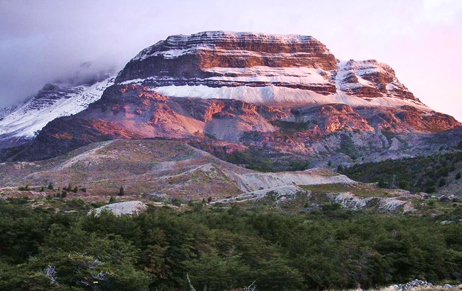
Perito Moreno National Park
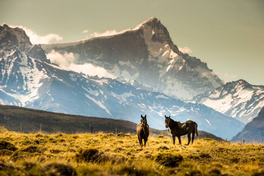
Patagonia's least visited National Park, it covers an area of 115,000 ha (444 sq. mi.) with turquoise lakes, glaciers, forests, steppe, grasslands at the foot of the Andes.
Lake Belgrano with its sky-blue water:
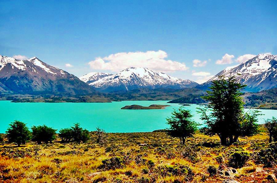
The image above depicts the Estancia Menelik which is a cattle ranch. It is located in the Belgrano River Valley and was established in the early 1900s by a German pioneer, Johan Broedner.
Some photos of the Perito Moreno National Park
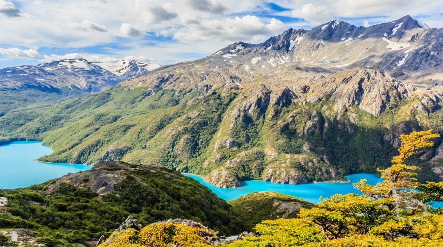
Lakes in the National Park:
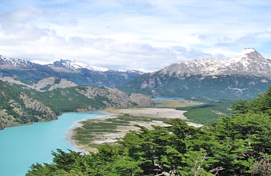
Lake Nansen in the Perito Moreno National Park:
"Perito" Moreno
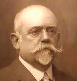
Francisco Pascasio Moreno
Francisco Pascasio Moreno was born in Buenos Aires in 1852. He was an explorer and scientist who in the 1870s ventured into the until then unknown reaches of Patagonia.
He crossed Northern Patagonia from the coast, reaching what are now Bariloche, Cholila and Esquel. He was captured by the natives and escaped death by braving the Limay River rapids on a raft.
He explored Southern Patagonia: Santa Cruz, La Leona and Shalia Rivers, lakes Argentino, Viedma and San Martín.
He served as the Head of the Argentine Border Demarcation Committee, which settled in an amicable and peaceful manner the border dispute between both countries. His position here, as an expert ("Perito" in Spanish), is the origin of the prefix attached to his name.
He helped the native people return to Patagonia and re-settle there after the military campaigns in 1879-83 that had dislodged them.
He donated land ceded to him by the Federal Government, as a reward for his services as a "Perito", deeding it towards the creation of Argentina's first national park (Nowadays the "Nahuel Huapi National Park").
Later he was elected as a Representative (Diputado) in the National Congress' House of Representatives. Passing away in 1919.
The National Park close to Ruta 40, a lake near the city of Bariloche, the town which marks the end of this section of Ruta 40, and the famous Perito Moreno Glacier are all named after him.
From Las Horquetas to Bajo Caracoles
The road runs along a flat area, and is straight. It meets gravel surfaced Ruta Prov. 79, on the right (km 331). At km 340 some gullies. The highway descends into the Valley of the río Olnie River. Here once stood the old "Hotel El Olnie", another roadside inn. Ahead, next to the river at km 363 is the entrance to the estancia La Irenita (right).
Río Olnie River
This is a word from the original native people of this area, the Tehuelche nation. It means: orr: "Corner" y nie: "Point", which means "The pointed corner", after the "V" shaped area formed at the confluence of two rivers.
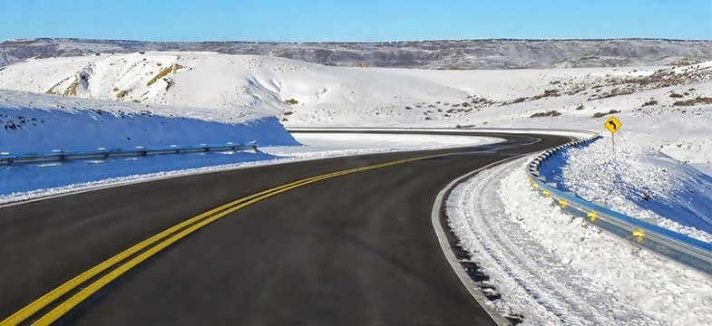
Now comes the final leg that at km 389 leads to the place known as Bajo Caracoles at the junction with Provincial Highway 39:
Bajo Caracoles
Consists of a few scattered homes and it has lodging, gasoline and minimum services for the traveler.
Bajo Caracoles
Complete information on > > Bajo Caracoles [see our Spanish language webpage].
Excursions from Bajo Caracoles
The Andes: Lakes Posadas, Pueyrredón & Mount San Lorenzo
From Bajo Caracoles you can reach the Andes along gravel surfaced Ruta Provincial 39. You can read more about the attractions there in our Spanish language webpages:
- Lakes Pueyrredón and Posadas
- Provincial Monte San Lorenzo Natural Reserve
- The small village of Hipólito Yrigoyen - Lago Posadas.
Lago Posadas - H. Yrigoyen
Full details > > H. Yrigoyen - Lago Posadas [see our Spanish language webpage].
>> Find your hotel in Lago Posadas
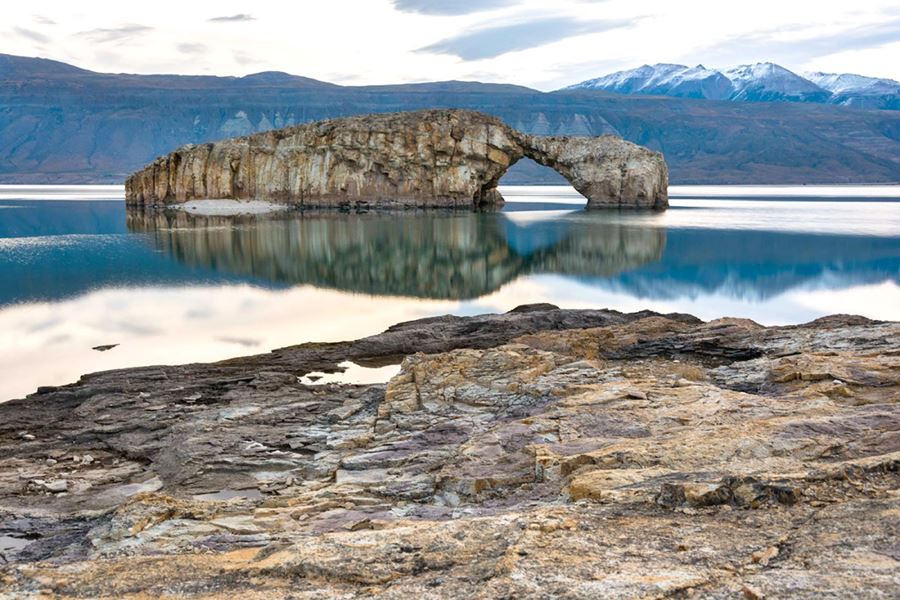
The rock arch on the island of Lago Posads:
Los Antiguos and Mt. Zeballos Scenic Highway
To the Northwest, along the Chilean border:
- The brand new Parque Nacional Patagonia a national park on the Lago Buenos Aires "meseta" (a basaltic plateau)
- The scenic road along Monte Zeballos between Paso Roballos border crossing and the town of Los Antiguos on the coast of Lago Buenos Aires
Mt. Zeballos Scenic Hwy: The highest Road in Patagonia
The scenic road of Monte Zeballos, Ruta Provincial 41, reaches an elevation of 1.500 m (4,920 ft.) at "El Portezuelo" making it the highest road in Patagonia.
It goes through three ecological zones: the steppe, the forest and the high Andean tundra.
Learn all about the Monte Zeballos Scenic Highway.
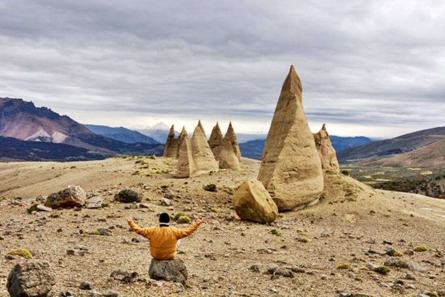
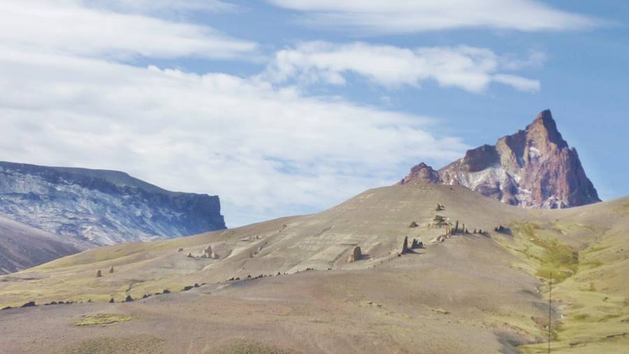
Back to Bajo Caracoles. From here, heading east is the remarkable Cueva de las Manos cave:
Visiting the Cueva de las Manos
UNESCO World Heritage Site
La Cueva de las Manos
We have an English language webpage dedicated exclusively to the "Cueva de las Manos": its history, the Paleoindians that painted it and more...
UNESCO World Heritage Site
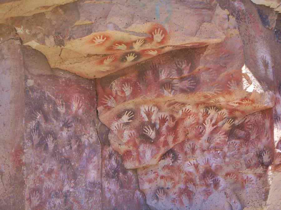
The "Cueva de la Manos" (In Spanish, it means "The Cave of the Hands") is an archeological site that protects an ensamble of prehistoric rock art.
The main figures are stencilled hands painted on the walls of a cliff, some 13.000 to 9.500 years ago. The cave's name is due to these "hands".
How to get to the Cueva de las Manos?
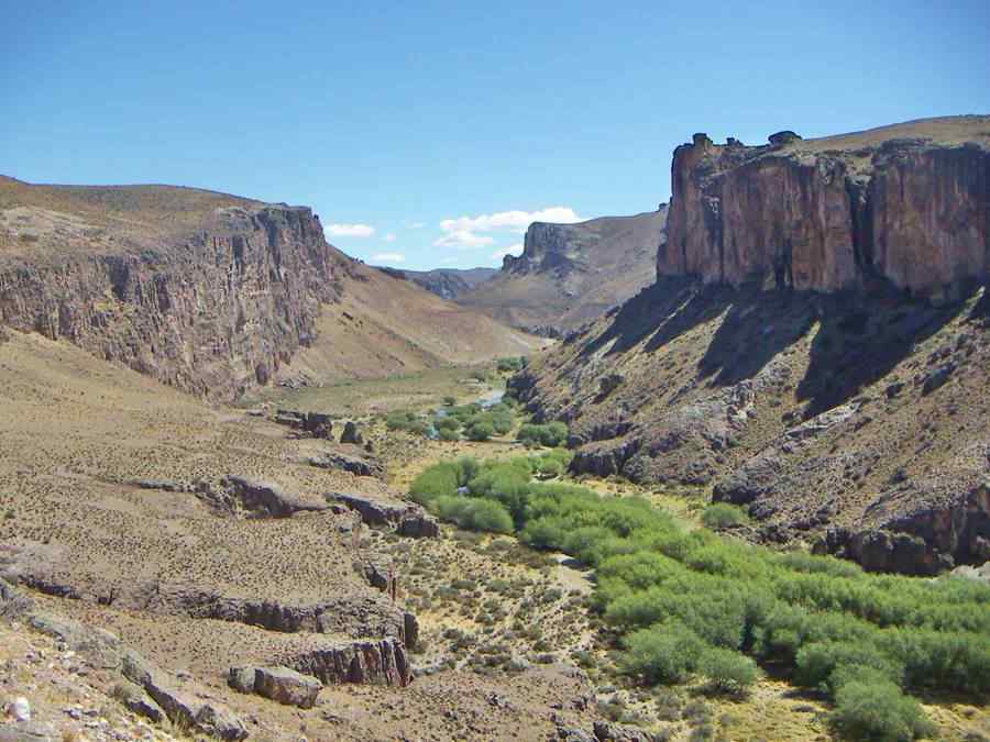
Leave Bajo Caracoles along Ruta 40 and then take (right) gravel surfaced Ruta Provincial 97 which leads you along the west side of the Pinturas River (Pinturas means "paints" in Spanish). After 11 km you will glimpse a volcanic hill, Cerro Poivre, to the left. After another 38 km a sharp curve begins the descent (120 m) into the canyon of the Pinturas River, this is a winding cliff-hanging road. After 1.5 km you reach the Site's entrance. With museum, cafe and toilets. Buy your entrance ticket here.
Valley of the río Pinturas seen from the Cueva de las Manos:
The final leg into Perito Moreno
Head north (fill up your gas tank) from Bajo Caracoles along Ruta 40 km 392 fork of Ruta Prov. 97 to the Cueva de las Manos, keep left along Ruta 40.
At km 406 junction with Ruta Provincial 41 which heads west (left) to Paso Internacional Roballos a border crossing into Chile, lago Ghio and the Mount Zeballos Scenic Highway. It is a gravel road.
To your right is the road into Estancia Caracoles.
The Ruta 40 climbs the side of the plateau and at km 433 passes by Estancia La Criolla. At the Ecker River, to your right at km 436 is a camping spot at estancia Casa de Piedra.
Ruta 40 enters the abrupt volcanic eastern edge of the Meseta del Lago Buenos Aires:
Meseta del Lago Buenos Aires
This "meseta" or plateau is one of the largest (6,000 km2 - 2,320 sq.mi.) and voluminous (ca. 2,000 km3 - 480 cu. mi.) basaltic plateaus in Central Patagonia. Its first lava flows date to 14 Million years ago.
It was eroded by the glaciers during the Ice Ages.
Ruta 40 runs along its eastern side. It lies south of the great Lake Buenos Aires and west of the Mt. Zeballos Scenic Hwy.
The Parque Nacional Patagonia national park is located on the meseta:
Parque Nacional Patagonia
Peter Buckley, Kristine McDivitt Tompkins and her late husband, Douglas Tompkins purchased land on the Meseta and donated it to the Argentine government, for the creation of a National Park.
It protects lagoons and small wetlands on the palteau that are bird sanctuaries for some species such as the Macá Tobiano, which is on the verge of extinction.
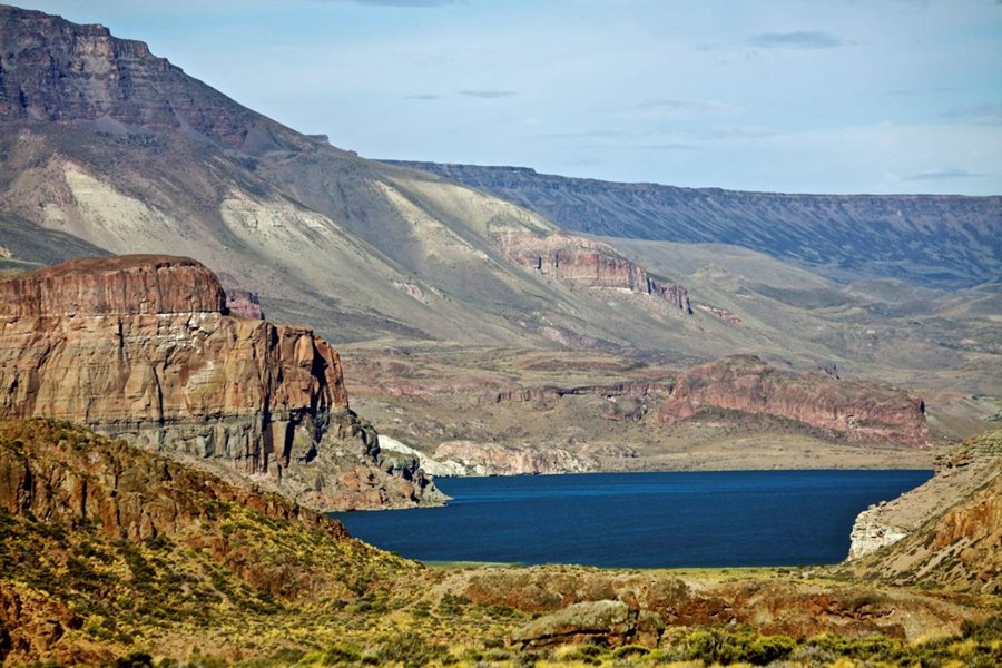
The basaltic plateau of Lago Buenos Aires lake, and a lagoon in the Patagonia National Park:
At km 462 access road to the Hostería Cueva de las Manos a tourist estancia with accommodation:
>> Find your hotel in the Cueva de las Manos
Ahead the highway crosses arroyo Feo ("Ugly creek") and after crossing arroyo Telken stream, to your left is estancia La Paloma (km 480).
Ruta 40 passes nexst to the tourist estancia Telken km 490 (right) and after crossing the arroyo Page bbrook, to your right is the Cerro Volcán volcano, elev. 666 m - 2,184 ft.
The road descends into the valley of the río Fénix (Phoenix River) and reaches the outskirts of Perito Moreno, km 517 entering the town. The downtown area marks the end point of this section, km 519.
Perito Moreno
Perito Moreno is a locally relevant town, and it has all that a tourist may need: hotels, restaurants, gas stations, shops and stores, airport and hospital.
Perito Moreno
Learn all about > >Perito Moreno [see our Spanish language webpage].
>> Find your hotel in Perito Moreno
Tips and Advice for a Safe Journey
1. Weather: Patagonia's relentless weather
This area has a low average annual temperature, which is warmer in the northern part of the segment (low altitude and proximity to the large lake Buenos Aires).
The climate is drym windy and arid. Roughly 260 mm of rain falls each year (10.2 in.), snow can fall on the plateau far from the Andes in winter.
Summer is cool, winter is cold with frost and snow. Highs in summer are around 25°C; (77°F), nights are cool during summer.
Winter days average 1,5°C (35°F), and nights are cold.
Clouds, wind chill factor and the cold weather mean that it can get pretty cold quickly even in summer, and specially in the Andean foothills and at higher altitudes close to the Chilean border. So carry warm clothes with you at all times.
Wind is strong, it blows from the west and gusts can be bothersome while driving on the open steppe.
2. When to visit the region
Summer, late spring and early Fall (autumn) are ideal, the weather is warmer, the days are longer (due to their southern latitude). So visit the area between November and April. You can also visit the region during winter, the low season, but snow may block some roads in the Andean area, it is colder and ice - snow can be bothersome.
3. Safety Tips
Very Important: Fill your gas tank before leaving Tres Lagos, top it up in Gobernador Gregores and Bajo Caracoles.
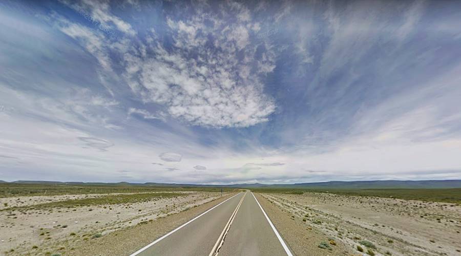
Ruta 40 crosses the steppe where the "Estancias" are the only source of assistance in case of emergencies. Bajo Caracoles is a tiny hamlet but Gobernador Gregores is a larger town that can provide all the services you may need.
Pay attention when you drive (Guanaco and the South American ostrich, the ñandú live in this area) for animals on the highway and sudden gusts of wind.
During winter iced spots can be risky.
This section has only one unpaved segment, so be careful when driving on the gravel road surface.
Road Conditions
Check out our website to learn about the current: Road Conditions along Ruta 40.
Important Tips
- Fill up the gas tank whenever you get the chance to do so.
- Carry food and water with you.
- Carry warm clothes, jacket, pullover. Even in summer.
- Find out about the road conditions before venturing into the Andes.
- Excursions to Rio Mayer, Perito Moreno National Park requires extra fuel for the return trip, there are no service stations to fill up along the way.
There is fuel in El Chaltén, Tres Lagos, Gobernador Gregores, Perito Moreno, Los Antiguos, Bajo Caracoles and Hipólito Yrigoyen.
›› Location of Ruta 40's Service Stations
Accommodation in Santa Cruz
Find your hotel along Ruta 40 in the province. Cities listed from north to south:
>> Lodging in Perito Moreno
Hotels along Ruta 40 in Santa Cruz
>> Find your room in Santa Cruz province

