Into the Glaciers
Ruta 40 in SW Santa Cruz Province
This section Argentina's Ruta 40 is completely paved, and it runs along the steppe, the foothills of
the Andes and the eastern shores of two of Patagonia's largest lakes: Viedma and Argentino.
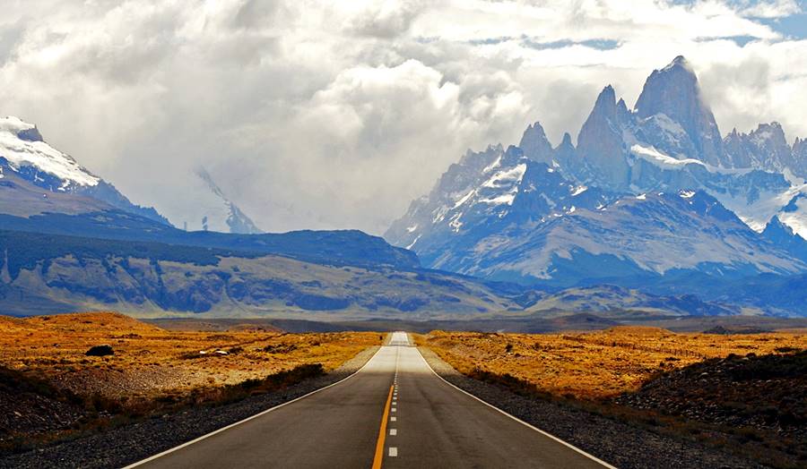
Ruta 40 is the access to the town of El Calafate from where you can visit the Perito Moreno Glacier and El Chalteén which lies at the foot of the mighty granite needles of Mount Fitz Roy.
Ruta 40 by the Andes, lakes and glaciers
3nd Leg
Map of this Segment
>> Interactive Map of Ruta 40 in Santa Cruz
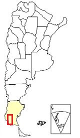
Section 3 is located in southern Argentina,
see red box at the bottom of this map
Map of the segment of Ruta 40 that links Río Turbio with Tres Lagos
See this Map of the section.
Other maps of this area and of the province of Santa Cruz in Argentina
Description of the itinerary: Section 3
The road runs along the Patagonian steppe, which in the southern part is greener than in its northern part. It heads north parallel to the Argentine-Chilean border for a while, then heads east to bypass the Andean foothills south of Lago Argentino. It turns north again crossing the Santa Cruz river -outlet of that lake and La Leona River, the outlet of Lake Viedma.
It coasts along the arid eastern tips of both lakes.
You can use it to visit The Chilean National Park of Torres del Paine and Argentina's Parque Nacional Los Glaciares National Park.
Elevation of this segment
- 328 m. (1,075 ft) at its starting point in Río Turbio [see our Spanish language webpage]
- 232 m. (761 ft)At the end of the segment in Tres Lagos [see our Spanish language webpage]
Highest Point of this leg
818 m (2,682 feet) at the beginning of the steep and winding Cuesta de Miguez ( Miguez' slope) at km 261.
Gravel and Paved sections of Ruta 40
This section is paved.
Learn all about which parts of Ruta 40 are not yet paved:
Leaving Río Turbio
Important. Don't forget to fill up your gasoline tank before leaving Rio Turbio, top it up whenever you get the chance to do so. It is a long journey with few places to stop and load gasoline.
>> Book your hotel in Río Turbio
We describe this leg from South to North. Leave Rio Turbio (km 0 of this section) and head east. At km 7,5, you will reach the hamlet of Julia Dufour (Campamento Dorotea) where the access road from Rio Turbio meets Ruta 40.
Towards the right (south) is the Section from Río Turbio to Río Gallegos (Section 2).
Turn left, nortbound towards El Calafate.
Westernmost Point of Ruta 40
Just 3.300 meters north of the junction of Ruta 40 with the access road into Río Turbio está is the westernmost point of the whole Ruta 40.
This is a map showing where it is located.
Its coordinates are 72° 15' 57.4" W (Long) y 51° 31' 28.4" S (Lat)
Other extreme points of Ruta 40
Northernmost and Easternmost points coincide in the end point of the highway, in the town of La Quiaca, Jujuy [see our Spanish language webpage].
The Southernmost point is at Cabo Vírgenes, Santa Cruz [see our Spanish language webpage].
The highway runs more or less parallel to the Chilean - Argentine boreder which is located to the west, beyond the hills. To the east is the Cordillera Chica range. The road follows the valley of the río Turbio River and passes next to the Estancia La Primavera ("Estancia" is Spanish for ranch, and in Patagonia the estancias are basically sheep farms).
Just ahead the Ruta 40 crosses the Río Turbio River. At km 35 Estancia Tres Marías, and bridge across the río Guillermo River. At km 40 a fork to the left which leads to a border crossing into Chile.
Side Trip into Chile
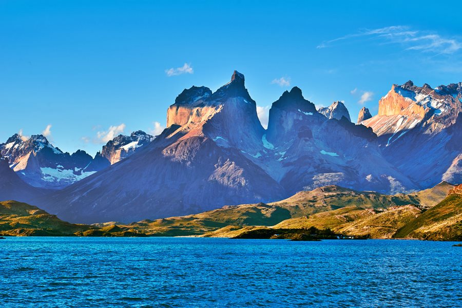
Parque Nacional Torres del Paine National Park
The road at the for runs to the Río Don Guillermo (or Cancha Carrera) border crossing, which is only 6 km west along a good surfaced gravel road. It heads towards the Chilean National Park of Torres del Paine, the crossing is open from 9:00 to 23:00 hs. Make sure you have all the necessary documents to cross the border.
The Torres del Paine national Park protects a region which includes the Andean sub-Antarctic forest and the steppe that surrounds the Paine Massif.
The Paine mountains have several summits, and Paine Grande is the highest (3.050 m - 10,754 ft). It is a block of gray granite covering an area of 400 km2 that is isolated from the main Adean Cordillera which makes it seem even higher.
More information at the Torres del Paine National Park official English website.
Find your Hotel in Chile
>> Book your hotel in Puerto Natales and in the magnificent Torres del Paine
Continuing along Ruta 40 towards Tapi Aike
From the fork, the recently paved Ruta 40 heads towards the northeast. The older alignment, gravel surfaced runs further west.
The straight stretch ends at km 48 with an "S" shaped climb up to km 51. To the right is a small lake called Laguna La Esperanza it is the source of the Coig (or Coyle) River.
Coyle or Coig River
The river has two names which sound similar but have different origins:
- Coyle. Is a word from the native people who lived here, the Aonikenk or Austral Tehuelche. The meaning? Coy: "lagoon" y Le: "where there is", meaning "There is a lake there".
- Coig. Alessandro Malaspina led a Spanish expedition to map South America in 1789. His map shows a "Coig Bay" at the mouth of this river, which honors an officer of his squadron, Don Claudio Coig y Sansón.
The northern arm of the Coyle river has its sources here, in the Andean foothills at "Fuentes del Coyle" (laguna Esperanza) on the Vizcachas plateau. It is fed by the snowmelt and rainfall. This river crosses the province heading east flowing into the Atlantic Ocean. It is 350 km long. During hot and dry summers the river can dry up.
This point is 450 m above sea level. The road now heads east and descends. The acces to Estancia Fuentes del Coyle (Ruta Prov. 61) is located at km 67 with the old Inn of Fuentes del Coyle.
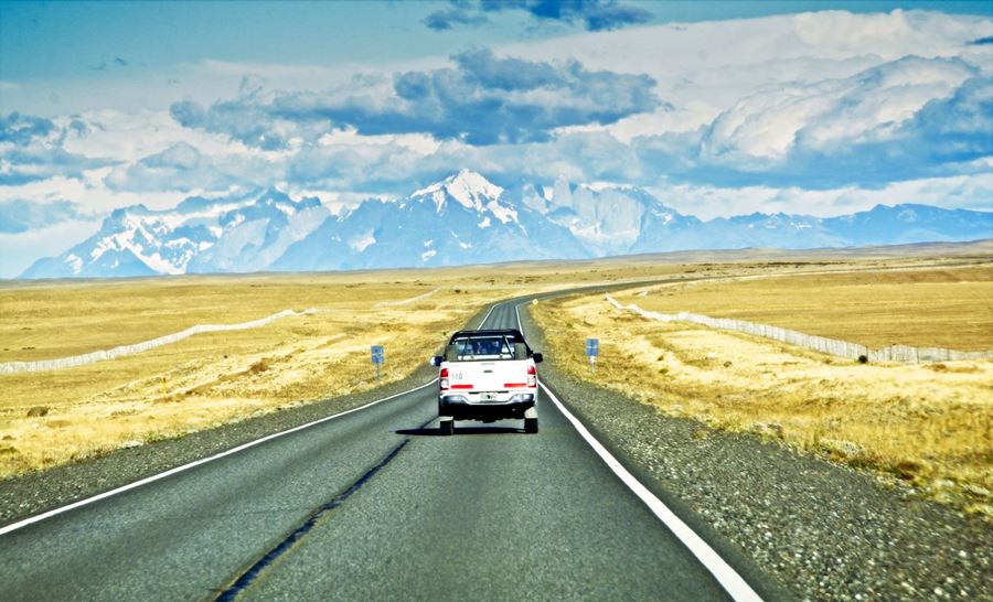
Towards the west you can see the old gravel alignment of Ruta 40 and if the weather is clear, the magnificent view of the granite peaks of the Paine massif almost 50 miles (80 km) away, see image below:
From Fuentes del Coyle (Spanish for "sources of the Coyle"), Ruta 40 takes an eastern course and reaches the crossing known as Tapi Aike:
Estancia Tapi Aike
Estancia Tapi Aike, (km 80) is a tourist estancia located on the Coig River at the junction of the "old" gravel alignment of 40. This alignment is on the north (left) side of the highway and meets the new one again, further north, close to "Cuesta de Miguez".
The new alignment is longer and continues east coasting the Coig (or Coyle) River to Esperanza where it turns north.
Tapi Aike was established in 1904 by von Heinz and Stubenrauch in a relatively high area with poor pastures on the plateau.
The name is ancient, an Aonikenk place name for the small brackish lagoon that is located there. The word means "kidney" perhaps it was a good hunting place for guanacos.
Along the Steppe towards La Esperanza
Leaving Tapi-Aike Ruta 40 follows the south shore of the Coig River. At km 99 access to Estancia La Lolita (right). At km 108 the highway is very close to the river.
At km 158 are a few scattered houses, the place is known as Paraje La Esperanza (Which in Spanish means "Hope"):
La Esperanza
Set at an elevation of 196 m it is placed at the crossroads of Ruta 40 and Ruta Provincial 5, the latter heads south and is paved all the way to Río Gallegos which is 146 km to the Southeast).
There is gasoline here (top up your tank) and basic services for the tourist: tire repair shop, café, restaurant, police station and a health center with an ambulance.
Tehuelche Community of Camusu Aike
It used to be a native reservation, now it is a community located 3 km from Ruta 40 and 28 km from La Esperanza. Only accessible during spring and summer along a gravel road.
It's Tehuelche language name means "place with waving grass", an old camping spot of the native people which became a reservatin in 1898. The last of the Aonikenk were confined there. It covers 30.000 ha. (116 sq.mi.)
From La Esperanza to lake Argentino
Head north out of La Esperanza along Ruta 40, cross the Coig River using the Siete Puentes (Seven Bridges). Two kilometers ahead the road forks towards the north is Ruta Provincial 2. Keep left along the paved road.
At km 178 To your left is an SOS post and the entrance to estancia Librún. At km 226 is the place known as El Cerrito (Spanish for hillock), here is the junction (to your left) with the "old" Ruta 40 coming from Tapi Aike. Road maintenance post.
The highway starts to climb gradually, first along the valley of the Pelque River (an Aonikenk name: Pelk, which became Pelke, meaning "axe").
Ruta 40 keeps on climbing and at km 254 to the left is the Laguna los Escarchados and the "old" Ruta 40 that heads north towards the Santa Cruz River.
Cuesta de Miguez (Miguez incline or slope)
The new paved road crosses a small hummock to reach its Maximum height in this leg: 818 m (2,682 feet)
Scenic Overlook: On a clear day you can see the Lago Argentino (the largest freshwater lake in Argentina and the fourth in South America) and behind it, the snowcapped peaks of the Andes.
The highway turns west and descends towards the Santa Cruz River (km 261) along "Cuesta de Miguez" (Miguez Slope).
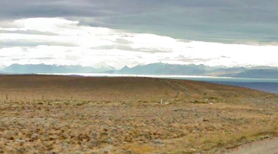
The slope is also known as "Cuesta de la Escarchada" (after the small lake) and it is sometimes spelled as "Migues" or "Miguens". It descends along the rather steep edge of the plateau that Ruta 40 has crossed since La Esperanza, and the bottom of the Santa Cruz River Valley.
The average height of the plateau is around 750 m.
The glaciers of the ice ages cut a gash across the plateau forming a valley roughly 25 to 30 km wide. The basaltic highlands continue on the north side of the valley.
The valley's steep slope and the plateau itself has remains of the morraines or stone rubble transported by the glaciers.
In the central part of the valley runs the Santa Cruz River with an elevation of 160 m. It is the outlet of the Argentino lake.
Ruta 40 drops from the 818 m at the summit of the "Cuesta de Miguez" to 240 m at the junction with Ruta Provincial 9 in a 14 km-long descent.
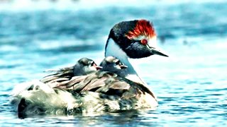
Macá Tobiano with two chicks on its back.
Source
Macá Tobiano
The Macá Tobiano (Podiceps gallardoi) or Hooded Grebe, is an aquatic bird that only lives in Southern Patagonia, it is on the verge of extinction.
The species was first seen at the "Los Escarchados" lagoon in 1974. The lagoon became a sanctuary to protect the bird.
At km 276 junction with the gravel surfaced Ruta Provincial 9 which to the east reaches the towns of Puerto Santa Cruz and Luis Piedra Buena (both of them on Ruta Nacional 3 close to the Atlantic Ocean).
Ruta 40 overlapping Ruta Provincial 9 heads west towards the city of El Calafate passing by the estancias Maria Elisa and Franka.
Santa Cruz River - Geography
It has an average flow of 700 to a 800 m3⁄seg and can reach 2.000 m3⁄seg during spring and summer when the snow melts on the mountains.
It is the outlet of the two large lakes: Viedma and Argentino, both were formed during the ice ages. A dam is being built downstream, for hydroelectricity.
The river is 388 km long and flows into the Atlantic Ocean.
Santa Cruz River - History
Magellan, 1520
The river gives its name to the province and is, in fact one of Argentina's oldest place names (with San Julián and Cabo Vírgenes): they were all named during the expedition of Magellan (Hernando de Magallanes), one of whose ships was the first to sail around the globe.
While Magellan's ships wintered at San Julián, the commander sent an expedition to explore the area and it was Captain Serrano aboard the "Santiago" who discovered the river's mouth, on May 3, 1520 the day on which the Catholic church commemortes the invention of the Holy Cross (Santa Cruz means "Holy Cross"), he named it according to that celebration. The Santiago was shipwrecked there but all its crew survived and managed to walk back to San Julián.
Darwin, 1834
During the voyage of the "Beagle", commanded by Captain Fitz Roy, Charles Darwin (who conceived the Theory of Evolution), the Captain and some sailors decided to row up the river to its sources.
The set off in April 1834 in three rowing boats upstream against the strong current. They ran out of food and turned back on May 4th without reaching the then unknown lake Argentino. But they did spot the Andean mountains and "Castle Hill" was named by them.
Río Bote
Ramón Plá a Catalonian settled at the confluence of the rio Bote creek with the Santa Cruz River. He opened a "boliche" (general store and bar that sold liquor) and then, in 1908 an inn in this spot.
Ruta 40 passes by the old Río Bote inn, where nowadays there is a bar and a tire repair shop. Just 10 km west the Ruta 40 turns sharply north. The Ruta Provincial 11 heads straight ahead into the city of El Calafate which is 32 km further west.
El Calafate
El Calafate
Full details about > > El Calafate [see our Spanish language webpage]
>> Book a hotel in El Calafate
El Calafate is the largest town close to the Parque Nacional Los Glaciares (Glaciers National Park)
Parque Nacional Los Glaciares
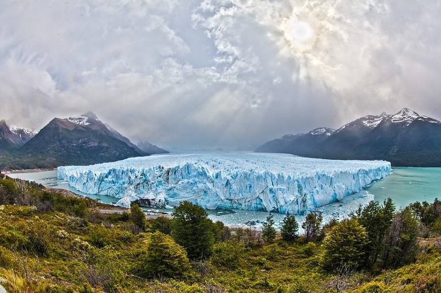
Perito Moreno Glacier
The glacier is one of the "Top 10 attractions Ruta 40"
Glaciar Perito Moreno
All you need to know about it: its periodic ruptures, surface, location, how to get there, when to visit it and where to stay:
Los Glaciares National Park
Created in 1937, it was one of Argentina's first national parks. It is known around the world for its glaciers, which descend from the Southern Ice Field that covers the Andes along the border between Argentina and Chile.
Glaciers like Upsala, Perito Moreno, Spegazzini, Onelli, Viedma, calve icebergs into the turquoise colored lakes.
It was designated as a UNESCO World Heritage Site due to its scenic beatury
- Surface area. 724.000 ha.
- Location: Southwestern corner of Santa Cruz province, bordering Chile.
- Eco region: Patagonian Andean forests and steppe. High Andean tundra and Southern Continental Ice Field
The "Big Lakes" and the steppe
At the junction, head right, northwards long Ruta 40. At km 295 Carlos Fuhr.
Charles Fuhr
Here is the bridge across the Santa Cruz River, which is the outlet of Lago Argentino, just 7 km west of the bridge.
Lowest point of this leg: 180 m (549 ft). It is also the lowest point of all the rest of the alignment of Ruta 40 from here to its northern terminus in La Quiaca.
This spot was chosen as a river crossing point because it is the river's first narrow spot. Charles (Karl) Fuhr settled here between 1895 and 1900 and set up a ferry across the river.
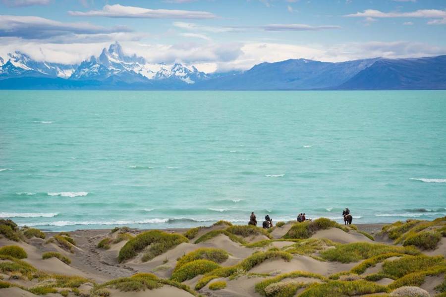
The highway runs northwards parallel to Lake Argentino's eastern tip, you can catch a good view of the lake when you reach its northeastern angle.
Lago Argentino
Largest and southernmost of Argentina's Patagonian lakes.
Surface area 1.466 m2 (566 sq.mi), elevation 187 m (613 ft.); depth: over 500 m or 1,640 ft.
The original Tehuelche people called it Kelta.
It was discovered by Captain H. Gardiner who followed Darwin and Fitz Roy's steps in 1867. Lieutenant Valentín Feilberg reaches it in 1873, but believes it is Viedma lake. It was explorer Francisco P. Moreno who in February 1877 names it and navigates it for the first time.
Ruta 40 runs north between the glaciar morraines and at km 309 it meets Ruta Provincial 17, a gravel road that goes east towards the town of Comandante Luis Piedra Buena, across the basaltic plateau.
Another bridge appears ahead, it crosses the La Leona river (Spanish for "lioness"), which comes from the north, with the outflow of Lake Viedma. After the bridge Ruta 40 runs along the NE tip of the lake before entering the plateau once again.
La Leona
La Leona River, its name
It was close to the bridge that Francisco Moreno was attacked by a female puma (the "lioness") on March 3, 1877.
At km 320 fork to the left of the gravel surfaced Ruta Provincial 19 which runs along lake Argentino's northern shores.
Ruta 40 runs along the valley of La Leona River passing by the entrandce to the estancia La Irene (to the left at km 332) and the fork with Ruta Provincial 69 (km 345); this gravel surfaced road goes up the Guanaco River Valley passing by the tourist estancia La Sofía:
Dinosaur
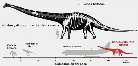
Here, on the eastern side of the La Leona River Kenneth Lacovara discovered in 2005, one of the largest dinosaurs in the world, it weighed around 65 tonnes, and lived some 85 Millin years ago. He named it Dreadnoughtus schrani (dreadnought: he who fears nothing).
At km 363 junction with Ruta Provincial 21 that runs along the southern shore of lake Viedma. Ahead is the Parador La Leona (Historic Site), here is the road that leads to a tourist lodge at Estancia La Estela (with accommodation), the estancia is located at the outlet of Lake Viedma into the La Leona River, 1 km north of Ruta 40.
Parador La Leona
"Parador" means "inn", a place that provided accommodation, food, and drink for travellers. The old building which has been restored dates back to 1894. It was built by the Jensens next to the ford across the river. You can spend the night here.
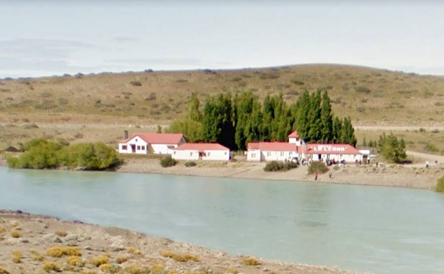
American train and bank robbers Butch Cassidy and the Sundance Kid stopped by here in 1905.
Side trip to Visit the Petrified Forest and Helsingfors
From "Parador La Leona", (km 0) head along the gravel surfaced Ruta Provincial 21. It runs around the northern side of Cerro Guacho -also known as Los Hornos, a hill (elev. 580 m).
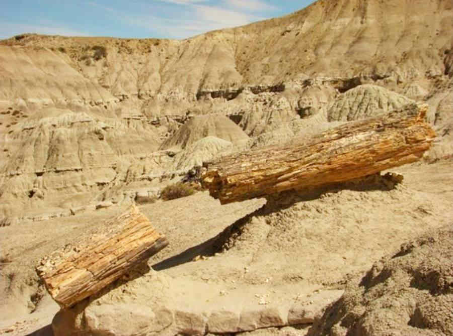
The petrified forest is at the foot of the Los Hornos hill. They are tree trunks of conifers from the Cretacean period, related to the araucaria or "monkey puzzle". There are also fossilized bones.
At km 9 bridge across te Guanaco River, the road runs through an arid area, close to the lake (km 11) but then goes inland. At km 44, muddy lake close to Estancia Santa Teresa (km 47), followed by Condor River (km 50). At km 60 after the entrance to Estancia Los Hermanos, the road approaches Lake Viedma's shores. You can see the Andes clearly.
At km 66 the road crosses Milodon Creek and at km 67 reaches the entrance into the Parque Nacional Los Glaciares. Finally at the entrance of the lake's Viedma Channel, at km 71 you reach the end of the road at Estancia Helsinfors a "Five Star" Lodge. Stay here or return along the same road.
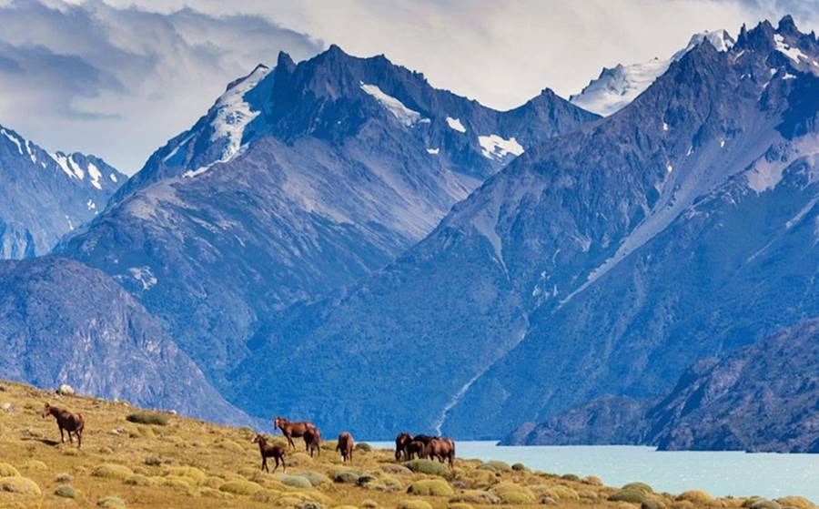
Viedma Glacier
Covering an area of 900 km2 (348 sq.mi.) it is the largest glacier in Argentina and the second largest of the Southern Patagonian Ice Field.
It calves icebergs into lake Viedma.
Lake Viedma
It is 80 km long and about 16 km wide (50 miles and 10 miles respectively), its surface area is 1.088 km2 (420 sq.mi.)
In the Aonikenk language it was called Capar, a local tunip. Spanish official Antonio de Viedma discovered it in 1782.
Final leg into Tres Lagos
At "Parador La Leona" Ruta 40 crosses the La Leona river again (km 364) and takes a northern course along the eastern shore of Lake Viedma.
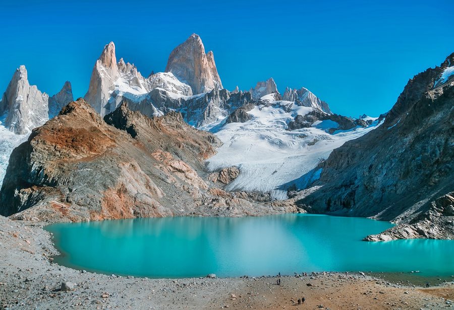
If the weather allows, you can see the Andes and the mighty granite peak of Cerro Fitz Roy towering 11,171 feet (3,405 meters) above sea level.
At km 377 secenic outlook to your left. At tihis point the road heads towards the northeast leaving the lake behind.
At km 384 junction with the paved road to El Chaltén. The highway runs 90 km along the northern side of lake Viedma and reaches El Chaltén:
El Chaltén
Small village at the foot of Mount Fitz Roy known as the "Capital of Patagonian Trekking". Great place to hike in the forests and see the glaciers.
El Chaltén
All you need to know about > > El Chaltén [see our Spanish language webpage]
>> Book your hotel in El Chaltén
End of the Journey: Tres Lagos
Keep on Ruta 40 which heads east. At km 406 Paisan creek, At km 417 Gas station and junction with the "old" gravel alignment of Ruta 40 which has been bypassed by the paved one.
The new road heads east (right) into the village of Tres Lagos (the name means "Three Lakes" in Spanish, after lakes Argentino, Viedma and San Martín).
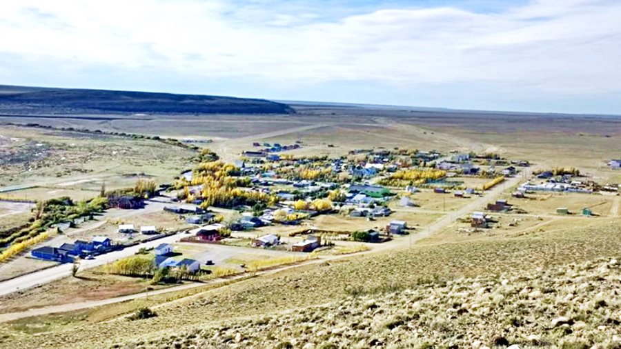
The village is in the valley of the Chalía River (it is also called Shehuen River). Ruta 40 is the village's main street.
Tres Lagos
At km 420 you reach the village of Tres Lagos, End point of this leg of Ruta 40.
Tres Lagos
Full information on > > >Tres Lagos [see our Spanish language webpage]
>> Book your hotel in Tres Lagos
Tips and Advice for a Safe Journey
1. Weather: The tough and unpredictable Patagonian weather
The weather in southern patagonia is cold and the wind chill can make it even colder. The average mean temperature is only 6 °C (43°F). The steppe is dry and arid with only 260 mm of yearly rainfall (10.2 in.)
Summers are cool and winters very cold with occasional snow. Freezing temperatures and frost can be expected from May to September. Summer's maximum temperatures are high reaching 30°C; (86°F).
The rainfall increases as you head west into the Andes, and the vegetation show this effect: steppe turns into a lush forest.
Clouds, drizzle, gales and even snow can be encountered even in summer in the Andes at El Chaltén or at the glaciers in El Calafate.
The wind is persistent at over 40 km⁄h (25 mph) and Patagonia is one of the windiest places on Earth).
Sunny clear days are rare so use them to take those breathtaking photos of the amzing Andean peaks. Clouds and overcast skies over the Andes are very common.
2. When to visit the area
Late spring and summer is the best time of the year to visit this region (November to April), but you can visit it throughout the year. Winter is the low season and it is less crowded and it is cheaper.
3. Safety Tips
Very Important: Fill your gas tank before leaving Río Turbio and refuel at Tres Lagos.
There are hardly any services along the way excluding the estancias, and the village of La Esperanza. Of course El Calafate has everything that you may need (Hospital, Airport, hotels, stores, etc.)
Side winds and gusts can be dangerous so pay attention when you drive. Ice in winter can be dangerous.
It is completely paved so at least you don't have to worry about gravel (but the side roads and road shoulders are gravel surfaced).
Road Conditions
Check out our website to learn about the current: Road Conditions along Ruta 40.
Important Tips
- Take food, water and a paper map.
- Even in summer wear warm clothes and take a windproof jacket with you. Patagonia has unpredictable weather in Patagonia, it can go from rain to sun and icy sleet to dry wind in the same day.
- A blanket or sleeping bag and a small gas heater would come in handy if you hade to spend the night on the road.
There is fuel in 28 de Noviembre, Puerto Natales (Chile), Río Turbio,El Calafate, Tapi Aiken, La Esperanza, El Chaltén and Tres Lagos
›› Location of Ruta 40's Service Stations
Accommodation in Santa Cruz
Find your hotel along Ruta 40 in the province. Cities listed from north to south:
>> Lodging in Tres Lagos
Hotels along Ruta 40 in Santa Cruz
>> Find your room in Santa Cruz province

