Ruta 40 Section #13
Ruta 40 from Alpasinche to Santa María
This section of Ruta 40 links the village of Alpasinche with the town of Santa María, and is aligned through a broken terrain, river canyons, mountains and sleepy villages.
It is a journey into the past, the region’s history and culture. Its traditional hand-woven textiles, the remains of pre-Hispanic forts, temples and towns and scenery that ranges from the trees of the "Monte" to the desrtic dryness of the vast Campo Arenal.
Summary of this Section
It spans 261 km - 162 miles. Argentina's Route 40 climbs out of the río Colorado River Valley up to the highland of Campo Arenal and then drops into the "Valle de Yokavil" Valley in northern Catamarca province.
It is totally paved.
Elevation along the alignment
- 938 m - 3,075 ft. At its starting point in Alpasinche, La Rioja province.
- 1,880 m - 6,164 ft. At its ending point: Santa María, Catamarca.
Maximum Elevation of this segment
The road is 2.277 m - 7,465 above sea level in the Sierra de Hualfín Mountains, between Los Nacimientos and El Desmonte.
In the Quebrada de Belén canyon, the road is winding and there may be rocks on it, that fall off the side of the steep valley walls. The leg covering San Fernando – Hualfín – Los Nacimientos is also has plenty of curves, but was recently realigned and made straighter.
Towns and villages along the way
From North to South, these are the main "towns": Santa María, San José, Hualfín, Belén, Londres and Alpasinche.
Map of this Section of Ruta 40
>> Interactive Map of Ruta 40 in Catamarca
Maps covering the leg between Alpasinche and Santa María from north to south (also include neighboring areas)
Detailed itinerary from Alpasinche to Santa María
We describe it from South to North, starting out from the village of Alpasinche in La Rioja province.
Leaving Alpasinche
Set off from the junction of Ruta 40 with Ruta Nacional 60, (km 0) and head west towards Londres, Tinogasta, Fiambalá and Belén.
The highway crosses the Los Sauces River (pictured below) leaving the irrigated area and entering a drier zone.
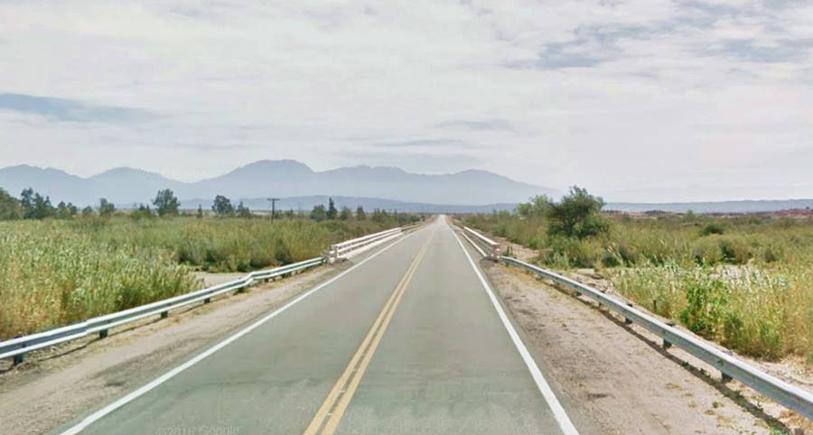
At km 5 a "T" fork: Ruta 40 turns to the right (north), leaving Ruta Nacional 60 that continues westwards into the Andes and on to the border with Chile:
Ruta Nacional 60
Argentina's Ruta Nacional 60 is, in this area an interesting road-trip. The road is paved all the way to the Chilean border. First it heads west to the towns of Fiambalá and Tinogasta in the Abaucán River Valley, which has the historic la Adobe Route through colonial adobe churches, wineries and Inca ruins. In Fiambalá are the famous hot springs and the world's tallest sand dunes.
The Ruta 60 continues then into the Andes as the Ruta de los Seismiles, a scenic drive past a vast volcanic field with summits that exceed 6,000 meters (19,670 ft), hence its name ("Seismiles" in Spanish means "six-thousands": the height of the volcanos in meters.)
Ruta 40 towards Londres
Turn north along Ruta 40. At km 7.5 bridge across the Salado or Colorado river, which drains the Abaucán Valley, and which after meeting the De los Sauces River, it vanishes in the sandy closed basin of "el Campo de Belén".
The river marks the provincial border between La Rioja and Catamarca.
The highway runs along the western side of the Campo de Belén basin. To your left is the Sierra de Vinquis range with a maximum height of 2,950 m (9,672 ft). Then comes the range of Sierra de Zapata which separates the Campo de Belén from the lush valleys of the Las Lajas and Abaucán rivers. Zapata's heighest peak is the Cerro de las Animas (2,948 m - 9,665 ft).
Campo de Belén Basin
It is a large basin shaped like a square with sides 100 km (60 mi.) long. It is enclosed by mountains on its four sides: The Sierras de Vinquis, Zapata, Fiambalá and Belén to the west, Velasco to the south, Ambato and Manchao ranges to the east and the Atajo hills to the north.
It is a sedimentary basin with many inverse flaws that was filled in during the Cenozoic and Holocene. It lacks an external drainage and the rivers that feed it evaporate due to the dryness and clear skies. The salts they leave behind formed the Salar de Pipanco salt flats 90 km (56 mi.) long.
At km 12 to the left is a dirt road towards the hamlet of Cerro Negro a farming community irrigate by the Colorado River. It has adobe houses and the historical chapel of San Buenaventura built in 1841.
The road is relatively straight and flat with concrete fords that allow the water of the summer downpours to flow across the road, slowdown as you drive across them.
Fords and summer rains
The rivers in this area are dry for most of the year. They only carry water during the summer rainy season. The summer storms cause mudslides on the mountain slopes, which wash rocks, bushes and mud across the concrete fords. Fords are a better option in comparison to bridges: they don't get clogged (acting as dams) with these mudflows, and can be cleared with a grader quite quickly.
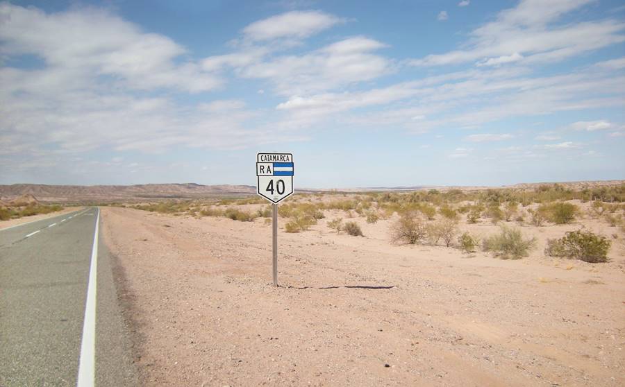
Km 4040 of Ruta 40
Don't miss the sign marking the kilometer 4040 of the Ruta 40. It is 33.8 km north of the junction of highways 60 and 40, and 36 mkm south of Londres, Catamarca (See the mapa).

Cuesta de Zapata
The Cuesta de Zapata or "Road Across the Zapata Range" is a narrow winding cliff-hanger dirt road Which is currently closed to traffic. It crosses the Sierra de Zapata and links the towns of Londres and Tinogasta.
It was, in the past the original alignment of Ruta 40 and before that, the Inca Trail used by the Native Americans.
Now it is favored by trekkers, mountain bike cyclists and those who drive off-road in 4x4 all terrain vehicles.
La Cuesta de Zapata meets Ruta 40 to your left at km 70.5 coming from the SW.
At km 74 in the outskirts of Londres, after crossing the Quimivil River is (left) the access road to the Archaeological Site of Shinkal de Quimivil.
Shincal de Quimivil
National Historic Monument and Inca town
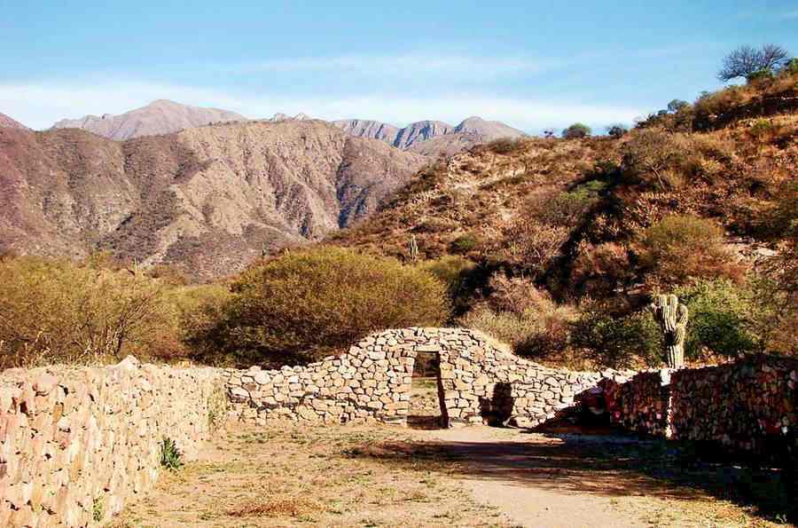
This was the most important Inca settlement in Argentina, with a temple, storage buildings and barracks for the military garrison.
El Shinkal de Quimivil MHN, view of a Kallanka (building):
Londres
The village begins at the crossroad leading to Shinkal. Londres has a semi-urban appearance and it is spread out along Ruta 40.
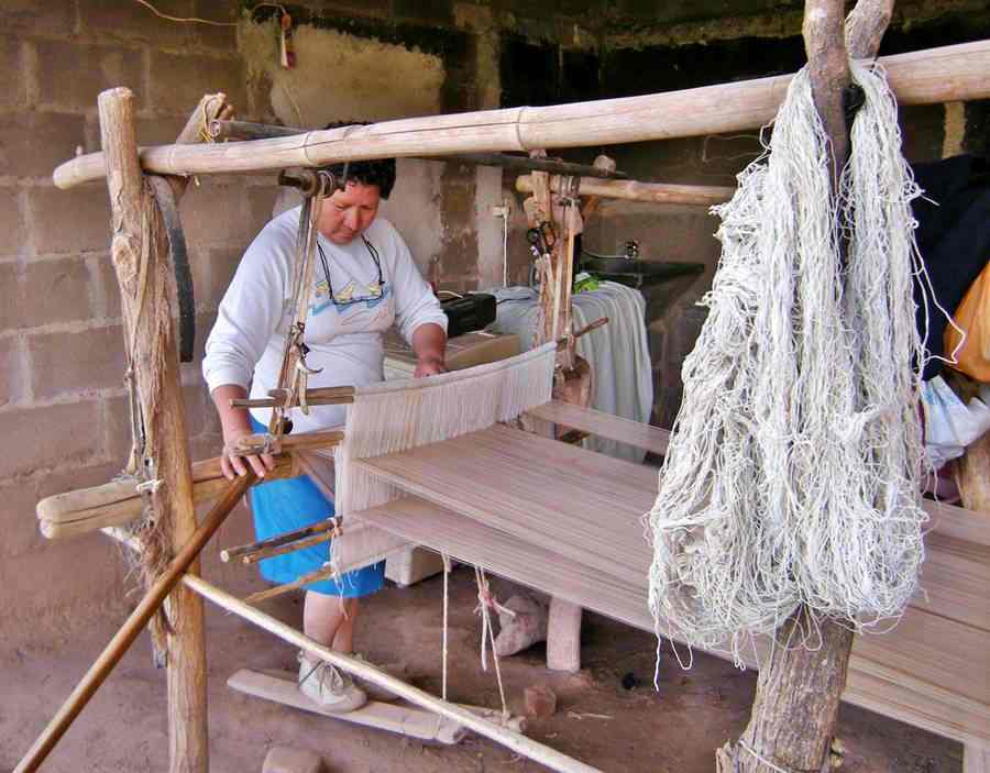
Set at an altitude of 1,225 m (4,016 ft). It is home to many women who work their handlooms to weave llama, alpaca and sheep wool into textiles.
Londres is the second oldest town in Argentina.
It was originally founded at the Shinkal de Quimivil site by Juan Pérez de Zurita on July 3, 1558. He named it Londres de la Nueva Inglaterra (London of the New England) to celebrate the wedding of Queen Mary Tudor, daughter of Henry VIII and the king of Spain, Phillip II. Both were Catholics.
The bloody Calchaquíes Wars raged on in this region for more than one century (1560 - 1666) and the rebellious natives destroyed the Spanish settlements time and time again. Londres was founded seven times. The final one survived until today, and was born around the chapel of Saint John the Baptist in the mid 1700s, built by Margarita de Guzmán y Mercado.
> > Find your Hotel in Londres
From Londres to Belén
On the northern tip of th town (km 77,6) is the statue of Zurita. Ruta 40 heads north along the foothills, many streams cross the highway. The terrain has natural fields. Just 9 kilómetros away (km 86,8) is the town of Belé.
> > More information on Belén [Spanish]
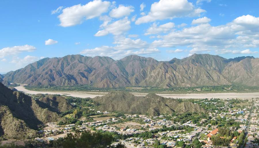
Belen is the head of the Belen Department and is the regional hub. Fill your gas tank here.
Its economy has traditionally been based on farming (walnuts, cumin, red peppers, olives and fruit), hand woven textiles woven on handlooms. Its fields are irrigated by the Belén River.
It was founded in 1681 when father Olmos donated some of the "Virgin's land" to establish a town on what during the 1700s and 1800s was the "Road of the Cuyo people to the High Perú" (current alignment of Ruta 40) it was also a main crossroads for those moving between Chile and Tucumán.
> > Find your hotel in Belén
Some Tourist Attractions inBelén
- Cóndor Huasi Provincial Museum: with over 5,000 prehispanic artifacts of the Diaguita culture.
- Mirador del Cerro Nuestra Señora de Belén a great lookout just a 2 km walk from downtown Belen. There ia an image of the Virgin Mary 15 m tall (45 ft.). Fabulous view of the valley and the town. Take water and a hat for the trek.
- "Centro Cultural y Artesanal". The main handicraft market in town, facing the main square. Many local crafts including handwoven goods, ceramics, and home made jams.
North of Belén
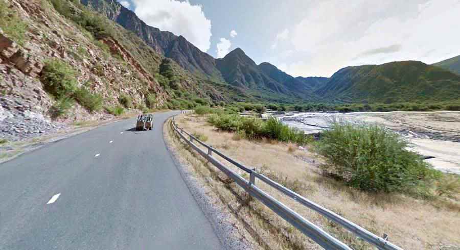
Head northwards, along Ruta 40 out of Belen, behind the hills that enclose the town on its northern side (km 91) the road enters the Belén River Valley or (Quebrada de Belén -Belen Cayon).
Ruta 40 climbs the meandering valley on its western side, passing through El Dique (km 93.7). At km 103 bridge across the Condor Huasi River ("Place of the Condor" in Quichua language) and to your left access road to Puerta de San José ("Puerta" means "door" in Spanish). This is the doorway to a circuit through some small farming communities in the mountains, such as Cóndor Huasi, Las Barrancas and Las Juntas.
La Ciénaga
The highway keeps on climbing and goes by km 108 La Ciénaga de Abajo (right) followed by km 111, La Ciénaga with fields to your right.
At km 131 to your right is the access road to San Fernando, a village from the 1700s with a nice colonial church. The bridge across San Fernando River is just ahead.
To your left at km 137 is the road leading to the tiny hamlet of Las Juntas and at km 140 is El Eje, whre the road forks. To your left is provincial highway 43 that goes NW into the Puna highland in Catamarca and reaches the town of Antofagasta del a Sierra [Spanish language webpage] (222 km away).
Side Trip to Antofagasta de La Sierra
It is a 222 km drive from El Eje to Antofagasta de la Sierra. This high altitude road is almost totally paved except for an 18 km gravel stretch at the begining, between Puerta de Corral Quemado and Villa Vil.
On the way, you will pass by the Natural Reserve "Reserva de Biosfera Laguna Blanca", that protects the endangered vicuña, the Andean skunk some wild cats and chinchillas.
It is a conservation area for birds and an ideal site for bird watching.
Keep right along Ruta 40, cross the Villa Vil River (km 143) and then, at km 147 to your right is the entrance to Hualfín. The new alignment of Ruta 40 passes by the town's western flank. The "old" alignment went through it.
Hualfín
Read all about Hualfín (Spanish webpage).
Small town with the ruins of an Inca fort or "pucará", located at an elevation of 1.842 m (6,039 ft.) is is irrigated by the Hualfín River. The fields grow grapes processed at the local winery, corn, and bell peppers.
Don't miss the Church of Nuestra Señora del Rosario, on the eastern side of the village. It dates back to 1770.
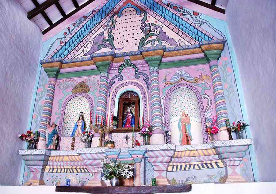
Capilla Nuestra Señora del Rosario
National Historic Monument. Built by Doña María Medina de Montalvo on her lands, in 1770. It has a very colorful altar, pictured below:
This was the land of the brave Native Chief Chelemín who fought against the Spaniards during the Second of the three Calchaquí Wars. There are remains of the Inca fort and the Hualfin Indians village to the west of the town.
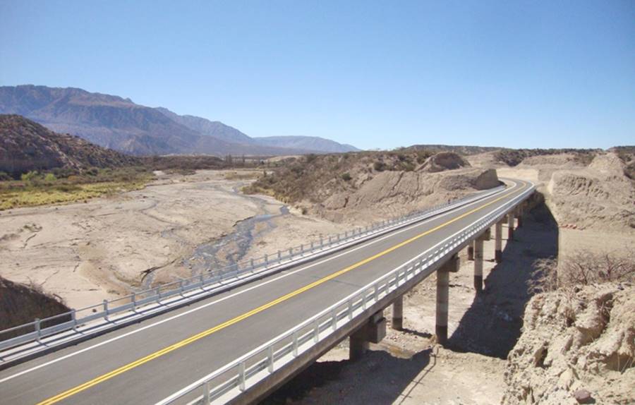
At km 151 the "old Ruta 40" meets the new alignment to yoour right. The highway climbs northwards, crossing the Nacimientos (or De Las Cuevas) River along a new bridge (see photo) and at km 161 reaches Los Nacimientos Abajo built next to the river.
It then passes by Los Nacimientos Arriba and leaves the río de las Cuevas River Valley, reaching at km 176 the maximum height of the whole section: 2.277 m - 7,465 ft.
Campo Arenal
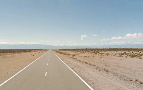
The road now levels off and just ahead (km 179) to your right is the airfield of the Alumbrera - Farallón Negro mines. The highway now runs along the western side of the Campo Arenal (Sandy country) a large relatively flat desertic basin. The minerals exploited here were discovered by the ancient native cultures. Far to the east and NE you can see the high snow capped Nevado de Aconquija mountain range.
The Ruta 40 is straight here and curves slightly towards the NE. At km 213 it descends at Cuesta Pie de Médano along the dunes that mark the southern banks of the Cerro Colorado River, which has its sources in the mountains to the NW, and whose waters eventually reach the Atlantic Ocean after flowing through the Santa María, de las Conchas, Juramento, Salado, Paraná and the River Plate rivers.
The highway passes by Pie de Médano ("Foot of the sand dune") and follows the river. At km 224 dirt road to your right (Prov. Hwy. 47 from Andalgalá).
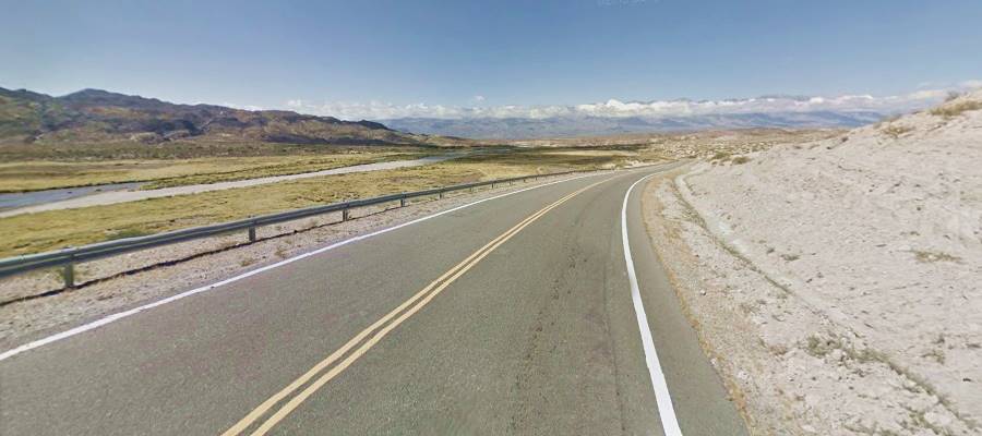
At km 227 Punta de Balasto, (Pre-Hispanic site) fields here are irrigated. The road heads north along the Santa María Valley passing through El Desmonte (km 238) and (km 245) the irrigated fields south of Santa María. Here are the villages of Casa de Piedra, San José (km 248) and Loro Huasi (km 257) -"Home of Parrots" in Quechua language.
At km 258 to your left is the road leading into the town of Santa María, which you reach at km 261, End point of this section of Ruta 40.
Santa María
> > Full information on Santa María [Spanish page]
Built at 1,880 m above sea level ( 6,164 ft.), it was founded in the early 1700s once the region had been pacified after the third and last Calchaquí War. It lies on the eastern bank of the Santa Maria River.
Its valley is also known as "Valle de Yocavil", and to the north it is linked to the Valles Calchaquíes in Salta province
The whole valley is full of remains of ancient native settlements: The Diaguita people lived here. There are remains of the Inca forts and the Inca Trail too.
> > Find your hotel in Santa María
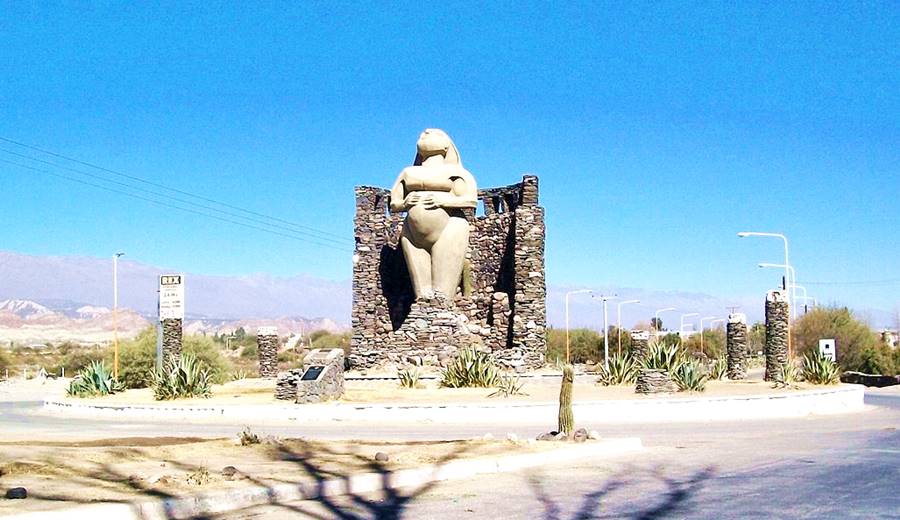
Monument to Pachamama or Mother Earth on the north side of Santa Maria. She was the native's representation of fertility, and crops, here she is represented as a pregnant woman gazing up to heaven:
Tips for those visiting the area
1. Weather on this section of Ruta 40
The climate is very dry: 170 mm per year of rainfall - 6.7 in. with very low relative humidity. Summer is the rainy season (Nov. to March). Temperature drops a lot between day and night.
The average temperature in Londres is 18°C. (64°F), January is the hottest month, averaging 25°C (77°F) and with highs that are above 32°C (90°F). June is the coldest month with an average of 9.8°C (50°F) and a low of 1°C (34°F). In Hualfin the temperatures are lower (due to the altitude).
June is the driest month with only 2 mm de of rainfall (1/frasl;10th of an inch) and January is the wettest: 45 mm (1.77in.) average.
2. Safe Driving
Keep your fuel tank full.
Ruta 40 is fully paved in this section, it is relatively straight and flat up to Belen, but then becomes a winding mountain road up to Campo Arenal. After that it is once again straight and rather level.. The shoulders are gravel and there are concrete fords across the dry river beds that cross the road at frequent intervals.
Fords, summer rains and safety
There are many dry river beds that run across the highway's alignment, draining the Andean foothills that lie to the west. They only carry water during the summer rainy season, and building bridges to cross them would be an expense. Furthermore, the summer flash floods wash mud, branches and rocks down from the mountains which would quickly clog the area beneath the bridges, damming the rivers.
After a downpour, the road is quickly cleared with road grader that moves the mud ⁄ rock slides and opens the highway to traffic.
Don't attempt to drive across a flooded ford, wait for the water level to drop.
Check the road conditions on our website: Road Conditions.
There are service stations in Santa Maria, Tafi del Valle, Amaicha del Valle, Belén, Hualfín, Tinogasta, Fiambalá and San Blas.
›› Location of Ruta 40's Service Stations
Accommodation on Ruta 40 in Catamarca
Find your room and lodging along Ruta Nacional 40 on this leg:
>> Hotels in Santa María
Hoteles alibg Ruta 40
- Catamarca Province
- Santa María
- Belén
- Londres
- Chañarmuyo
- La Rioja Province
- Famatina
- Chilecito
- Villa Unión
- Aimogasta
Close to Ruta 40 in the Andes and the Sixthousands
>> Find accommodation in the Provincia de Catamarca

