Ruta 40 Section 15
Ruta 40 in Salta
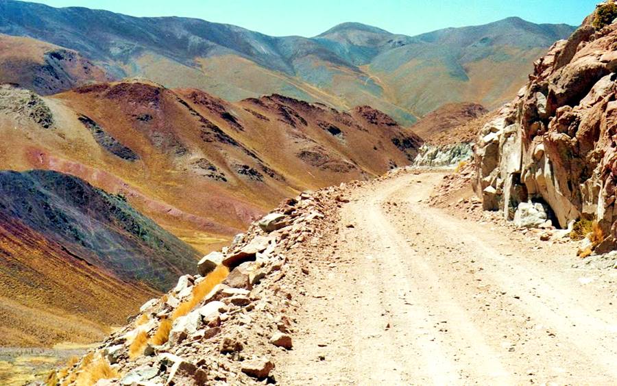
This section of Ruta 40 is one of its most difficult ones due to its high altitude and its gravel and dirt road surface.
The narrow, winding cliff-hanging highway crosses the imposing highest point of Ruta 40: El Abra el Acay Pass, at 16,050 feet (4.895 meters) above sea level.
Ruta Nacional 40 in Salta, Northwestern Argentina, Argentina
A Summary of this Road Section
It is a short leg: only 90 miles long (145 km).
It begins in the valley of the Calchaquí River and follows the river up to its sources before climbing across the Abra del Acay pass to reach the Puna highlands.
It links the town of Cachi with San Antonio de los Cobres, both of them in the province of Salta.
Heights along this leg
- 9,442 ft (2.880 m). At its starting point: Cachi, Salta.
- 12,374 ft (3.774 m). At its ending point: San Antonio de los Cobres, Salta.
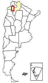
Section 15 is located in NW Argentina,
see red box at the top of this map
Road surface: It has two short paved sections, the first 12.3 km between Cachi and the junction of Ruta 40 with Ruta Provincial 33 in Payogasta (see map), and the final 13.1 km into San Antonio de los Cobres (see map).
The remaining road section is gravel, sand, dirt (119.6 km).
Difficulty: High. Almost no towns or villages along the road. Lacks most basic services (service stations, lodging, etc.); it is a high-altitude highway.
It is a very high road section, with an average altitude of over 11,500 ft (3.500 m).
Section's maximum altitude
As we mentioned above, the road peaks at 16,050 feet (4.895 m) at the Abra del Acay Pass, heighest point of Ruta 40.
Difficulty level: High. Lacks service stations and services, only small settlements along the road. Bad mountain road at high altitude.
Villages along this Section of Ruta 40
You will only find basic services at Payogasta and, half way along the itinerary, at La Poma. The major towns are at both tips of the leg, at Cachi and en San Antonio de los Cobres
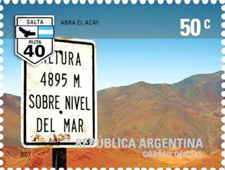
Argentine postage stamp, Abra el Acay
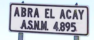
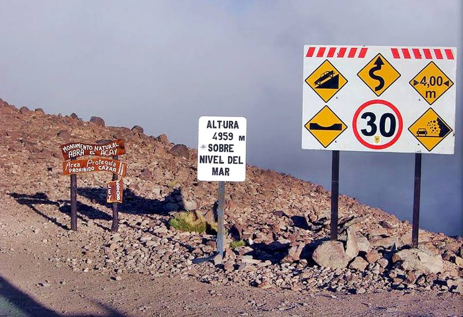
Road sign with the altitude of Abra de Acay
When should you drive this leg of Ruta 40?
The best time of the year to visit the area
- Winter. It is the "Dry" season, with clear sky. Sunny weather. It does not snow often (only on the very lofty peaks), but expect frost. Frozen springs and rivers in the high areas, and very cold -below freezing- temperatures. Try to avoid the Argentine winter holiday period during July (high season) or book accommodation before traveling.
- Summer. Is the "Wet" season. The area is very arid, but most of the rain falls between Nov. and Mar. with sudden downpours which provoke flash floods, rock and mudslides which can blick highways. Summer is quite cool (due to the altitude).
- Fall and Spring. From March to November is the best period to visit the region. It does not rain, weather is nice: cool during daytime, cold at night. Sunny. Take note that Easter and long weekends may bring more tourists to the area, mostly local - Argentine visitors, so book your hotels in advance.
Some Attractions and Sights
Things to see along this leg of Ruta 40
In our English language webpages
- Volcanes Gemelos (Twin Volcanoes)
- Puente del Diablo (Devil's Bridge)
- Abra del Acay Pass
In our Spanish webpages
Detailed Itinerary
>> Interactive Map of Ruta 40 in Salta.
From Cachi to San Antonio de los Cobres
We will describe the trip from south to north, starting at the town of Cachi (Spanish webpage), and ending at the town of San Antonio de los Cobres (Spanish webpage), both in the province of Salta, Argentina.
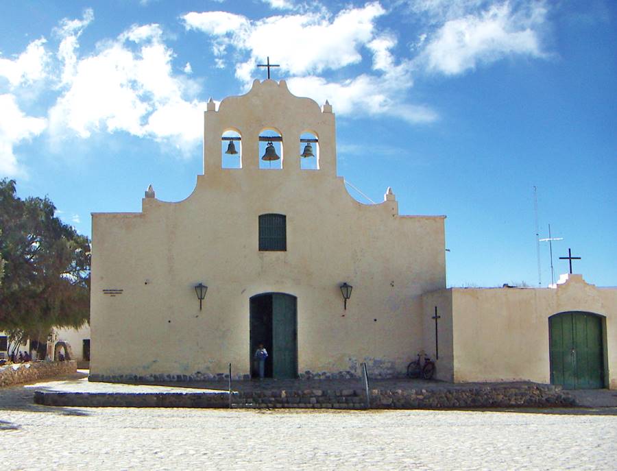
Cachi
Full details on the town of > > Cachi [our Spanish language webpage]
>> Find your hotel in Cachi
How to reach Cachi?
You can get to Cachi along Ruta 40, from the south, driving from the town of Cafayate (Spanish webpage), along the valley of the Calchaqui River. We describe this leg in our webpage : Section 14 of Ruta 40.
For those coming from the city of Salta, you can also drive up the Cuesta del Obispo, "Bishop's Slope":
> > Complete information on Cuesta del Obispo (Spanish webpage)
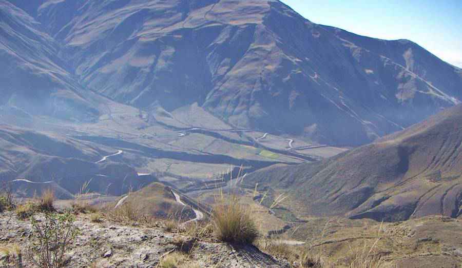
Leaving Cachi
Read our Tips and suggestions before attempting to drive into the Puna: it is a high altitude difficult road (gravel, narrow and mountain road) with extreme weather (cold, windy), with few places to provide support, assistance or fuel. Plan your trip well.
Leave the plaza at Cachi (km 0 of this leg), heading norhtwards and cross the bridge over the Calchaquí River. The road here is paved and runs along the eastern shore of the river all the way to Payogasta, crossing irrigated fields. At km 11 you will reach the small village of Payogasta.
Payogasta
Ruta 40 is its main street. The church is to your right -it lacks a steeple and has a palm tree in front of it. The road turns sharply to leave the town as a narrow street.
The name Payogasta combines the native Quechua word "Payo" ("blanket of clouds") with a word from the extinct Kakan or Diaguita language: "gasta" ("village").
This is a fishing spot for the "llusca", a local fish that resembles an eel, one-foot long (30 cm). Its name is Quechua, and means "slippery".
The town offers basic services and lodging:
Payogasta
Full details on the town of > > Payogasta [our Spanish language webpage]
>> Find your hotel in Payogasta
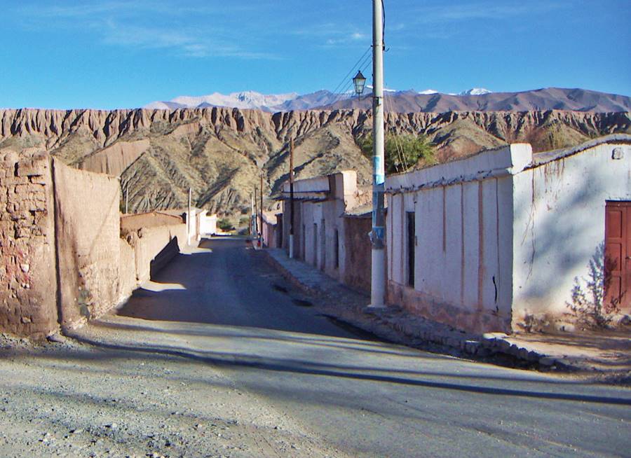
Junction of Ruta 40 and Ruta Provincial 33
Just 1 km east of Payogasta (km 12) is a fork: Ruta Nacional 40 turns left, to head north while ahead is the paved Ruta Provincial 33 that will take you to the city of Salta through the Cardones National Park (Spanish webpage) and the Cuesta del Obispo (Spanish webpage) slope, into the Quebrada de Escoipe Canyon and the lush jungle in the Andean foothills.
Turn North towards La Poma
At this fork, turn left and head north. Paved road ends here, gravel section begins.
The highway runs along the Calchaquí river Valley crossing dry streams that only carry water during the summer rainy season.
Close to the road are cultivated fields, irrigated by the river, they end at km 17.5 and there, is a fork to the right, of Ruta Provincial 104, a dirt track that follwos the río Potrero river to Punta de Agua and, after 14 km, reaches the Inca ruins at Potrero de Payogasta.
Potrero de Payogasta
Archeological Site
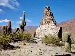
Inca ruins and cardon cacti. Source
The site is a National Historic Monument, an Inca settlement on the Inca Trail, a UNESCO World Heritage Site.
The trail linked it with the settlement of Tastil (Spanish webpage) which has some very well conserved ruins.
Going back to our itinerary, continue north along Ruta 40, and at km 27 is another road leading to Punta de Agua, 500 yards ahead to the left is the road into the settlement of Palermo, built on the western shore of the Calchaquí, river.
The road follows the river, with a winding course, reaching the Pueblo Viejo"Old Town" at km 33, with some houses and cultivated fields. The road runs between them and reaches a "grotto" with a virgin's image (km 43.5): "Gruta de la Vírgen de La Poma".
Inca Grain Silos
Archeological Site
Just ahead to the right, along a dry river bed is a trail that leads to this site (map showing location).
The 24 grain storage units are placed under a stone outcropping which is 114 feet long (35 m). Built of mud and straw adobe they could store up to 15 tons of corn and beans. There is also rock art, painted 900 years ago, which predate the Inca occupation period.
Ruta 40 moves away from the river and enters a volcanic area at km 47: the "Twin volcanoes"
Los Volcanes Gemelos or "Twin Volcanoes"
At km 50 is the Campo Negro (Black field), a lava field covered with dark basaltic rocks which erupted from the two volcanoes known as the twin volcanoes:
"Volcanes Gemelos"
To your right, east of Ruta 40 at km 52.
They don't seem high because the valley floor here is over 9,700 feet high. Their summits are 11,770 ft (3.590 m) and 9,836 ft (3.000 m) high.
They are extinct and the eruptions which provoked the lava flows which formed the "Black Field" took place some 11,000 years ago.
Vanished Lake
The lava flows actually formed a dam across the Calchaquí River, and this created a lake, which flooded the area where the village of La Poma is now located.
The water eventually eroded the dam and the lake emptied.
Puente del Diablo or "Devil's Bridge"
To your left, at km 50 there is a trail that after three quarters of a mile (1.200 m) leads to the "Cavern at Devil's Bridge" (Caverna Puente del Diablo).
The remains of the mighty lava dam of the Twin Volcanoes. This lava bridge, is a mighty tunnel over 330 feet long (110 m), and the water runs through it. It has stalactites.
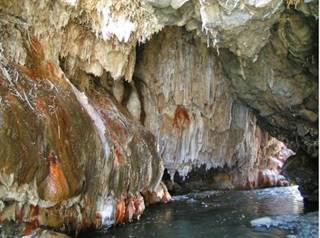
Devil's Bridge (Puente del Diablo), stalactite
and the Calchaquí River. Source
The bridge is part of the "Área Protegida Provincial Abra del Acay", a natural reserve.
The local people use the bridge to cross the river with their goats.
Do not visit it alone, only do so with a authorized guide, it is a dangerous place. Summer rains may flood the caves suddenly.
La Poma
Ahead, at km 52.5 to the left is the southern entrance into the village of La Poma (3.015 m), it was founded in 1930 after an earthquake razed the original village (which can still be seen 300 yards north of the "new" settlement). The entrance road crosses the Calchaqui River. It is a 5 km drive into La Poma.
This is the last village before the climb up the Abra del Acay Pass. Check road conditions with the locals and Register at the Police Station if you plan to drive across the Pass.
La Poma
Full details on the town of > > La Poma [our Spanish language webpage]
It offers basic services for the traveler, but no fuel.
Leave La Poma along its northern exit, cross the Paya river, see the old town ("Pueblo Viejo") at km 58. The road crosses the Calchaquí river, meets Ruta 40 again km 60 and heads towards Acay (left) northwards.
Towards Abra del Acay
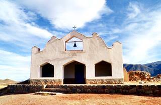
Church at el Trigal, Ruta 40. Raúl A. Balbastro
The road runs 1,000 yards east of the river and at km 64.4 reaches El Trigal (Spanish for "wheat field") see the old church and the cemetery to your left. The road then crosses a dry creek and enters a cultivated area. Esquina Azul ("Blue corner") is its northern tip.
At km 70 another cultivated area along the Cardonal river. The road climbs as the valley becomes narrower.
Ahead lies "El Saladillo" ("The Salty one") and at km 81, "Esquina Colorada" ("Red Corner"). The river is now much narrower. At km 89 the highway turns towards the northwest and a section with many sharp curves begins. The road here zig-zags as it climbs.
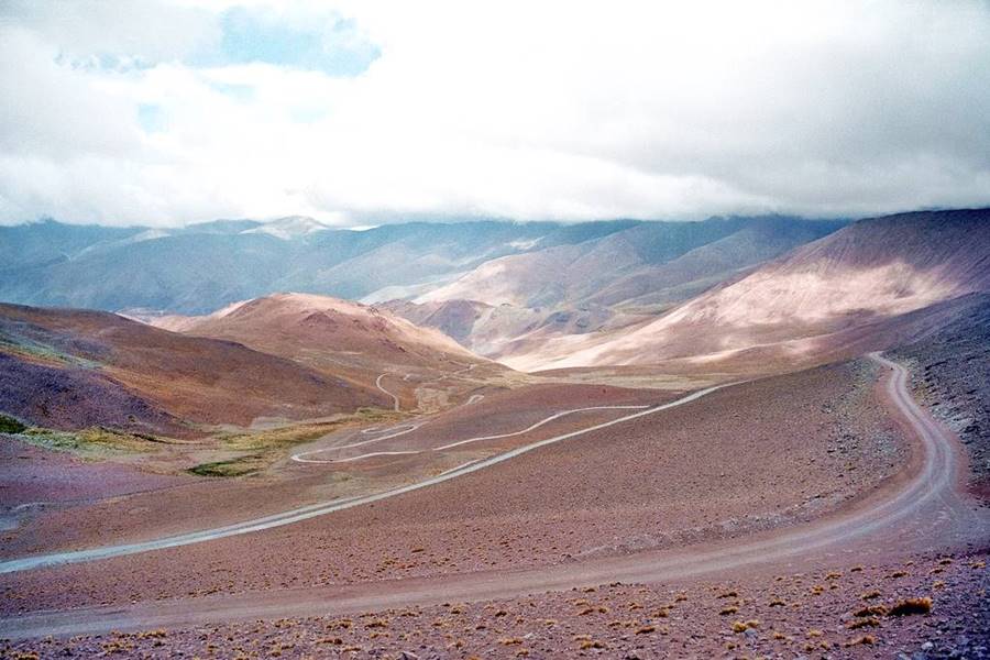
Abra del Acay
"Top 10 attractions on Ruta 40".
Ruta 40 climbs until it reaches its highest point at km 104, the Abra el Acay Pass, with a record height of 16,050 ft. (4.895) meters above sea level.
The Highest Highway
The altitude of "Acay Pass" not only makes it the heighest point of Ruta 40, it is also a World Record.
World Record: this is the highest mountain pass on a National Highway in the whole world. It is also the highest road segment outside of Asia.
It is even higher than Europe's highest mountain: Mont Blanc, the highest peak in the Alps measures 15,770 ft (4.810 m).
> > Read all about Abra el Acay Pass
Tips for a Safe Trip
One of our website's readers wrote to us with his suggestions:
(Aug. 7, 2013). "The trip from Cachi to San Antonio de Los Cobres is an amazing journey that is done in less than 4 hours.
It is very important to register at the police station in La Poma and to let them know at San Antonio de los Cobres once you get there (in case there is any emergency).
I drove a four wheel drive vehicle, I am not sure if it is ok for cars, my pick up tended to feel the lack of oxygen but I climbed the pass slowly. Some sections are narrow -one vehicle only.
I got the impression that during the rainy season the road is cut because you do drive along a river bed in some sections. I had to drive across ice from the springs which the weight of my pick up broke (August is Winter in Argentina).
Don't miss it if you can do it. There is no mobile signal.
Always check first with the police.
In case you are wondering, yes, you can drive the Acay Pass with a normal two-wheel-drive car. Also modern injection systems compensate for the altitude and the lack of oxygen in the engine's combustion.
Final Leg into San Antonio de los Cobres
After reaching the summit, the road heads downhill with a zig-zag course northwards and then levels off in the "Puna" highland when it reaches the Los Patos River (Spanish for "Ducks"). It meets Ruta Nacional 51 at km 134 (12,590 ft - 3.840 m). This highway is paved and links the capital city of Salta with San Antonio de los Cobres. This final leg is quite flat and is paved all the way into San Antonio de los Cobres.
Head left, westwards along the overlapping Ruta Nacional 51 and 40, and reach your final destination, San Antonio de los Cobres (km 147).
Remember to stop at the Police Station to tell them you arrived safely.
San Antonio de Los Cobres
End of the leg. This town has all the services that a tourist may need. It has stores, service station, hospital, lodging. You can use it as a base to visit the Puna.
San Antonio de los Cobres
Full details on the town of > > San Antonio de los Cobres [our Spanish language webpage]
>> Find your hotel in San Antonio de los Cobres
Things to see and do in San Antonio de los Cobres
Drive west and visit the Puna
The "Cono de Arita" (Arita Cone) in the Arizaro salt flats, Salta
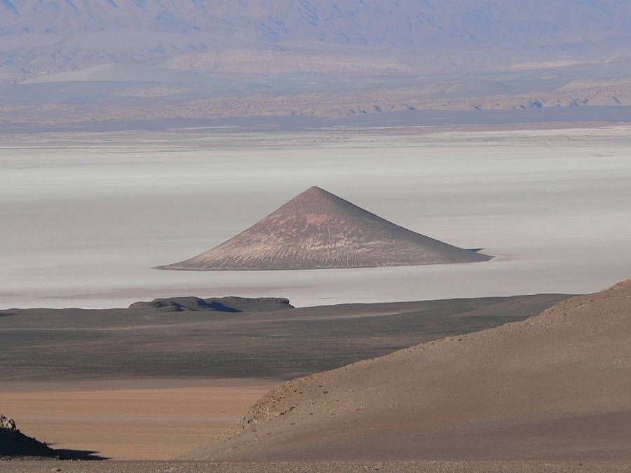
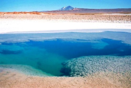
Drive along Ruta 51 towards the western Puna, visit the salt flats and the amazing scenery at Arizaro and Tolar Grande.
La Puna Highlands
The "Puna" region is, after Tibet, the world's second highests plateau. It spans over 70,000 sq. mi (180.000 km2) of Argentina, Bolivia and Chile.
It has an average altitude of over 11,000 feet (3.600 m).
The Puna was uplifted when the Andes formed 25 million years ago. It is a very dry area, with active volcanoes, salt flats, and scenery that seems out of this world.
Argentina's highways Ruta Nacional 40, 9, 51 and 52 are some of the highways that climb into the Puna.
From San Antonio de los Cobres you can head north along Ruta 40 deep into the Puan, which we describe in Final Section to La Quiaca, and visit the Salinas Grandes Salt flats.
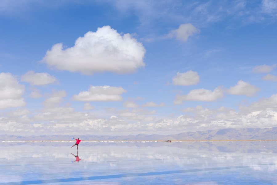
Tips & Advice: Visiting this region
1. Weather: in the "Valles Calchaquíes" and the Puna
Dry climate with very low relative humidity. It only rains in summer (Nov. to March). Wide temperature swing between day and night.
Rain can cut highways due to flash floods and mudslides.
Dry air and high altitude make for clear sunny skies the rest of the year. Use sunscreen.
Cold winters with frost and freezing temperatures.
2. Height: Mountain sickness
When you go above 6,500 feet (2.000 m) air pressure drops, reducing the content of oxygen. This may cause nasty symptoms such as fatigue, nausea headache, dizziness and confusion.
Learn how to mitigate the impact of Altitude Sickness
4. Safety Tips
This is a difficult mountain road: it is narrow, winding, and unpaved. It reaches very high altitudes and the weather in the Puna is tough. There are few villages along the road to provide assistance, and they only offer basic services.
You should verify the road conditions before attempting to drive this leg of Ruta 40.
Your car must be in top condition and you should be well adapted to the high altitude.
Fords, dry river beds and summer rain
There are many "dry" river beds that cut across the highway in the Puna. They are dry most of the year but will turn into rushing rivers during flash floods in the rainy summer season.
Road Conditions
Check the road conditions on our website: Road Conditions.
Important Tips
- Keep your gas tank full (below we list the gas stations). Top it up before setting out and whenever you can. There are few service stations in the area, and they may have run out of fuel.
- Take food and water with you. Carry a paper map -don't rely on the cellphone signal being available in the Puna.
- During the summer rainy season, there may be road closures on Ruta 40 and Rutas 9, 51, and 52
- Cross the fords carefully, especially during the summer flash flood season.
- This is a high altitude journey so factor in that you may suffer from Altitude Sickness.
- Wear appropriate clothes for the area (warm). Pack a blanket in case you have to spend the night out in the wilderness. Even in summer, it can get very cold at night (large day-to-night temperature swings).
Loose Gravel. Drive carefully on the gravel, it is slippery, you can skid, the dust may impair visibility, passing vehicles may fling stones at your windshield (cracking, chipping or even breaking it. Take extra insurance when you rent a car).
There are service stations at Cafayate, Salta, Cachi, San Antonio de los Cobres, Susques, Purmamarca and Paso de Jama.
›› Location of Ruta 40's Service Stations
Map for Section #15 of Ruta 40
Map of Ruta 40 from Cachi to San Antonio de los Cobres via El Acay Pass
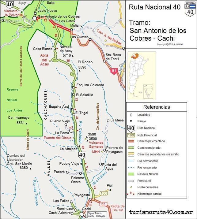
Map with Directions
This is a map with directions from Cachi to San Antonio de los Cobres
Your hotel on this Leg of Ruta 40
There is lodging at Cachi, La Poma, Payogasta and San Antonio de los Cobres
Find a Hotel in Cachi
>> Accommodation in Cachi
Hotels in Salta alog Ruta 40
North in Jujuy
South along Ruta 40
>> Book your hotel in Salta Province

